


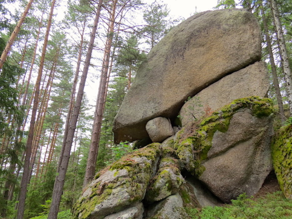
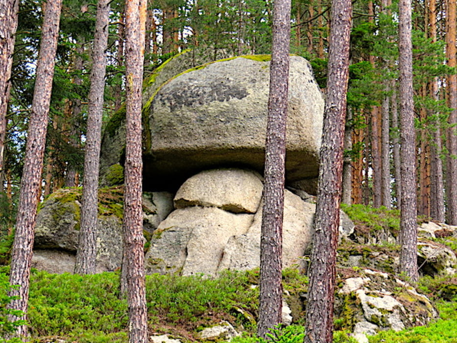
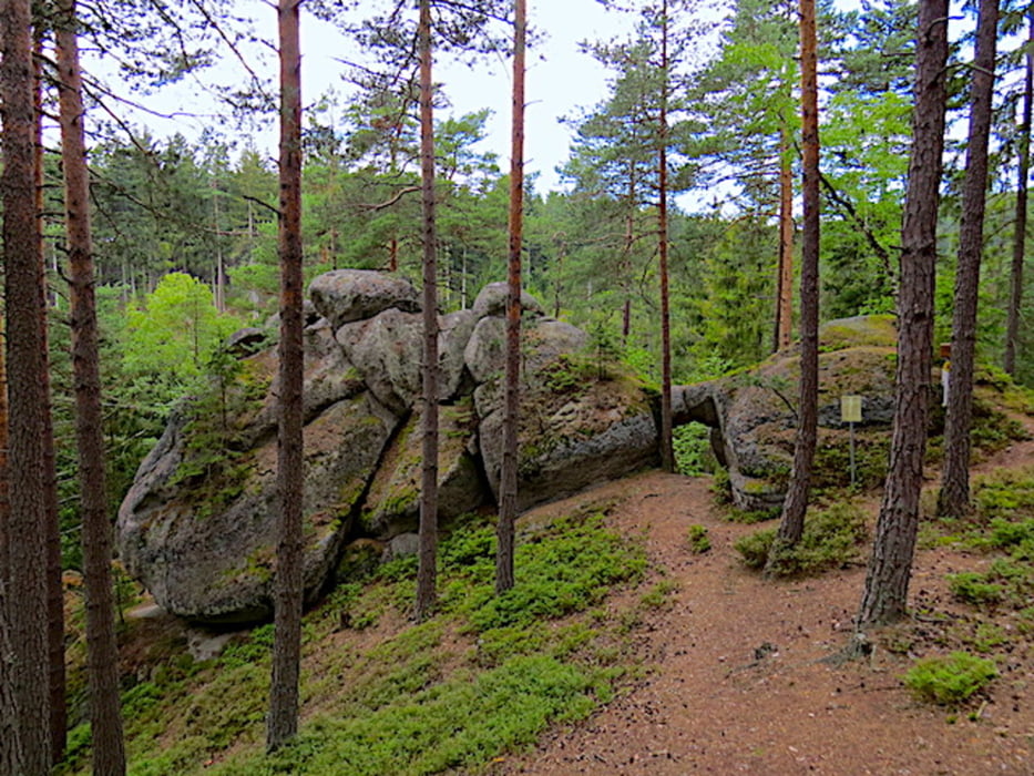
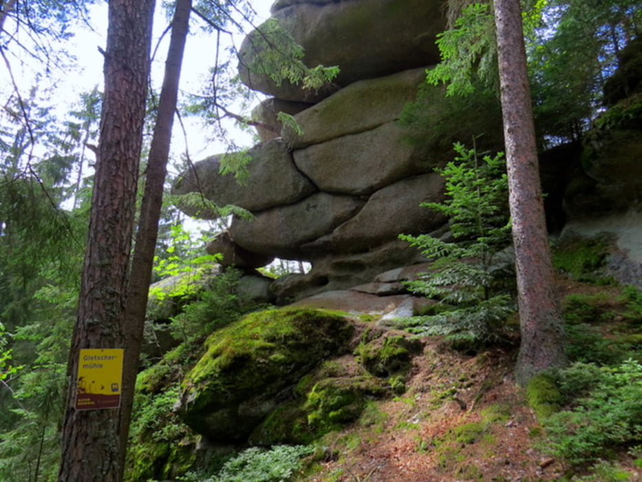
Der Sidestep Felsengarten zweigt nach Feuranz vom Großen Bärentrail ab und führt durch eine bizarre Felslandschaft mit dem „Fichtenschluf“ und dem „Pilzstein“, vorbei am „Steinernen Torbogen“ bis zur „Gletschermühle“ und wieder zurück. Man kann ihn als Abstecher innerhalb der Großen Bärentrail Wanderung „mitnehmen“ oder als eigenständige Runde erkunden, so wie wir es nun tun.
Wir starten nördlich von Feuranz an der Straße beim Einstiegspunkt zum Felsengarten.
Die Gletschermühle ist ein ca. 12 Meter hoher Granitturm mit eigentümlichen, muldenartigen Eintiefungen, die an eine Gletschermühle erinnern. Mit der Eiszeit hat die Felsformation aber nichts zu tun. Die bizarren Granit-Formen entstanden durch Auswitterung des über 350 Millionen Jahre alten Urgesteinsmassivs.
Mehr Info und Deine Meinung in meinem Wanderblog - schau doch mal vorbei!
Karten:
- Austria Map Ost (BEV)
- ÖK25V 4316 WEST RAPPOTTENSTEIN
Further information at
http://www.zwalk.at/Galería de rutas
Mapa de la ruta y perfil de altitud
Minimum height 717 m
Maximum height 821 m
More about the tour author
|
|
Jonny |
Comentarios

Per Auto
- südlich Westautobahn A1 Abfahrt Ybbs, Würnsdorf, Ottenschlag, Grafenschlag, Rappottenstein, Neustift, Feuranz
- östlich Krems, Zwettl, Rappottenstein, Neustift, Feuranz
- nördlich Zwettl, Rappottenstein, Neustift, Feuranz
Tracks GPS
Puntos del track-
GPX / Garmin Map Source (gpx) download
-
TCX / Garmin Training Center® (tcx) download
-
CRS / Garmin Training Center® (crs) download
-
Google Earth (kml) download
-
G7ToWin (g7t) download
-
TTQV (trk) download
-
Overlay (ovl) download
-
Fugawi (txt) download
-
Kompass (DAV) Track (tk) download
-
Hoja de ruta (pdf) download
-
Original file of the author (gpx) download
More about the tour author
|
|
Jonny |
Add to my favorites
Remove from my favorites
Edit tags
Open track
Mi valoración
Rate