


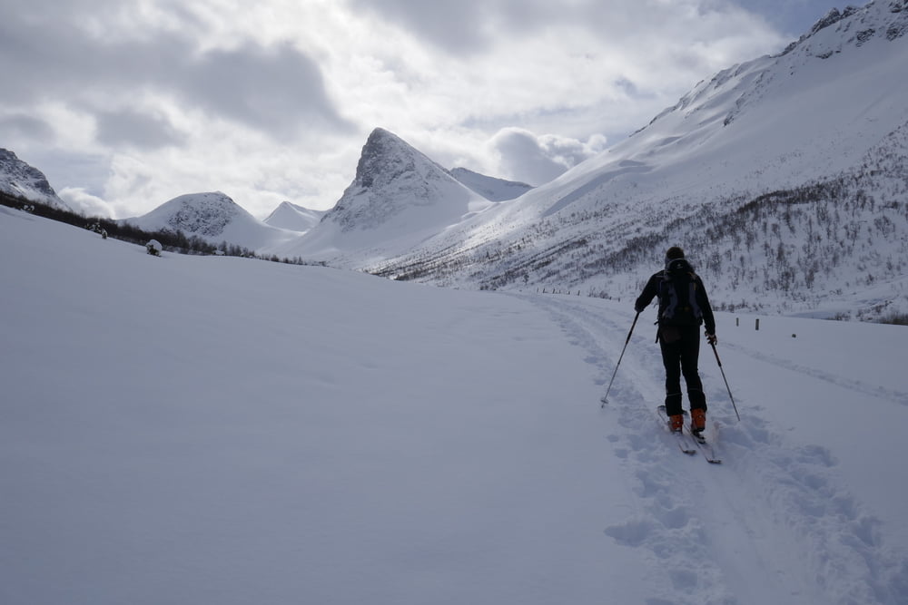
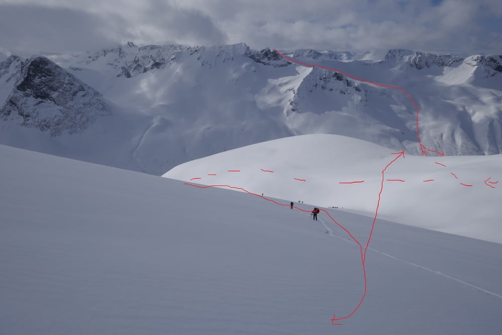
An Gehöft mit altem Flugzeug davor vorbei und auf verschneiter Straße das Tal nach S hinein.Relativ lange an ein paar Hütten vorbei flach anteigen bis die steilen Hänge links einer etwas flacheren breiten Rinne Platz machen. Diese hinauf und in grpßem Rechtsbogen über den Rücken bis zum Gipfel. Abfahrt entweder über die Rinne, oder, bei günstigen Verhältnissen, so wie wir rechts der Rinne nördlich des Blathornet über die etwas steilere Flanke hinab. Nun entweder zurück zum Auto oder auf der anderen Talseite hinauf zum Kopphornet. Dafür eine günstige Stelle zum Überqueren des Bachs suchen und auf der anderen Seite ziemlich gerade empor bis der Hang wieder flacher wird und in ein breites Hochtal mündet. Hier links halten und zuerst etwas querend zum Gipfel des Kopphornet aufsteigen.
Abfahrt wie Aufstieg
Galería de rutas
Mapa de la ruta y perfil de altitud
Minimum height 112 m
Maximum height 1528 m
More about the tour author

|
Gi |
Comentarios

Ca 2.5 km westlich von Sæbø (netter Laden mit Cafe) links abbiegen und an geeigneter Stelle parken.
Tracks GPS
Puntos del track-
GPX / Garmin Map Source (gpx) download
-
TCX / Garmin Training Center® (tcx) download
-
CRS / Garmin Training Center® (crs) download
-
Google Earth (kml) download
-
G7ToWin (g7t) download
-
TTQV (trk) download
-
Overlay (ovl) download
-
Fugawi (txt) download
-
Kompass (DAV) Track (tk) download
-
Hoja de ruta (pdf) download
-
Original file of the author (gpx) download
More about the tour author
|
|
Gi |
Add to my favorites
Remove from my favorites
Edit tags
Open track
Mi valoración
Rate