


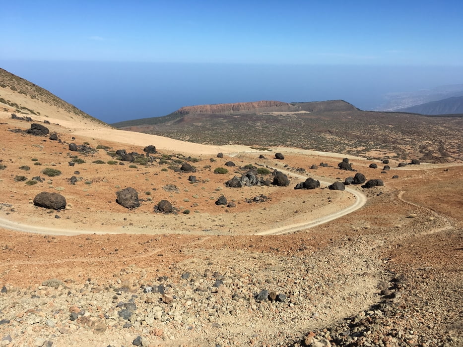
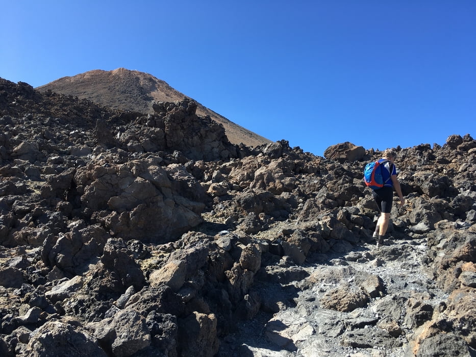
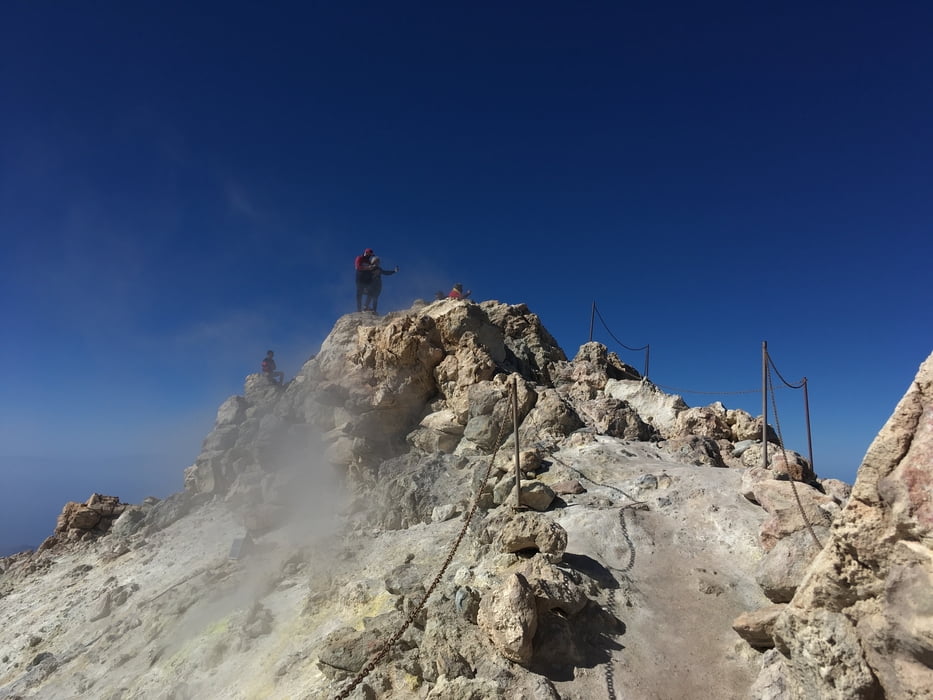
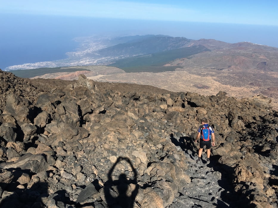
Von Vilaflor auf der Hauptstraße bis kurz hinter die Seilbahnstation des Teide. Hier zweigt links eine unbefestigte Straße ab, auf der aber leider Fahrradverbot herrscht. also versteckten wir die MTB's kurz vor der Abzweigung in den Lavafeldern und gingen zu Fuß weiter. auf ca. 2700m verläßt man die Straße nach rechts auf dem Fußweg zum Refugio Altavista auf ca. 3250 m Höhe. von dort geht es weiter zu einem Aussichtspunkt der auch von der Seilbahn erreicht werden kann. Nun an der Kontrollstation für die Gipfelbesteigung vorbei (Genehmigungen für den Gipfel müssen weit vorher im Internet beantragt werden. Wegen der Corona-Pandemie war dies bei uns auch noch wenige Tage vorher möglich) und hinauf zum Gipfel. Zurück auf dem gleichen Weg
Sieh auch Trackvideo: https://ayvri.com/scene/pmke417w5x/ckh9k6vp90001286i9lux656j
Galería de rutas
Mapa de la ruta y perfil de altitud
Minimum height 1410 m
Maximum height 3658 m
More about the tour author

|
Gi |
Comentarios

Tracks GPS
Puntos del track-
GPX / Garmin Map Source (gpx) download
-
TCX / Garmin Training Center® (tcx) download
-
CRS / Garmin Training Center® (crs) download
-
Google Earth (kml) download
-
G7ToWin (g7t) download
-
TTQV (trk) download
-
Overlay (ovl) download
-
Fugawi (txt) download
-
Kompass (DAV) Track (tk) download
-
Hoja de ruta (pdf) download
-
Original file of the author (gpx) download
More about the tour author
|
|
Gi |
Add to my favorites
Remove from my favorites
Edit tags
Open track
Mi valoración
Rate