


Start der Tour ist beim Strandbad Untersee (Bad Goisern).
Streckenverlauf: Untersee - Gosau - Badstumhütte - Rossalm - Salzberg - Hallstatt - Obertraun - Koppental - Bad Aussee - Sarstein - Bad Goisern
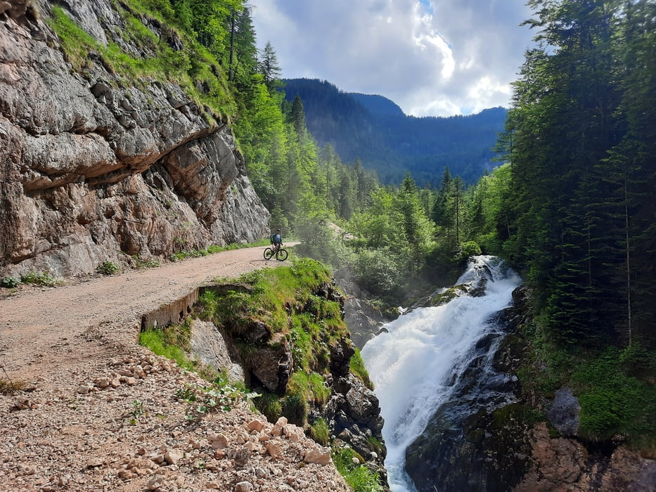
Die Strecke verläuft auf offiziellen MTB-Strecken und Radwege, ausgenommen ist das Teilstück vom Salzberg hinunter nach Hallstatt, es ist nur für ein paar Wochen vor der Salzkammergut Trophy für Trainingszwecke freigegeben.
Wer nicht schieben möchte bleibt auf der offiziellen Strecke und fährt das Echerntal hinunter nach Halllstatt.
Die Badstummhütte und Rossalmhütte sind gute Einkehrmöglichkeiten.
Further information at
https://www.im-salzkammergut.at/Einschränkungen
This tour has a carry or push section on 3.2 kilometers
Galería de rutas
Mapa de la ruta y perfil de altitud
Minimum height 493 m
Maximum height 1499 m
More about the tour author
|
|
kersti |
Comentarios

Parkmöglichkeit Strandbad Untersee
Einschränkungen
This tour has a carry or push section on 3.2 kilometers
Tracks GPS
Puntos del track-
GPX / Garmin Map Source (gpx) download
-
TCX / Garmin Training Center® (tcx) download
-
CRS / Garmin Training Center® (crs) download
-
Google Earth (kml) download
-
G7ToWin (g7t) download
-
TTQV (trk) download
-
Overlay (ovl) download
-
Fugawi (txt) download
-
Kompass (DAV) Track (tk) download
-
Hoja de ruta (pdf) download
-
Original file of the author (gpx) download
More about the tour author
|
|
kersti |
Add to my favorites
Remove from my favorites
Edit tags
Open track
Mi valoración
Rate