


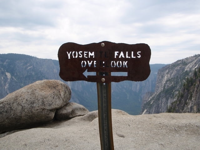
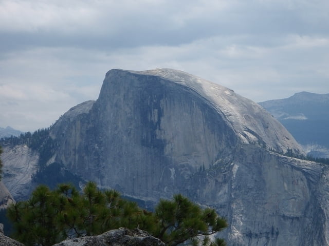
Los geht es im Yosemite Valley entlang des Merced Rivers. Je nach dem wo man geparkt hat ist es ca. 1 km bis zum Trailheat, welcher sich nördlich des Camps 4 befindet. Nun gehts bergauf, und zwar im Zick Zack, begleitet von der atemberaubenden Kulisse des Yosemite Valleys. Bei Wegweisern immer Richtung Yosemite Falls, aber auf jeden Fall die Overlooks nicht verpassen! Befindet man sich am Yosemite Creek, welcher die Fälle speist, ist es noch ca. eine halbe Stunde bis zum Yosemite Point, wo man einen sehr schönen Ausblick ins Tal und auf den Half Dome hat.
Der Track stellt nur eine Richtung dar, leider muß man den selben Weg wieder zurück. Trotzdem ist diese Tour sehr Lohnenswert!
Es lohnt sich auch schon bei Zeiten aufzustehen und loszumarschieren, da dass Yosemite Valley meist stark frequentiert wird - vor allem im Sommer.
Further information at
http://www.nps.gov/yose/Galería de rutas

Mapa de la ruta y perfil de altitud
Minimum height 1212 m
Maximum height 2118 m
More about the tour author

|
domingo_chavec |
Comentarios

Über den Highway 41 ins Tal fahren und dort entweder am Besucherzentrum Parken oder einen der Rastplätze in der Nähe aufsuchen.
Tracks GPS
Puntos del track-
GPX / Garmin Map Source (gpx) download
-
TCX / Garmin Training Center® (tcx) download
-
CRS / Garmin Training Center® (crs) download
-
Google Earth (kml) download
-
G7ToWin (g7t) download
-
TTQV (trk) download
-
Overlay (ovl) download
-
Fugawi (txt) download
-
Kompass (DAV) Track (tk) download
-
Hoja de ruta (pdf) download
-
Original file of the author (gpx) download
More about the tour author
|
|
domingo_chavec |
Add to my favorites
Remove from my favorites
Edit tags
Open track
Mi valoración
Rate