Login

Login oublié ?

Cookies have to be accepted!
Your browser's cookie functionality is disabled. Please enable this functionality.

Not a member yet?

Register now
Login

Available for registred users only

Log in to use this feature.

Login oublié ?

Cookies have to be accepted!
Your browser's cookie functionality is disabled. Please enable this functionality.

Not a member yet?

Register now
Filter
Catégories
Advanced filters
  • Longueur (km)
  • Altimètre
Enregistrer le filtre Reset filter

TrackRank

QRCode

Technical data

Longueur12,1 km Altimètre1048 m Way down1041 m Durée03:30 h:m Date09.12.2013
Evaluations Author Paysage Aspect amusement Condition Technique

Statistiques

862 Vues Evaluations 22 Téléchargements Moyenne
Rate
  • Feuille de tours
  • Arrivée
  • Téléchargements
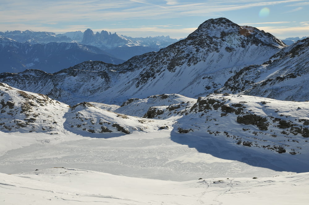
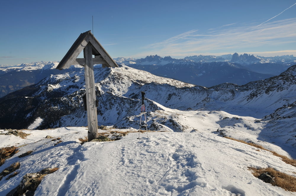
Anspruchsvolle Gipfeltour, die bei ungünstigen Schneebedingungen auch ziemlich anstrengend sein kann. Oberhalb der Waldgrenze bei klarem Wetter beeindruckende Landschaft.

Galerie du tour

Carte du tour et altitude

  • Open Street Map
  • Google
Minimum height 1454 m Maximum height 2527 m Vue de détail

More about the tour author

fwolfgang
Member since 2013

Send private message

Commentaires

Von Vahrn bei Brixen fährt man zunächst nach Schalders. Bei der Kirche fährt man in der Rechtskehre weiter und biegt kurz später links ab und erreicht nach einigen km einen kleinen Parkplatz vor einer Brücke (Steinwend).


Tracks GPS

Trackpoints
  • GPX / Garmin Map Source (gpx) download
  • TCX / Garmin Training Center® (tcx) download
  • CRS / Garmin Training Center® (crs) download
  • Google Earth (kml) download
  • G7ToWin (g7t) download
  • TTQV (trk) download
  • Overlay (ovl) download
  • Fugawi (txt) download
  • Kompass (DAV) Track (tk) download
  • Feuille de tours (pdf) download
  • Original file of the author (gpx) download

More about the tour author

fwolfgang
Member since 2013

Send private message
Share track
Add to my favorites
Remove from my favorites
Edit tags
My score
Rate
Tour: Gaishorn
Cat.: Raquette
Longueur: 12,1 km
Evaluated on:
Durée:
Day(s)
Hour(s)
Minute(s)
Evaluation: Paysage Aspect amusement Condition Technique