Login

Login oublié ?

Cookies have to be accepted!
Your browser's cookie functionality is disabled. Please enable this functionality.

Not a member yet?

Register now
Login

Available for registred users only

Log in to use this feature.

Login oublié ?

Cookies have to be accepted!
Your browser's cookie functionality is disabled. Please enable this functionality.

Not a member yet?

Register now
Filter
Catégories
Advanced filters
  • Longueur (km)
  • Altimètre
Enregistrer le filtre Reset filter

TrackRank

QRCode

Technical data

Longueur8,1 km Altimètre0 m Way down0 m Durée02:00 h:m Date12.06.2016
Evaluations Author Paysage Aspect amusement Condition Technique

Statistiques

1475 Vues Evaluations 4 Téléchargements Moyenne
Rate
  • Feuille de tours
  • Arrivée
  • Téléchargements
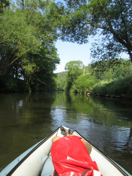
Auf dem kleinen Fluss "Rhume" geht es vom Dorf Elvershausen in die Kleinstadt Northeim, Einzleheiten im verlinkten Fahrtenbericht.

Further information at

https://rrbdpublic.wordpress.com/2016/06/07/paddeltour-auf-der-rhume-von-elvershausen-nach-northeim/

Carte du tour et altitude

  • Open Street Map
  • Google
Minimum height 99999 m Maximum height -99999 m Vue de détail

More about the tour author

RrBd
Member since 2014

Send private message

Commentaires

Zur Einsetzstelle in Elvershausen kann man bis auf wenige Meter mit dem PKW heranfahren, der Endpunkt in Northeim ist etwa 200m von der Bundesstraß 3 entfernt

Tracks GPS

Trackpoints
  • GPX / Garmin Map Source (gpx) download
  • TCX / Garmin Training Center® (tcx) download
  • CRS / Garmin Training Center® (crs) download
  • Google Earth (kml) download
  • G7ToWin (g7t) download
  • TTQV (trk) download
  • Overlay (ovl) download
  • Fugawi (txt) download
  • Kompass (DAV) Track (tk) download
  • Feuille de tours (pdf) download
  • Original file of the author (gpx) download

More about the tour author

RrBd
Member since 2014

Send private message
Share track
Add to my favorites
Remove from my favorites
Edit tags
My score
Rate
Tour: Rhume von Elvershausen nach Northeim
Cat.: Bateau et canot
Longueur: 8,1 km
Evaluated on:
Durée:
Day(s)
Hour(s)
Minute(s)
Evaluation: Paysage Aspect amusement Condition Technique