


Meakan-dake ist ein moutain im östlichen Hokkaido. Wir gingen durch Snowshoe vom Parkplatz am heißen Frühling und gehen gerade zur Oberseite voran. Jedoch ist das letzte Teil nahe der Oberseite auf der Nordseite für Snowshoes zu steil, also gingen wir zum Süden umher und kletterten dann von dort. Es gibt ein fabulou 360 Grad Panorama von der Oberseite. Auf der Weise unten, nahmen wir zu langes im tiefen Schnee, also war er dunkel, als wir zum See kamen. Bleiben Sie auf dem Weg auf der Nordseite von diesem See.
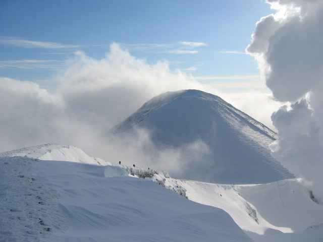
Meakan-dake is a mountain in Eastern Hokkaido. We went by snowshoe from the car park at the hot spring and headed straight to the top. However, the last part near the top on the northern side is too steep for snowshoes, so we went around to the south, and then climbed from there. There is a fabulou 360 degrees panorama from the top.
On the way down, we took too long in the deep snow, so it was dark when we got to the lake. Stay on the path on the northern side of this lake.
Ulteriori informazioni sotto
http://www.malcomson.com/gallery/hokkaido2004Galleria itinerari
Mappa itinerario e altimetria
Altezza minima 127 m
Altezza massima 1498 m
Maggiori informazioni sull'autore del tour

|
zangezur |
Commenti

Fliege zu Kushiro von Tokyo. Sie müssen ein Auto oder einen Packwagen mieten, und er ist am besten, der Antrieb und Schneegummireifen mit vier Rädern zu haben.
Fly to Kushiro from Tokyo. You will need to rent a car or van, and it is best to have four wheel drive and snow tires.
Fly to Kushiro from Tokyo. You will need to rent a car or van, and it is best to have four wheel drive and snow tires.
Tracce GPS
Punti di traccia-
GPX / Garmin Map Source (gpx) download
-
TCX / Garmin Training Center® (tcx) download
-
CRS / Garmin Training Center® (crs) download
-
Google Earth (kml) download
-
G7ToWin (g7t) download
-
TTQV (trk) download
-
Overlay (ovl) download
-
Fugawi (txt) download
-
Kompass (DAV) Track (tk) download
-
Scheda tecnica (pdf) download
-
File originale dell'autore (g7t) download
Maggiori informazioni sull'autore del tour
|
|
zangezur |
Aggiungi ai miei preferiti
Rimuovi dai miei preferiti
Modifica dei tag
Tour aperto
Il mio voto
Vota