


AlpenX 2012/16: Die für mich schönste Route über die Alpen
Garmisch - Molina di Ledro
6 Etappen, 426km, 9800hm
Stationen:
Garmisch - Imst - Scoul - Bormio - Dimaro - Albergo Brenta - Molina di Ledro
Pässe:
Hochtörl, Fernpass, Pass da Costainas, Döss Radond, Passo di Giava, Passo Tonale, Passo Campo Carlo Magno, Passo Bregn de L'Ors (Bärenpass), Passo Duron, Passo del Ballino
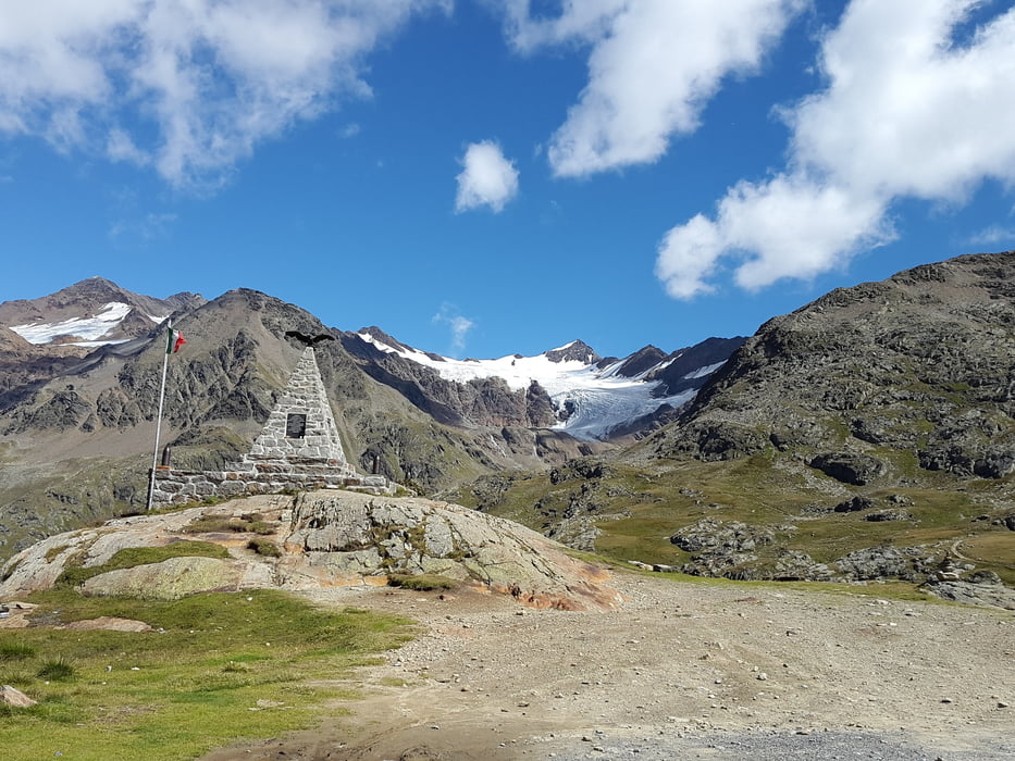
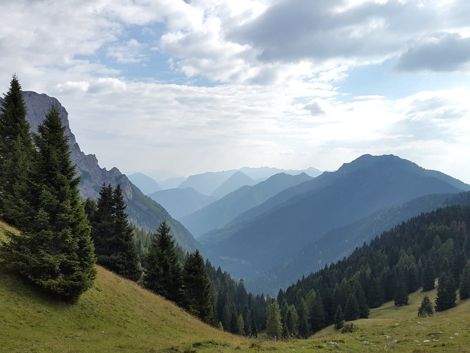
Diese Route ist für mich die schönste Querung der Alpen!
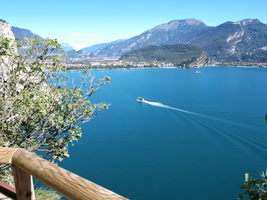
Start und Ziel entsprechen einer klassischen Transalp. Der Hüpfer von Riva zum Ledrosee ist eine Genuss-Zugabe und das Zielgetränk (jeder wählt selbst) schmeckt noch besser.
Alles ist gut fahrbar, keine Schiebe- oder Tragestrecke (kleine Ausnahme: Bärenpass). Übernachtungen im Tal bei hervorragender Pizza und Bierversorgung.
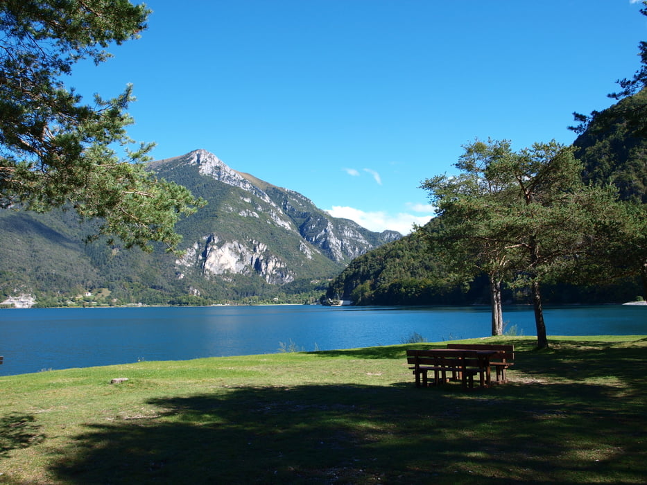
Mein geliebter Lago di Ledro ist ein prima Ziel. Die alte Ponale-Straße ist einfach traumhaft.
Etappen (Die Übernachtungsorte sind Wegpunkte im GPX-File):
Tag 1: 70km 1566hm
Tag 2: 90km 1095hm
Tag 3: 77km 2055hm
Tag 4: 84km 2025hm
Tag 5: 43km 1653hm
Tag 6: 62km 1342hm
Fazit: Diese Strecke kann - und will - man mehrfach fahren.
Galeria trasy
Mapa trasy i profil wysokości
Minimum height 62 m
Maximum height 2618 m
More about the tour author

|
MohlsenBike |
Komentarze

GPS tracks
Trackpoints-
GPX / Garmin Map Source (gpx) download
-
TCX / Garmin Training Center® (tcx) download
-
CRS / Garmin Training Center® (crs) download
-
Google Earth (kml) download
-
G7ToWin (g7t) download
-
TTQV (trk) download
-
Overlay (ovl) download
-
Fugawi (txt) download
-
Kompass (DAV) Track (tk) download
-
Karta trasy (pdf) download
-
Original file of the author (gpx) download
More about the tour author
|
|
MohlsenBike |
Add to my favorites
Remove from my favorites
Edit tags
Open track
My score
Rate