Login

Si pozabil/a podatke za prijavo?

Cookies have to be accepted!
Your browser's cookie functionality is disabled. Please enable this functionality.

Not a member yet?

Register now
Login

Available for registred users only

Log in to use this feature.

Si pozabil/a podatke za prijavo?

Cookies have to be accepted!
Your browser's cookie functionality is disabled. Please enable this functionality.

Not a member yet?

Register now
Filter
Kategorije
Advanced filters
  • Dolžina (km)
  • Metri nadmorske višine
Shrani filter Reset filter

TrackRank

QRCode

Technical data

Dolžina14,5 km Metri nadmorske višine617 m Way down597 m Trajanje04:00 h:m Datum13.10.2020
Ocene Author Pokrajina Dejavnik zabave Kondicija Tehnika

Statistika

88 Pogledi Ocene 3 Prenosi Povprečje
Rate
  • List z izleti
  • Prihod
  • Prenosi
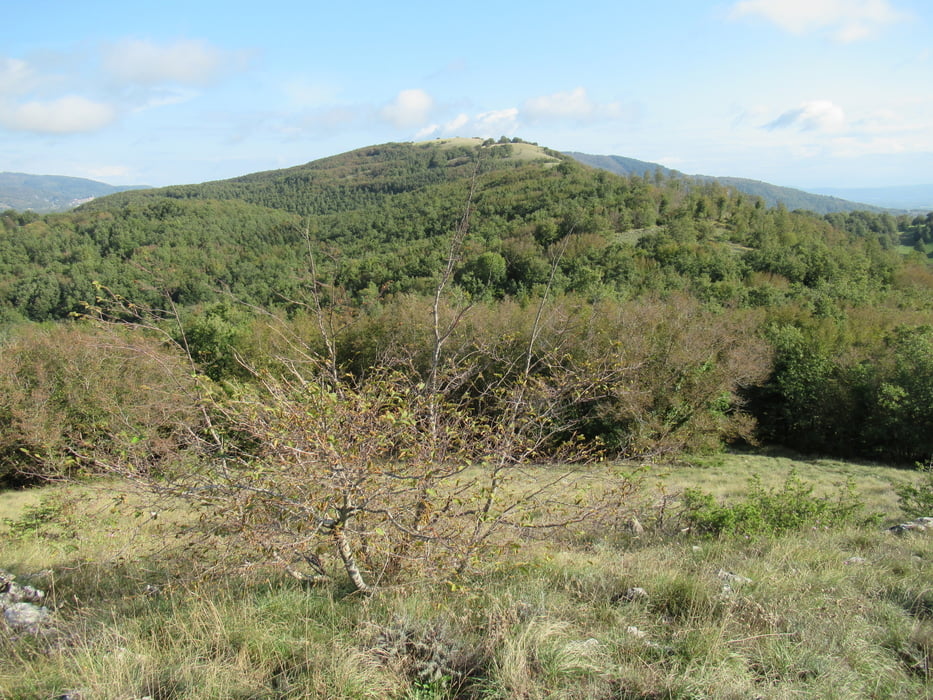
einfache Tour mit zwei Gipfel und Blick bin ans Meer. Nicht schwer, im zweiten Teil geht es etwas steil durch den Wald bergauf

Galerija izletov

Zemljevid in višinski profil izleta

  • Open Street Map
  • Google
Minimum height 583 m Maximum height 912 m Prikaz podrobnosti

More about the tour author

tazzo
Member since 2009

Send private message

Komentarji

Parken kann man am Dorfeingang. Start ist am Platz unten neben einem roten Briefkasten

Poti GPS

Trackpoints
  • GPX / Garmin Map Source (gpx) download
  • TCX / Garmin Training Center® (tcx) download
  • CRS / Garmin Training Center® (crs) download
  • Google Earth (kml) download
  • G7ToWin (g7t) download
  • TTQV (trk) download
  • Overlay (ovl) download
  • Fugawi (txt) download
  • Kompass (DAV) Track (tk) download
  • List z izleti (pdf) download
  • Original file of the author (gpx) download

More about the tour author

tazzo
Member since 2009

Send private message
Share track
Add to my favorites
Remove from my favorites
Edit tags
My score
Rate
Izlet: Prata
Vrsta: Pešačenje
Dolžina: 14,5 km
Evaluated on:
Trajanje:
Day(s)
Hour(s)
Minute(s)
Ocena: Pokrajina Dejavnik zabave Kondicija Tehnika