


At the Psilo Dendro Restaurant, look for a sign and a concrete path to the Caledonian Falls, on the left when facing the Restaurant.
The hike to the actual waterfall, is only about 20 minutes. Take the usual photos and continue.
The first half of the hike is uphill, through superb woodland with many specially labelled trees. The path crosses and re-crosses the Kryos Potamos stream, and although sometimes rocky and slippery the way is never difficult. This stream from the surrounding mountains, is said to always have water flowing, even in the summer.
After about an hour, the woodland path ends at a road. This is the highest point, some 300mtrs below the highest part of Cyprus.
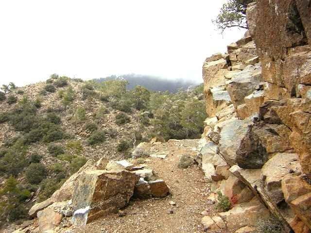
To the right side as you exit the path, there is an obvious forest track signed Makrya Kontarka, this track is the route back. Take care over the scree slopes and vertiginous sections
This return track is the better part to me as it is mainly through open mountain scenery with fabulous views.
I completed the walk in March 2006, and although not cold, it was cool enough to wear extra clothing, there was still snow in parts. So be prepared.
The hike to the actual waterfall, is only about 20 minutes. Take the usual photos and continue.
The first half of the hike is uphill, through superb woodland with many specially labelled trees. The path crosses and re-crosses the Kryos Potamos stream, and although sometimes rocky and slippery the way is never difficult. This stream from the surrounding mountains, is said to always have water flowing, even in the summer.
After about an hour, the woodland path ends at a road. This is the highest point, some 300mtrs below the highest part of Cyprus.
To the right side as you exit the path, there is an obvious forest track signed Makrya Kontarka, this track is the route back. Take care over the scree slopes and vertiginous sections
This return track is the better part to me as it is mainly through open mountain scenery with fabulous views.
I completed the walk in March 2006, and although not cold, it was cool enough to wear extra clothing, there was still snow in parts. So be prepared.
Tour Galerie
Tour Karte und Höhenprofil
Minimale Höhe 1181 m
Maximale Höhe 1631 m
Mehr zum Tourautor

|
SILVAED |
Kommentare

The hike starts at the car park of the Psilo Dendro Trout Farm and Restaurant, this is about 1km further on from the village of Pano Platres.
The village is central in the Troodos range, See the Mapquest map here of the Trailhead for directions.
The village is central in the Troodos range, See the Mapquest map here of the Trailhead for directions.
GPS-Tracks
Trackpunkte-
GPX / Garmin Map Source (gpx) download
-
TCX / Garmin Training Center® (tcx) download
-
CRS / Garmin Training Center® (crs) download
-
Google Earth (kml) download
-
G7ToWin (g7t) download
-
TTQV (trk) download
-
Overlay (ovl) download
-
Fugawi (txt) download
-
Kompass (DAV) Track (tk) download
-
Tourenblatt (pdf) download
-
Originaldatei des Autors (gpx) download
Mehr zum Tourautor
|
|
SILVAED |
Zu meinen Favoriten hinzufügen
Von meinen Favoriten entfernen
Tags bearbeiten
Tour öffnen
Meine Bewertung
Bewerten