


Once you have figured out your way from the busy town areas on Batam Island, there is only one road left, so it is not so difficult to find your way.
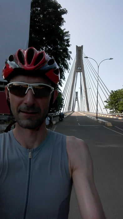
The characteristic bridge is right at the start of the "Barelang" road as it marks the end of Batam island and open the road to the other five.
I remember the ride as quite tough, even though it may not seem to be soooo long but it has rolling hills especially towards the end of the which in combination with the midday heat is pretty painful.
I rode the road out and back totaling almost 180km; most of the riders from the area would get a truck to drive then back from the end of the road. You may want to consider this option as riding back will be really tensing.
the good thing is you cannot get lost, as there is only one road. :-)
The track uploaded here is a bit longer than the 81km as it contains also a portion (about 14km) of the way back.
Tour Galerie
Tour Karte und Höhenprofil
Minimale Höhe 6 m
Maximale Höhe 59 m
Kommentare

Take the ferry from Singapore or Bintan to reach Batam island. Alternatively you can also fly in as Batam has also an airport.
GPS-Tracks
Trackpunkte-
GPX / Garmin Map Source (gpx) download
-
TCX / Garmin Training Center® (tcx) download
-
CRS / Garmin Training Center® (crs) download
-
Google Earth (kml) download
-
G7ToWin (g7t) download
-
TTQV (trk) download
-
Overlay (ovl) download
-
Fugawi (txt) download
-
Kompass (DAV) Track (tk) download
-
Tourenblatt (pdf) download
-
Originaldatei des Autors (gpx) download
Zu meinen Favoriten hinzufügen
Von meinen Favoriten entfernen
Tags bearbeiten
Tour öffnen
Meine Bewertung
Bewerten