


Date: September 13, 2009
Total ascent: 562 m (130 m by cable car)
Total descent: 562 m
The tour starts at Glocknerhaus, you can park your car here. To reach Glocknerhaus, you must take the 'Grossglockner Hochalpenstrasse', which is a beautiful Alpine scenery road. It is only open during the summer. You will find all kinds of information, including prices (toll road!) here: Grossglockner High Alpine Road.
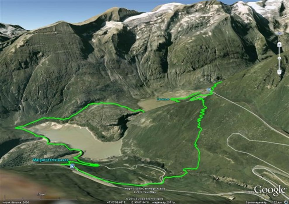
The trail we took:
- Glocknerhaus
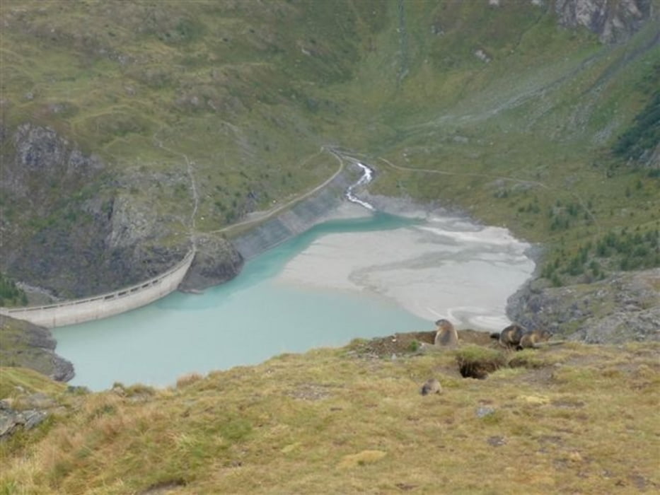
- Margaritzenstaus
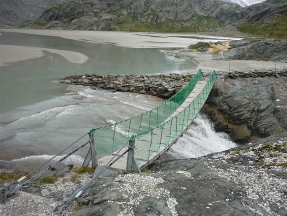
- Sandersee
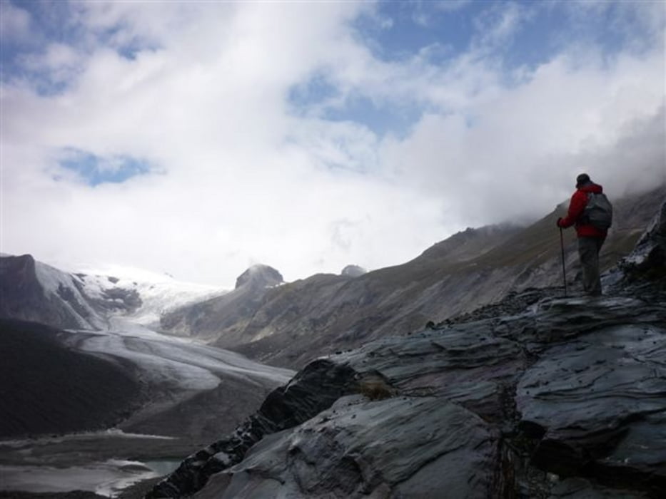
- Pasterze Glacier
- Kaiser Franz Josefs Höhe (you can take the funicular up from the glacier, info here, but for those up for some more cardio, you can walk up stairs too)
- Franz Josefs Haus
- Glocknerhaus
You can eat and drink at Glocknerhaus and Franz Josefs Haus, but there are plenty of rocks and benches as well for those in favor of picknick.
**************************
Do not take anything, do not leave anything!
**************************
Please, do NOT leave trash behind. Paper tissues are also trash! Chocolate wrap as well. Bring a small trash bag with you and take your trash with yourself to the next trash can. It is not that heavy.
**************************
Weitere Informationen unter
http://www.beepee.hu/kepek/v/ausztrianemet0909/pasterze0913/Tour Galerie
Tour Karte und Höhenprofil
Minimale Höhe 2005 m
Maximale Höhe 2412 m
Mehr zum Tourautor
|
|
beepee |
Kommentare

From Heiligenblut head to Grossglockner Hochalpenstrasse. After the toll booth there will be an intersection, turn left - follow signs for Kaiser Frans Josefs Höhe.
More info about the road here: http://www.grossglockner.at/en/
**************************
Do not take anything, do not leave anything!
**************************
Please, do NOT leave trash behind. Paper tissues are also trash! Chocolate wrap as well. Bring a small trash bag with you and take your trash with yourself to the next trash can. It is not that heavy.
**************************
GPS-Tracks
Trackpunkte-
GPX / Garmin Map Source (gpx) download
-
TCX / Garmin Training Center® (tcx) download
-
CRS / Garmin Training Center® (crs) download
-
Google Earth (kml) download
-
G7ToWin (g7t) download
-
TTQV (trk) download
-
Overlay (ovl) download
-
Fugawi (txt) download
-
Kompass (DAV) Track (tk) download
-
Tourenblatt (pdf) download
-
Originaldatei des Autors (gpx) download
Mehr zum Tourautor
|
|
beepee |
Zu meinen Favoriten hinzufügen
Von meinen Favoriten entfernen
Tags bearbeiten
Tour öffnen
Meine Bewertung
Bewerten