


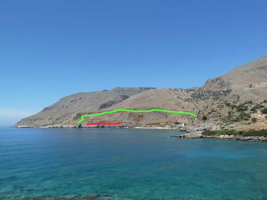
Many guidebooks describe the passage from Loutro to the Marmara-Bay (mouth of the Aradhena gorge) as being a bit "tricky", since this part of the E4 leads over some cliffs and a relatively small ledge some height above the sea.
The track you can download here provides an alternative path for people who want to avoid this passage. The detour costs about 20 minutes of extra time, but it will help hikers who do not want to try the difficult passage.
The track starts on the E4 shortly after Marmara Bay and rejoins the E4 at Finikas Bay (Finix).
Weitere Informationen unter
http://loutro.gr/Tour Galerie
Tour Karte und Höhenprofil
Minimale Höhe -3 m
Maximale Höhe 95 m
Mehr zum Tourautor
|
|
Kretakulk |
Kommentare

The track branches off the E4 between Marmara and Loutro and rejoins the E4 at Finix.
GPS-Tracks
Trackpunkte-
GPX / Garmin Map Source (gpx) download
-
TCX / Garmin Training Center® (tcx) download
-
CRS / Garmin Training Center® (crs) download
-
Google Earth (kml) download
-
G7ToWin (g7t) download
-
TTQV (trk) download
-
Overlay (ovl) download
-
Fugawi (txt) download
-
Kompass (DAV) Track (tk) download
-
Tourenblatt (pdf) download
-
Originaldatei des Autors (gpx) download
Mehr zum Tourautor
|
|
Kretakulk |
Zu meinen Favoriten hinzufügen
Von meinen Favoriten entfernen
Tags bearbeiten
Tour öffnen
Meine Bewertung
Bewerten