
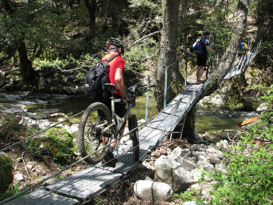

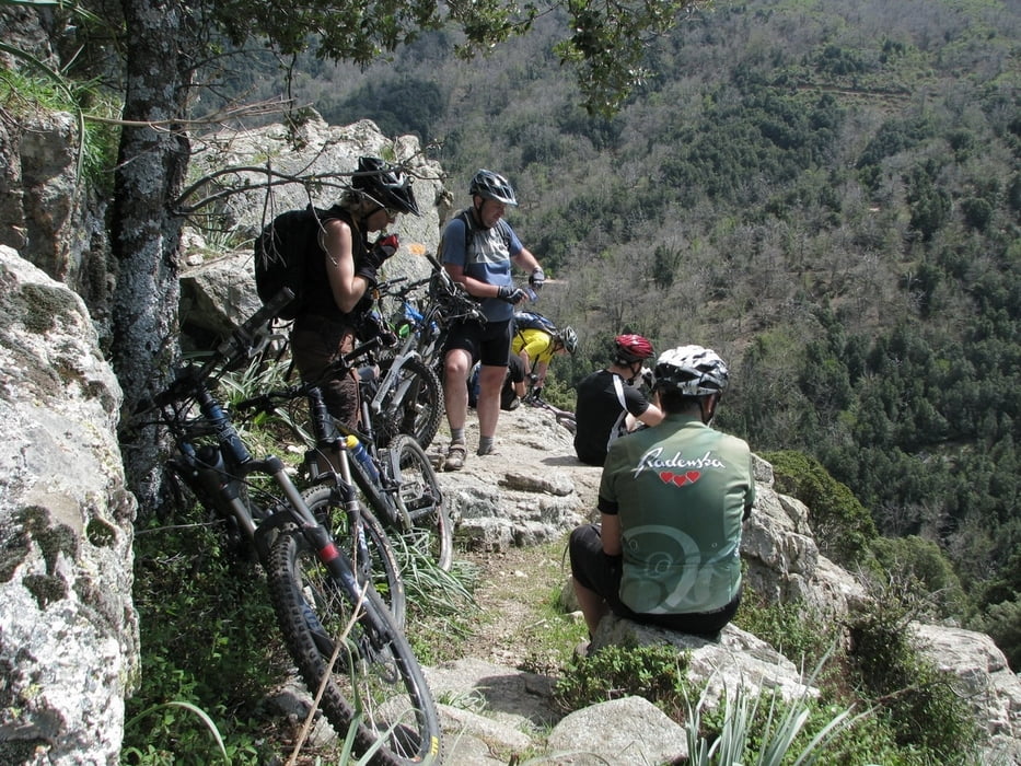
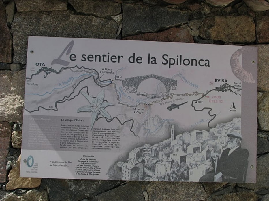
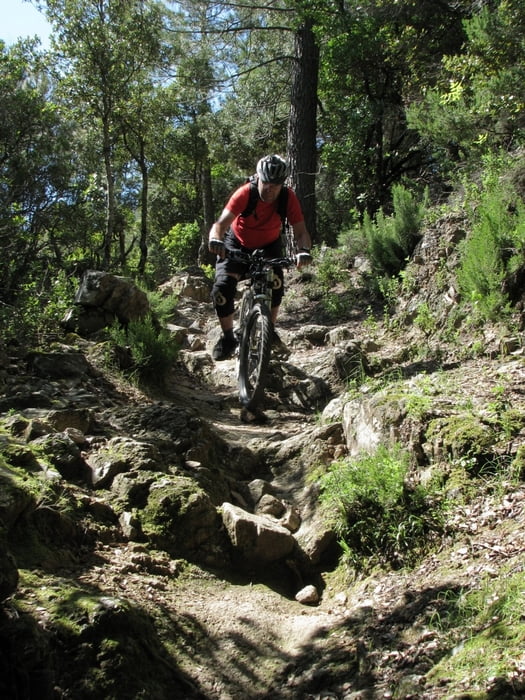
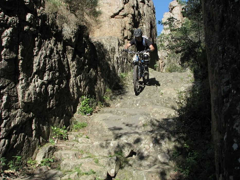
This tour starts in Porto. We were situated in a camping few km from the village. Tour begins on paved road in the direction to village Evisa. Wiev is beautiful, with lot of animals on the side. If you want to make only the downhill through Spelunca gorge just follow this road to Evisa. If you want some more adventure and you have nothing against wearing your bike for few minutes just follow the track. which leaves the paved road. On some parts trail nearly disappears, but then it comes again. When you come to village Evisa it is time to put protectors to your knees or shoulders if you have them. Downhill has a lot of rocks, you need a good suspension. Most of the time it is S1 with some parts S2-S3. But you can also walk! It took us about 8 hours to make this tour, but we stopped many times to enjoy.
If you do not like rocky terrain with steps do not make this tour.
Please respect the hikers, there can be many in the gorge.
More pictures on: http://picasaweb.google.com/DenisCindro/Korzika254252009#5331712145495216802
Spassfaktor realy depends on what you like! With hard tail bike it can be close to 1.
Further information at
http://www.vimeo.com/4852957Tour gallery
Tour map and elevation profile
Minimum height 106 m
Maximum height 833 m
More about the tour author
|
|
cindro |
Comments
Porto Village on the west coast of Corsica
GPS tracks
Trackpoints-
GPX / Garmin Map Source (gpx) download
-
TCX / Garmin Training Center® (tcx) download
-
CRS / Garmin Training Center® (crs) download
-
Google Earth (kml) download
-
G7ToWin (g7t) download
-
TTQV (trk) download
-
Overlay (ovl) download
-
Fugawi (txt) download
-
Kompass (DAV) Track (tk) download
-
Track data sheet (pdf) download
-
Original file of the author (gpx) download
More about the tour author
|
|
cindro |
Add to my favorites
Remove from my favorites
Edit tags
Open track
My score
Rate
Spelunca Schlucht