Login

Login vergessen?

Cookies müssen akzeptiert werden!
Die Cookie-Funktion Ihres Browsers ist deaktiviert. Bitte aktivieren Sie die Funktion.

Noch kein Mitglied?

Jetzt Registrieren
Login

Nur für eingeloggte Benutzer möglich

Melde dich an, um diese Funktion nutzen zu können.

Login vergessen?

Cookies müssen akzeptiert werden!
Die Cookie-Funktion Ihres Browsers ist deaktiviert. Bitte aktivieren Sie die Funktion.

Noch kein Mitglied?

Jetzt Registrieren
Filter
Kategorien
Erweiterte Filter
  • Länge (km)
  • Höhenmeter
Filter speichern Filter zurücksetzen

TrackRank

QRCode

Technische Daten

Länge31,8 km Höhenmeter1001 m Abstieg1001 m Dauer08:00 h:m Datum22.02.2010
Bewertungen Autor Landschaft Spaßfaktor Kondition Technik

Statistik

5182 Views Bewertungen 509 Downloads Durchschnitt
Bewerten
  • Tourenblatt
  • Anfahrt
  • Downloads

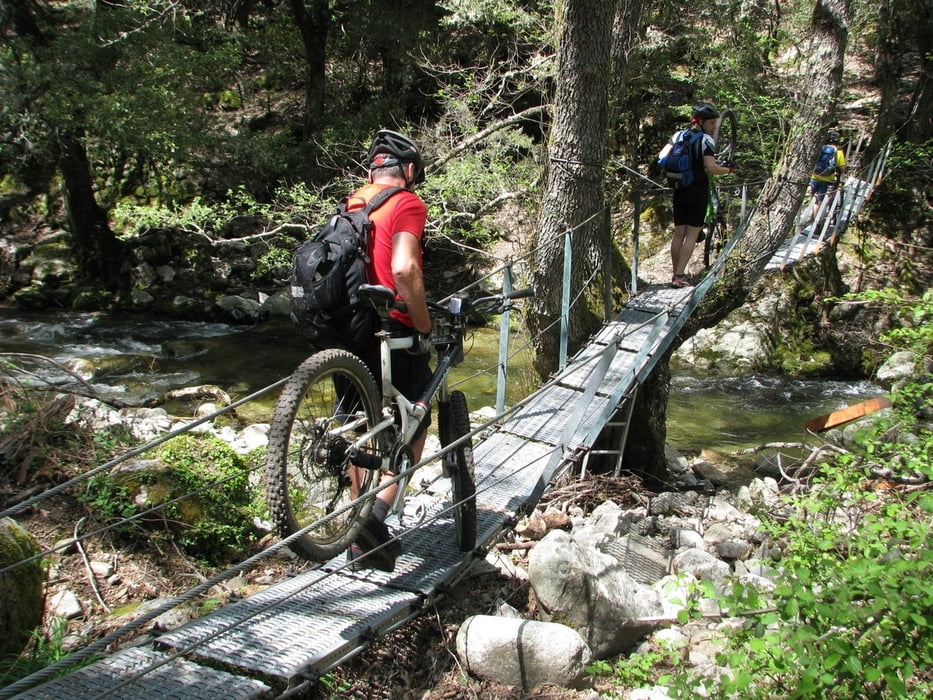
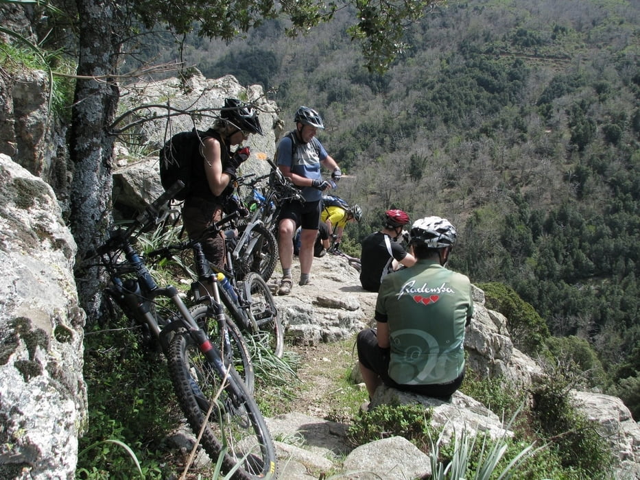
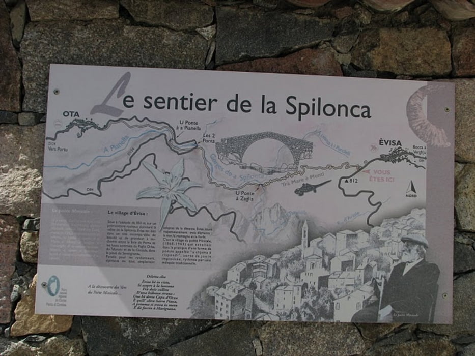
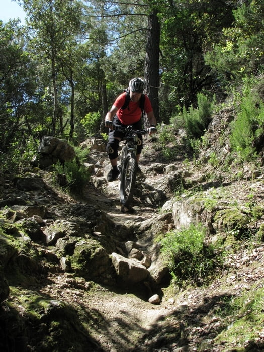
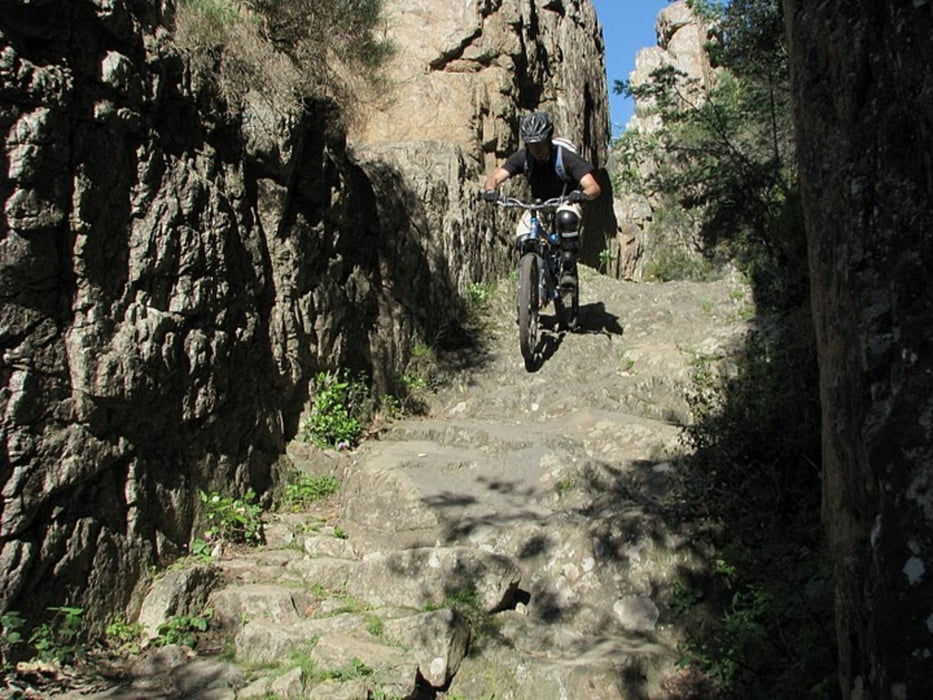
This tour starts in Porto. We were situated in a camping few  km from the village. Tour begins  on paved road in the direction to village Evisa. Wiev is beautiful, with lot of animals on the side. If you want to make only the downhill through Spelunca gorge just follow this road to Evisa. If you want some more adventure  and you have nothing against wearing your bike for few minutes just follow the track. which leaves the paved road. On some parts trail nearly disappears, but then it comes again. When you come to village Evisa it is time to put protectors  to your knees or shoulders if you have them. Downhill has a lot of rocks, you need a good suspension. Most of the time it is S1 with some parts S2-S3. But you can also walk!  It took us about 8 hours to make this tour, but we stopped many times to enjoy.

If you do not like rocky terrain with steps do not make this tour.

Please respect the hikers, there can be many in the gorge.

More pictures on: http://picasaweb.google.com/DenisCindro/Korzika254252009#5331712145495216802

Spassfaktor realy depends on what you like!  With hard tail bike it can be close to 1.

Weitere Informationen unter

http://www.vimeo.com/4852957

Tour Galerie

Tour Karte und Höhenprofil

  • Open Street Map
  • Google
Minimale Höhe 106 m Maximale Höhe 833 m Detailansicht

Mehr zum Tourautor

cindro
Mitglied seit 2008

Land: Slowenien

14 erstellte Touren
7.4
Private Nachricht senden

Kommentare

rob47 am 30.09.2012

Spelunca Schlucht

Die Spelunca Schlucht ist für fast Jeden unfahrbar. Sowohl technisch als auch die vielen Tourisis, die hier unterwegs sind: D.h: Bike tragen, ich schätze zu 80%, na dann viel Spass!

Porto Village on the west coast of Corsica

GPS-Tracks

Trackpunkte
  • GPX / Garmin Map Source (gpx) download
  • TCX / Garmin Training Center® (tcx) download
  • CRS / Garmin Training Center® (crs) download
  • Google Earth (kml) download
  • G7ToWin (g7t) download
  • TTQV (trk) download
  • Overlay (ovl) download
  • Fugawi (txt) download
  • Kompass (DAV) Track (tk) download
  • Tourenblatt (pdf) download
  • Originaldatei des Autors (gpx) download

Mehr zum Tourautor

cindro
Mitglied seit 2008

Land: Slowenien

14 erstellte Touren
7.4
Private Nachricht senden
Tour teilen
Zu meinen Favoriten hinzufügen
Von meinen Favoriten entfernen
Tags bearbeiten
Meine Bewertung
Bewerten
Tour: Spelunca - Corsica
Art: Mountainbike
Länge: 31,8 km
Bewertet am:
Dauer:
Tag(e)
Stunde(n)
Minute(n)
Bewertung: Landschaft Spaßfaktor Kondition Technik