Login

Forgotten password?

Cookies have to be accepted!
Your browser's cookie functionality is disabled. Please enable this functionality.

Not a member yet?

Register now
Login

Available for registred users only

Log in to use this feature.

Forgotten password?

Cookies have to be accepted!
Your browser's cookie functionality is disabled. Please enable this functionality.

Not a member yet?

Register now
Filter
Categories
Advanced filters
  • Distance (km)
  • Height
Save filters Reset filter

TrackRank

QRCode

Technical data

Distance24,6 km Height728 m Way down728 m Duration02:00 h:m Date20.06.2012
Scores Author Landscape Fun factor Fitness Technique

Statistics

273 Views Scores 37 Downloads Average
Rate
  • Track data sheet
  • Directions
  • Downloads
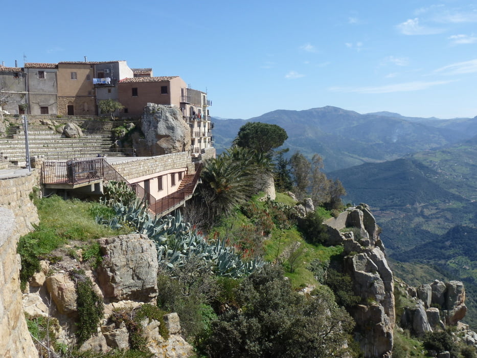
vom Camping Rais-Gerbi an der Küste bei Finale verläuft die Tour stetig aufwärts auf Asphaltstraße bis zum etwa 750 m hoch gelegenen Bergstädtchen Pollina mit wunderbarer Aussicht auf die Küste des Tirrenischen Meeres und den Naturpark Madonie. Für den Rückweg kann entweder dieselbe Strecke oder alternativ die Straße nach Finale gewählt werden.

Tour gallery

Tour map and elevation profile

  • Open Street Map
  • Google
Minimum height 28 m Maximum height 757 m Detailed view

More about the tour author

JonnyB
Member since 2008

Send private message

Comments

über die A20 Abfahrt Castelbuono auf der SS 113 nach Finale

GPS tracks

Trackpoints
  • GPX / Garmin Map Source (gpx) download
  • TCX / Garmin Training Center® (tcx) download
  • CRS / Garmin Training Center® (crs) download
  • Google Earth (kml) download
  • G7ToWin (g7t) download
  • TTQV (trk) download
  • Overlay (ovl) download
  • Fugawi (txt) download
  • Kompass (DAV) Track (tk) download
  • Track data sheet (pdf) download
  • Original file of the author (gpx) download

More about the tour author

JonnyB
Member since 2008

Send private message
Share track
Add to my favorites
Remove from my favorites
Edit tags
My score
Rate
Track: von Finale 750 hm zum Bergstädtchen Pollina
Type: Bicycle tours
Distance: 24,6 km
Evaluated on:
Duration:
Day(s)
Hour(s)
Minute(s)
Score: Landscape Fun factor Fitness Technique