Login

Forgot your login?

Cookies have to be accepted!
Your browser's cookie functionality is disabled. Please enable this functionality.

Not a member yet?

Register now
Login

Available for registred users only

Log in to use this feature.

Forgot your login?

Cookies have to be accepted!
Your browser's cookie functionality is disabled. Please enable this functionality.

Not a member yet?

Register now
Filter
Categories
Advanced filters
  • Distance (km)
  • Height
Save filters Reset filter

TrackRank

QRCode

Technical data

Distance10,5 km Height401 m Way down359 m Duration04:16 h:m Date27.07.2012
Scores Author Landscape Fun factor Fitness Technique

Statistics

2575 Views Scores 48 Downloads Average
Rate
  • Track data sheet
  • Directions
  • Downloads
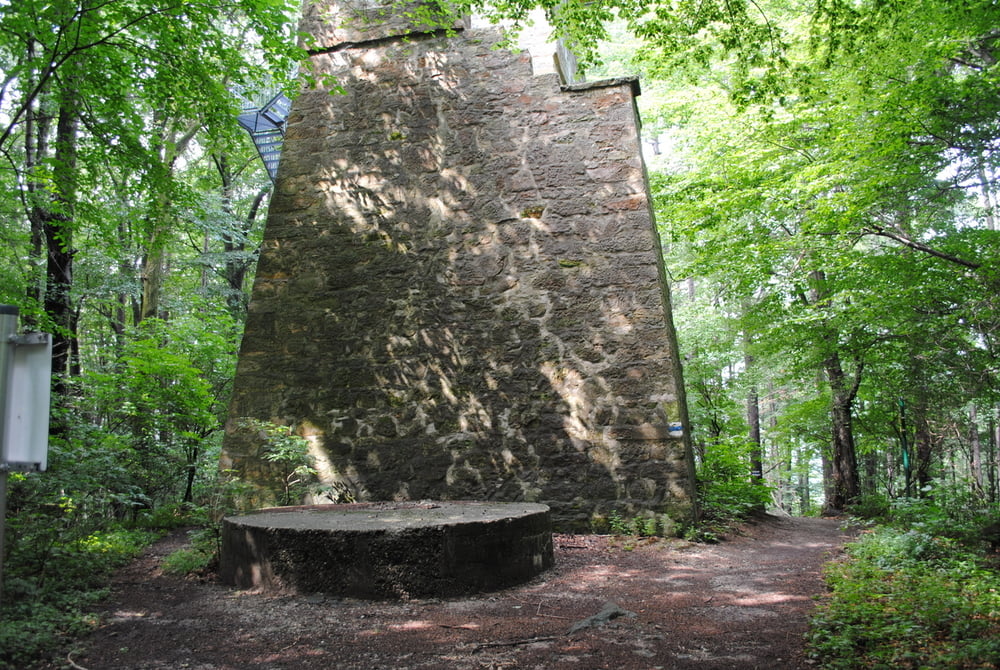
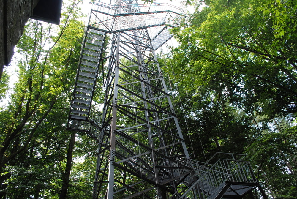
Ab gehts mit genügend Parkplatz in Gablitz.Auf blauer Markierung zuerst sehr gemächlich und am Schluß steiler bis auf den Troppberg.Unterwegs den Gedächtnisstein für den Volksschauspieler Josef Egger besuchen.Oben sehen wir eine sehr alte Warte die durch die Zeit und auch ihren"Erhaltern" sehr gelitten hat.Die neue Warte, gleich daneben, ist nicht mein Fall.Eine kalte Stahlkonstruktion die sich an einen Sendemast anschmiegt bietet zwar zweifelos eine gute Fernsicht ist aber seelenlos.Weiter dann auf kurz blau und grün bis zur Abzweigung zur Hochramalpe und dann auf rot bis zur Gaststätte.Akzeptable Küche und dann weiter auch auf rot wieder bis Gablitz.

Further information at

http://www.hochramalpe.at/

Tour gallery

Tour map and elevation profile

  • Open Street Map
  • Google
Minimum height 240 m Maximum height 570 m Detailed view

More about the tour author

LeoCheops
Member since 2008

Send private message

Comments

GPS tracks

Trackpoints
  • GPX / Garmin Map Source (gpx) download
  • TCX / Garmin Training Center® (tcx) download
  • CRS / Garmin Training Center® (crs) download
  • Google Earth (kml) download
  • G7ToWin (g7t) download
  • TTQV (trk) download
  • Overlay (ovl) download
  • Fugawi (txt) download
  • Kompass (DAV) Track (tk) download
  • Track data sheet (pdf) download
  • Original file of the author (gpx) download

More about the tour author

LeoCheops
Member since 2008

Send private message
Share track
Add to my favorites
Remove from my favorites
Edit tags
My score
Rate
Track: Über den Troppberg zur Hochramalpe
Type: Hiking
Distance: 10,5 km
Evaluated on:
Duration:
Day(s)
Hour(s)
Minute(s)
Score: Landscape Fun factor Fitness Technique