Login

Forgot your login?

Cookies have to be accepted!
Your browser's cookie functionality is disabled. Please enable this functionality.

Not a member yet?

Register now
Login

Available for registred users only

Log in to use this feature.

Forgot your login?

Cookies have to be accepted!
Your browser's cookie functionality is disabled. Please enable this functionality.

Not a member yet?

Register now
Filter
Categories
Advanced filters
  • Distance (km)
  • Height
Save filters Reset filter

TrackRank

QRCode

Technical data

Distance76,1 km Height271 m Way down306 m Duration05:00 h:m Date16.09.2012
Scores Author Landscape Fun factor Fitness Technique

Statistics

411 Views Scores 10 Downloads Average
Rate
  • Track data sheet
  • Directions
  • Downloads

16.09.2012

Von Bochum Hbf zur Emscherparkroute. Sehr gut ausgeschilderte Strecke!

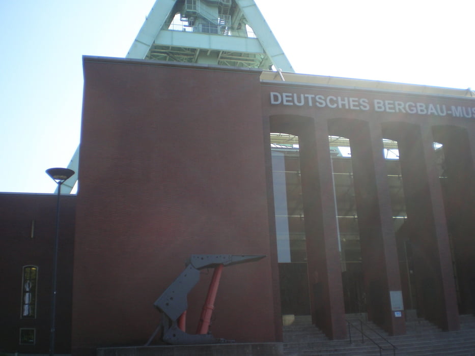
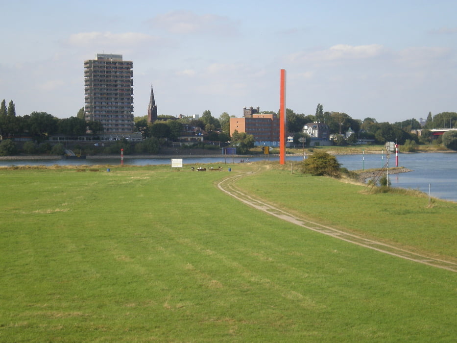
Vorbei am Deutschen Bergbaumuseum, Zeche Zollverein zur Ruhrmündung bei Rheinorange in Duisburg. Weiter durch Hochfeld, ab Huckingen der Anger entlang bis nach Angermund.


Tour gallery

Tour map and elevation profile

  • Open Street Map
  • Google
Minimum height 26 m Maximum height 101 m Detailed view

More about the tour author

GuenterM
Member since 2010

Send private message

Comments

GPS tracks

Trackpoints
  • GPX / Garmin Map Source (gpx) download
  • TCX / Garmin Training Center® (tcx) download
  • CRS / Garmin Training Center® (crs) download
  • Google Earth (kml) download
  • G7ToWin (g7t) download
  • TTQV (trk) download
  • Overlay (ovl) download
  • Fugawi (txt) download
  • Kompass (DAV) Track (tk) download
  • Track data sheet (pdf) download
  • Original file of the author (gpx) download

More about the tour author

GuenterM
Member since 2010

Send private message
Share track
Add to my favorites
Remove from my favorites
Edit tags
My score
Rate
Track: Bochum-Emscherparkroute-Rheinorange-Anger
Type: Trekkingbike
Distance: 76,1 km
Evaluated on:
Duration:
Day(s)
Hour(s)
Minute(s)
Score: Landscape Fun factor Fitness Technique