Login

Forgot your login?

Cookies have to be accepted!
Your browser's cookie functionality is disabled. Please enable this functionality.

Not a member yet?

Register now
Login

Available for registred users only

Log in to use this feature.

Forgot your login?

Cookies have to be accepted!
Your browser's cookie functionality is disabled. Please enable this functionality.

Not a member yet?

Register now
Filter
Categories
Advanced filters
  • Distance (km)
  • Height
Save filters Reset filter

TrackRank

QRCode

Technical data

Distance8,3 km Height493 m Way down383 m Duration05:00 h:m Date25.07.2013
Scores Author Landscape Fun factor Fitness Technique

Statistics

769 Views Scores 16 Downloads Average
Rate
  • Track data sheet
  • Directions
  • Downloads
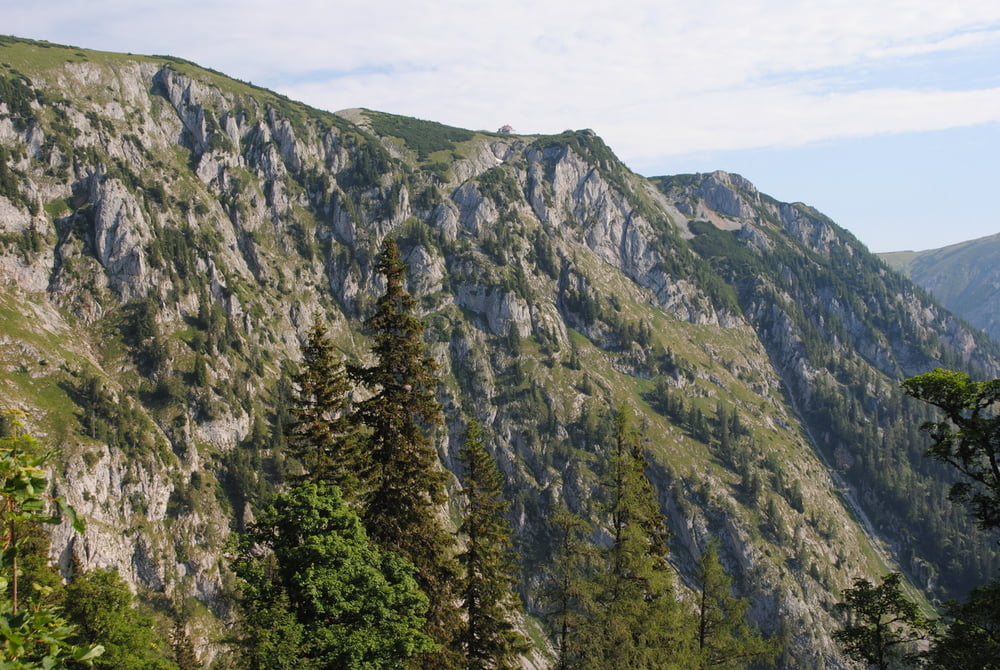
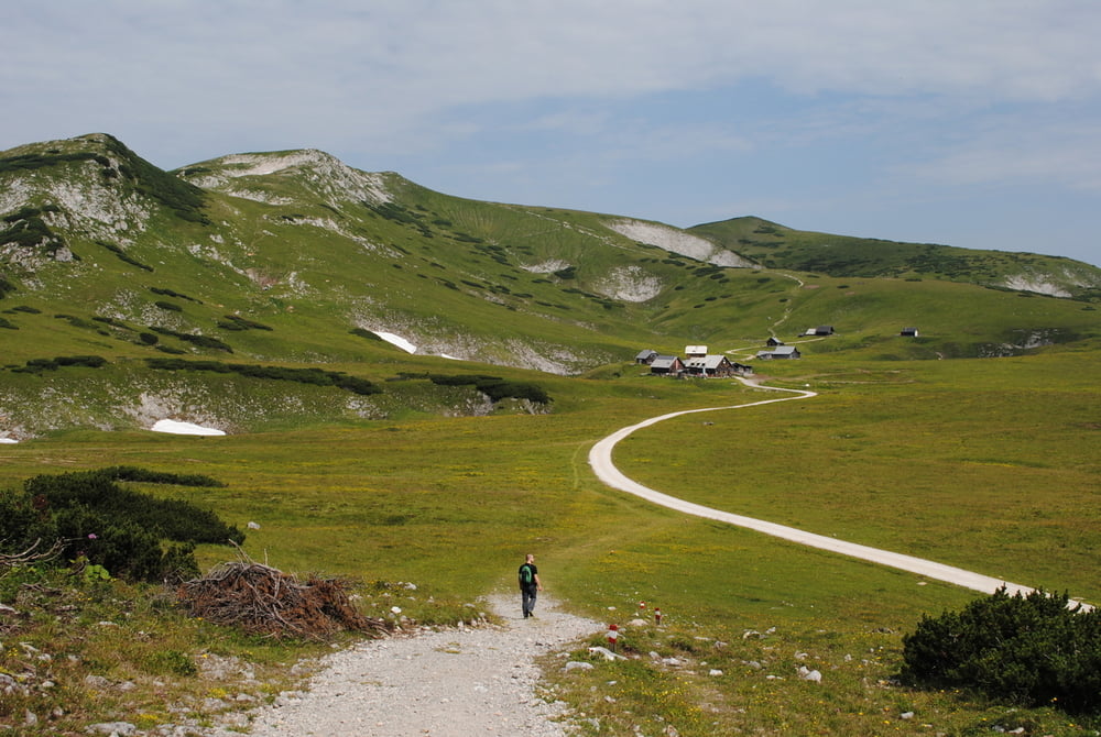
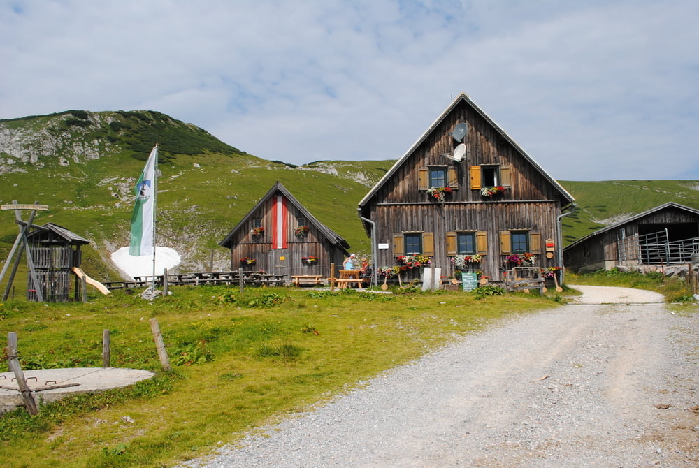
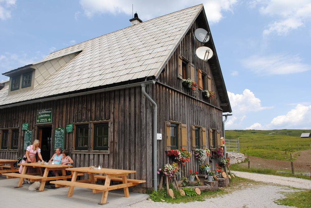
Wir benutzen die Mautstrasse ab Kapellen und stellen das Auto am Kohlebnerstand (befestigter Parkplatz) ab.Von dort geht es gleich am Anfang ziemlich steil bis zum Sender und zur Kutatschütte (Unterstand).Nun ,nur am Anfang ,in leichten Steigungen und später eben über die Hochfläche zu einer Gruppe von Almhäusern bis zur Michlbauerhütte.Wunderbare Sicht auf die Rax,das Schneealpenhaus und auf den Windberg.Freundliche Wirtsleute und gute Hausmannskost.Den Windberg haben wir aus Zeitgründen nicht bestiegen.Sollte man aber machen,daher eine gute Stunde für Auf-und Abstieg einplanen.Zurück gleiche Strecke.Variante:Rückweg überSchneealpenhaus.Wegzeit beinhaltet viele Fotostops und eine ausgiebige Mittagsrast.

Further information at

http://www.michlbauerhütte.at/

Tour gallery

Tour map and elevation profile

  • Open Street Map
  • Google
Minimum height 1349 m Maximum height 1773 m Detailed view

More about the tour author

LeoCheops
Member since 2008

Send private message

Comments

GPS tracks

Trackpoints
  • GPX / Garmin Map Source (gpx) download
  • TCX / Garmin Training Center® (tcx) download
  • CRS / Garmin Training Center® (crs) download
  • Google Earth (kml) download
  • G7ToWin (g7t) download
  • TTQV (trk) download
  • Overlay (ovl) download
  • Fugawi (txt) download
  • Kompass (DAV) Track (tk) download
  • Track data sheet (pdf) download
  • Original file of the author (gpx) download

More about the tour author

LeoCheops
Member since 2008

Send private message
Share track
Add to my favorites
Remove from my favorites
Edit tags
My score
Rate
Track: Schneealpe Zur Michlbauerhütte
Type: Mountain hiking
Distance: 8,3 km
Evaluated on:
Duration:
Day(s)
Hour(s)
Minute(s)
Score: Landscape Fun factor Fitness Technique