Login

Forgot your login?

Cookies have to be accepted!
Your browser's cookie functionality is disabled. Please enable this functionality.

Not a member yet?

Register now
Login

Available for registred users only

Log in to use this feature.

Forgot your login?

Cookies have to be accepted!
Your browser's cookie functionality is disabled. Please enable this functionality.

Not a member yet?

Register now
Filter
Categories
Advanced filters
  • Distance (km)
  • Height
Save filters Reset filter

TrackRank

QRCode

Technical data

Distance12,3 km Height439 m Way down372 m Duration05:40 h:m Date28.10.2013
Scores Author Landscape Fun factor Fitness Technique

Statistics

1392 Views Scores 18 Downloads Average
Rate
  • Track data sheet
  • Directions
  • Downloads
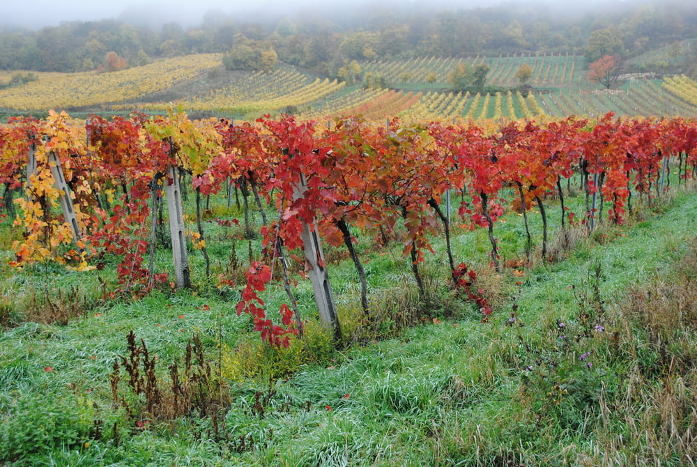
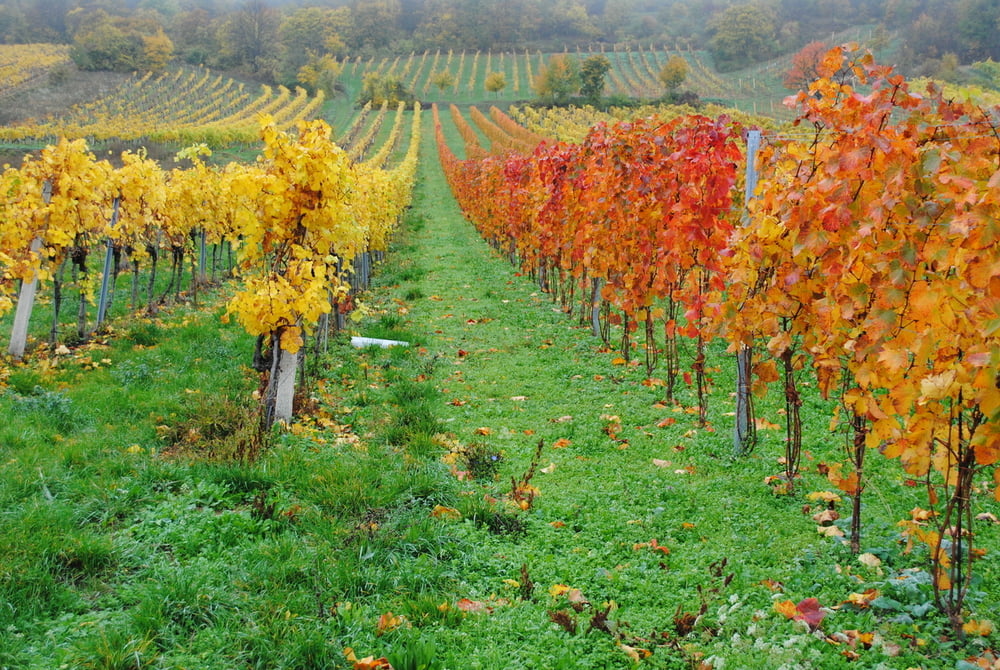
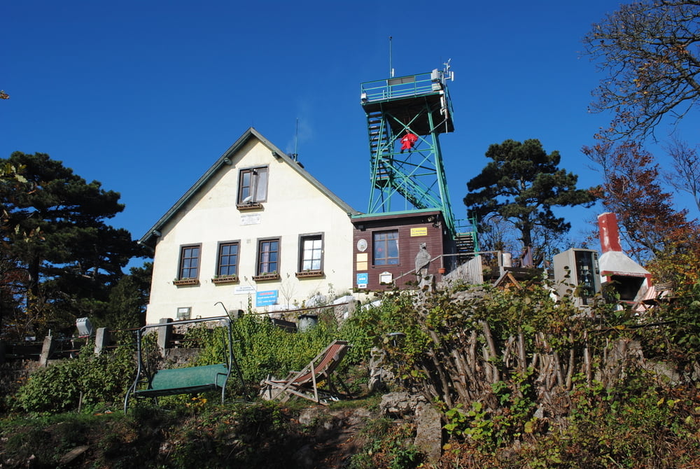
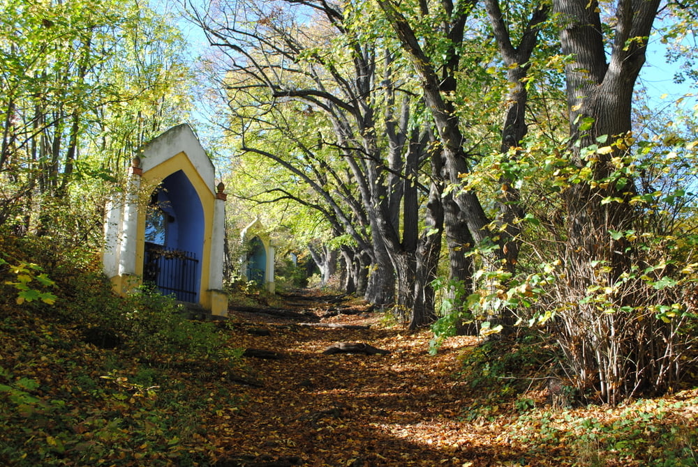
Start vom Parkplatz Gumpoldskirchen.Durch den Ortskern und weiter auf der Trasse der Wiener Hochquellenwasserleitung durch die Weingärten bis Pfaffstätten.Prachtvolle Farbspiele der Natur auf den Weinstöcken von zartgelb über gold ,rot bis dunkelbraun.Bei Pfafstätten herunter von der Trasse und auf der Straße bergan bis Öd.Dort rechts und mäßig steil durch den Wald auf die Rudolf Prokschhütte.Gute Hausmannskost z. b.Wildschwein.Dann über das Rote Kreuz zur Veiglhütte und dann rechts über den sehr schönen Kreuzweg zurück nach Gumpoldskirchen.

Further information at

http://www.prokschhuette.at/

Tour gallery

Tour map and elevation profile

  • Open Street Map
  • Google
Minimum height 202 m Maximum height 562 m Detailed view

More about the tour author

LeoCheops
Member since 2008

Send private message

Comments

GPS tracks

Trackpoints
  • GPX / Garmin Map Source (gpx) download
  • TCX / Garmin Training Center® (tcx) download
  • CRS / Garmin Training Center® (crs) download
  • Google Earth (kml) download
  • G7ToWin (g7t) download
  • TTQV (trk) download
  • Overlay (ovl) download
  • Fugawi (txt) download
  • Kompass (DAV) Track (tk) download
  • Track data sheet (pdf) download
  • Original file of the author (gpx) download

More about the tour author

LeoCheops
Member since 2008

Send private message
Share track
Add to my favorites
Remove from my favorites
Edit tags
My score
Rate
Track: Von Gumpoldskirchen auf die Rudolf Prokschhütte (26.10.2013)
Type: Hiking
Distance: 12,3 km
Evaluated on:
Duration:
Day(s)
Hour(s)
Minute(s)
Score: Landscape Fun factor Fitness Technique