Login

Forgot your login?

Cookies have to be accepted!
Your browser's cookie functionality is disabled. Please enable this functionality.

Not a member yet?

Register now
Login

Available for registred users only

Log in to use this feature.

Forgot your login?

Cookies have to be accepted!
Your browser's cookie functionality is disabled. Please enable this functionality.

Not a member yet?

Register now
Filter
Categories
Advanced filters
  • Distance (km)
  • Height
Save filters Reset filter

TrackRank

QRCode

Technical data

Distance6,5 km Height352 m Way down349 m Duration03:57 h:m Date30.06.2014
Scores Author Landscape Fun factor Fitness Technique

Statistics

152 Views Scores 8 Downloads Average
Rate
  • Track data sheet
  • Directions
  • Downloads
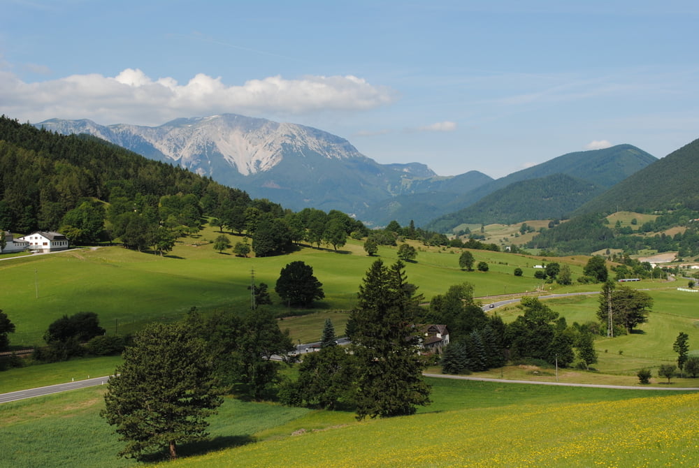
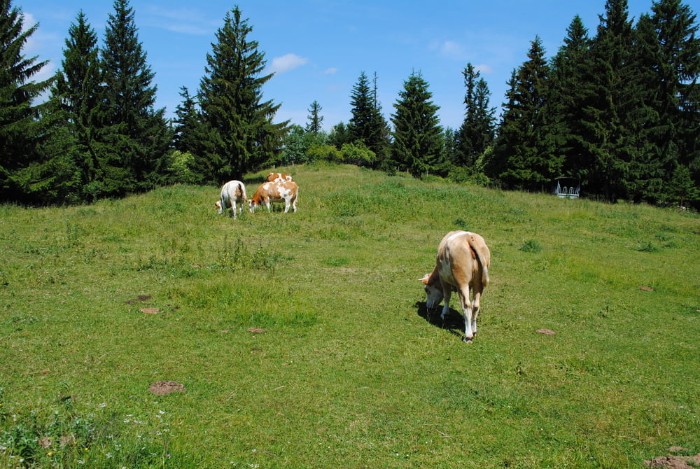
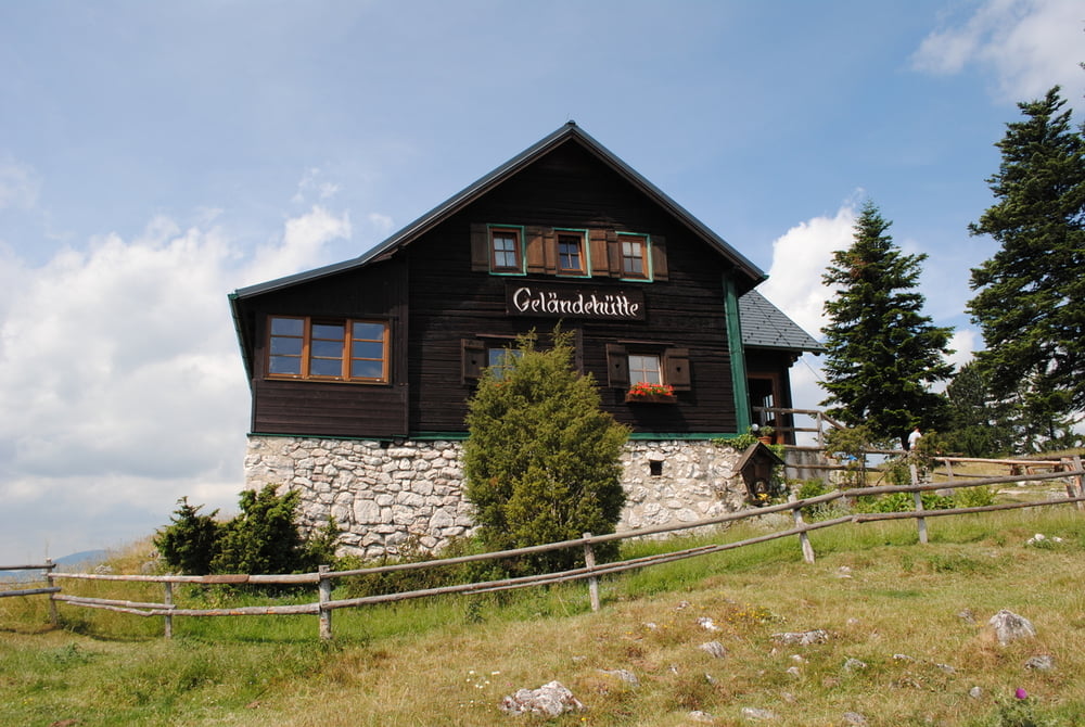
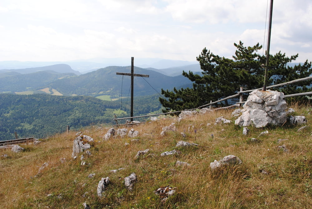
Start Parkplatz Grünbacher Sattel.Rot markiert auf Forststraße gemütlich bergan.Ich habe dann die rote Markierung verlassen und bin auf Forststrasse (Schild Josef Imnitzer Ruhe)verblieben.Bei Kreuzung mit blauer Markierung direkt kurz, aber ziemlich steil aufs Hochplateau bis zur Geländehütte.Gute Hausmannskost und herrlicher Blick auf den Schneeberg.Abstieg variabel.Alle Varianten kreuzen unten eine Forststrasse.Richtung Grünbacher Sattel nehmen.

Further information at

http://www.gelaende.at/

Tour gallery

Tour map and elevation profile

  • Open Street Map
  • Google
Minimum height 675 m Maximum height 1036 m Detailed view

More about the tour author

LeoCheops
Member since 2008

Send private message

Comments

GPS tracks

Trackpoints
  • GPX / Garmin Map Source (gpx) download
  • TCX / Garmin Training Center® (tcx) download
  • CRS / Garmin Training Center® (crs) download
  • Google Earth (kml) download
  • G7ToWin (g7t) download
  • TTQV (trk) download
  • Overlay (ovl) download
  • Fugawi (txt) download
  • Kompass (DAV) Track (tk) download
  • Track data sheet (pdf) download
  • Original file of the author (gpx) download

More about the tour author

LeoCheops
Member since 2008

Send private message
Share track
Add to my favorites
Remove from my favorites
Edit tags
My score
Rate
Track: Aufs Geländ (29.06.2014)
Type: Mountain hiking
Distance: 6,5 km
Evaluated on:
Duration:
Day(s)
Hour(s)
Minute(s)
Score: Landscape Fun factor Fitness Technique