Login

Forgot your login?

Cookies have to be accepted!
Your browser's cookie functionality is disabled. Please enable this functionality.

Not a member yet?

Register now
Login

Available for registred users only

Log in to use this feature.

Forgot your login?

Cookies have to be accepted!
Your browser's cookie functionality is disabled. Please enable this functionality.

Not a member yet?

Register now
Filter
Categories
Advanced filters
  • Distance (km)
  • Height
Save filters Reset filter

TrackRank

QRCode

Technical data

Distance5,6 km Height338 m Way down285 m Duration02:38 h:m Date09.08.2014
Scores Author Landscape Fun factor Fitness Technique

Statistics

200 Views Scores 11 Downloads Average
Rate
  • Track data sheet
  • Directions
  • Downloads
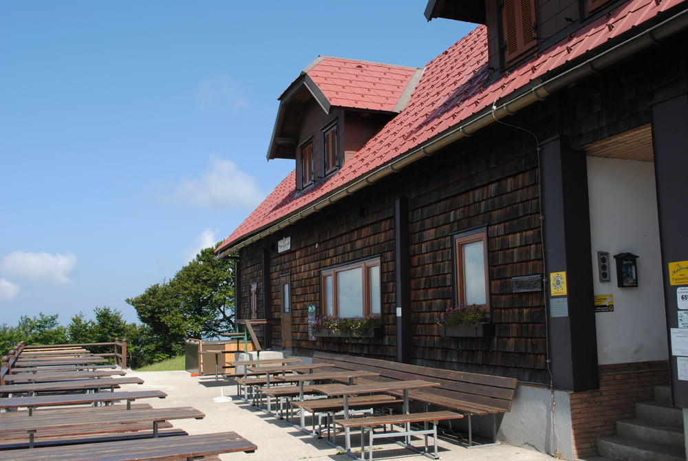
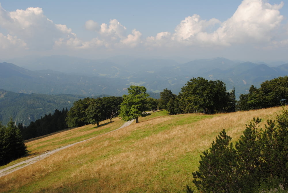
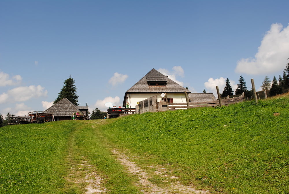
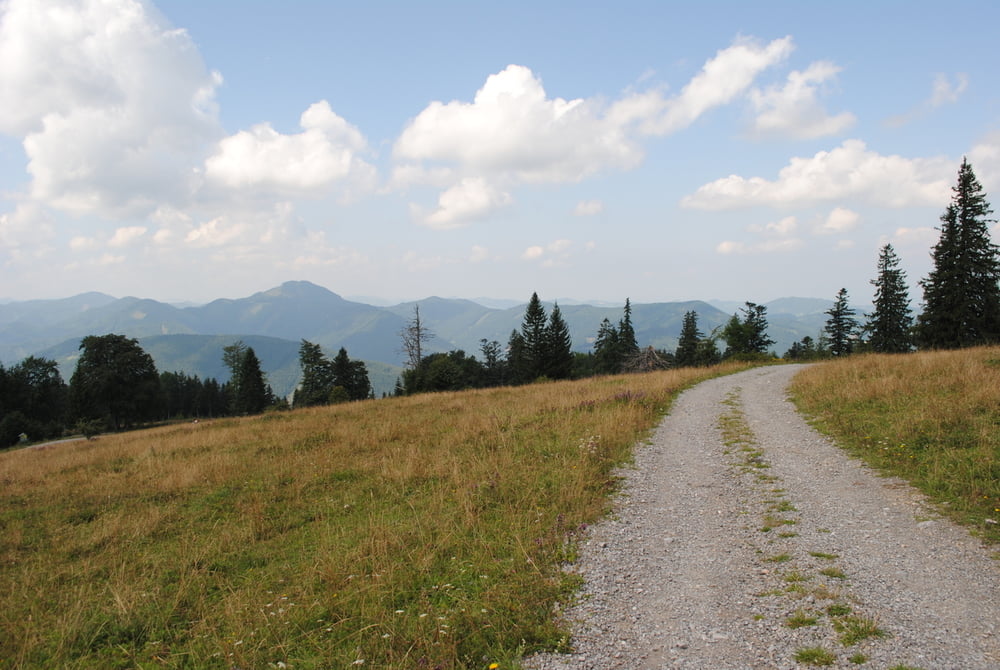
Start Bergstation Sessellift.Etwas steiler hoch zur Kloster Hinteralpe (Gratsteig  wählen, rot markiert) und weiter bis zur Traisener Hütte(war leider geschlossen) Kurz gerastet und schöne Fernsicht genossen) und dann weiter auf gelber Markierung (Lilienfelder Rundwanderweg)bis zum GH. Klosteralpe.Hausmannskost(ich Linsen mit Knödel) und dann weiter bis zum Kreuzungspunkt Lilienfelder Hütte oder Liftstation.Da die erstere auch geschlossen war ,hat mich die Lust verlassen und habe die Runde mit Rückkehr zur Liftstation beendet.

Further information at

http://www.traisen.com/freizeit_sport_wandern_traisnerhuette.asp?style=

Tour gallery

Tour map and elevation profile

  • Open Street Map
  • Google
Minimum height 1068 m Maximum height 1321 m Detailed view

More about the tour author

LeoCheops
Member since 2008

Send private message

Comments

GPS tracks

Trackpoints
  • GPX / Garmin Map Source (gpx) download
  • TCX / Garmin Training Center® (tcx) download
  • CRS / Garmin Training Center® (crs) download
  • Google Earth (kml) download
  • G7ToWin (g7t) download
  • TTQV (trk) download
  • Overlay (ovl) download
  • Fugawi (txt) download
  • Kompass (DAV) Track (tk) download
  • Track data sheet (pdf) download
  • Original file of the author (gpx) download

More about the tour author

LeoCheops
Member since 2008

Send private message
Share track
Add to my favorites
Remove from my favorites
Edit tags
My score
Rate
Track: Über den Muckenkogel (08.08.2014)
Type: Mountain hiking
Distance: 5,6 km
Evaluated on:
Duration:
Day(s)
Hour(s)
Minute(s)
Score: Landscape Fun factor Fitness Technique