


Tour around the Parco del Campo Dei Fiori, the nature parc behind the Lago di Varese.
The tour goes down mainly on small ways, up on streets, except some small parts. Long and difficult downhill on small footpath.
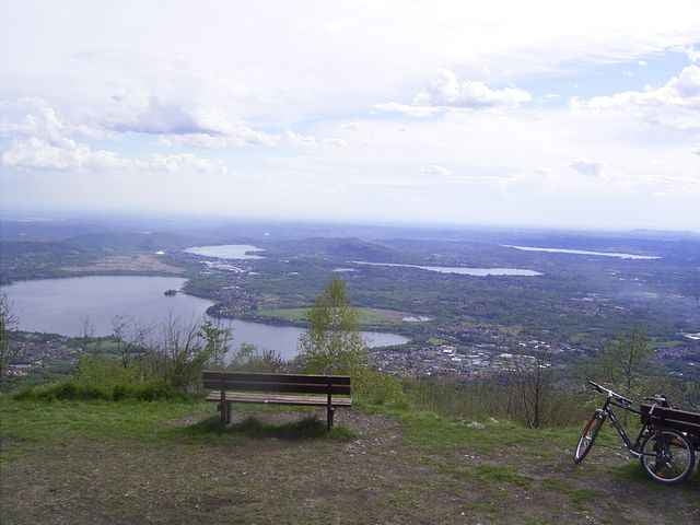
The tour starts in Laveno, goes on street to Brenta, on small ways to Cuvio, on street up to Comaccio and Orino (info on parking about the park ), there we reach the Parco and follow the way around the mountain. In Cerro you can go on up 90° left to the E1 way around the mountain or follow the more difficult track with some single trail and heavy stone ways / foothpaths up again to the E1. Before Velate we followed up the street for another footpath to Velate. In Velate is a bar and a fresh water source. Then we went on nearlay same height to the street (low traffic) up the mountain. When you reach the end of the street there is a view point. Then the way goes on footway along the top of the mountain. The heavy downhill starts after some steps (following sentiero 17). There are a lot alternative downhill ways from the top. For technical not so experienced riders please view the start of the downhill after the steps. The downhill goes down to Cerro/Orino, turns to Cerro and follows the green orange marked sentiero to Brenta. Short before Brenta is very steep downhill (too heavy/dangerous). This track is one of my first, if your is in better quality, please contact me.
The tour goes down mainly on small ways, up on streets, except some small parts. Long and difficult downhill on small footpath.
The tour starts in Laveno, goes on street to Brenta, on small ways to Cuvio, on street up to Comaccio and Orino (info on parking about the park ), there we reach the Parco and follow the way around the mountain. In Cerro you can go on up 90° left to the E1 way around the mountain or follow the more difficult track with some single trail and heavy stone ways / foothpaths up again to the E1. Before Velate we followed up the street for another footpath to Velate. In Velate is a bar and a fresh water source. Then we went on nearlay same height to the street (low traffic) up the mountain. When you reach the end of the street there is a view point. Then the way goes on footway along the top of the mountain. The heavy downhill starts after some steps (following sentiero 17). There are a lot alternative downhill ways from the top. For technical not so experienced riders please view the start of the downhill after the steps. The downhill goes down to Cerro/Orino, turns to Cerro and follows the green orange marked sentiero to Brenta. Short before Brenta is very steep downhill (too heavy/dangerous). This track is one of my first, if your is in better quality, please contact me.
Further information at
http://www.parcocampodeifiori.itTour gallery
Tour map and elevation profile
Minimum height 140 m
Maximum height 1122 m
More about the tour author
|
|
skyhopper |
Comments
More about the tour author
|
|
skyhopper |
Add to my favorites
Remove from my favorites
Edit tags
Open track
My score
Rate
Wiederholung am 31.05.2013
my report (in german): http://www.bergtour.ch/gipfelbuch/detail/id/60729
Started in Cittiglio.
Nice tour off the commonly croweded MTB hot spots