

Erster Tag des Harkerville Coastal Trails:
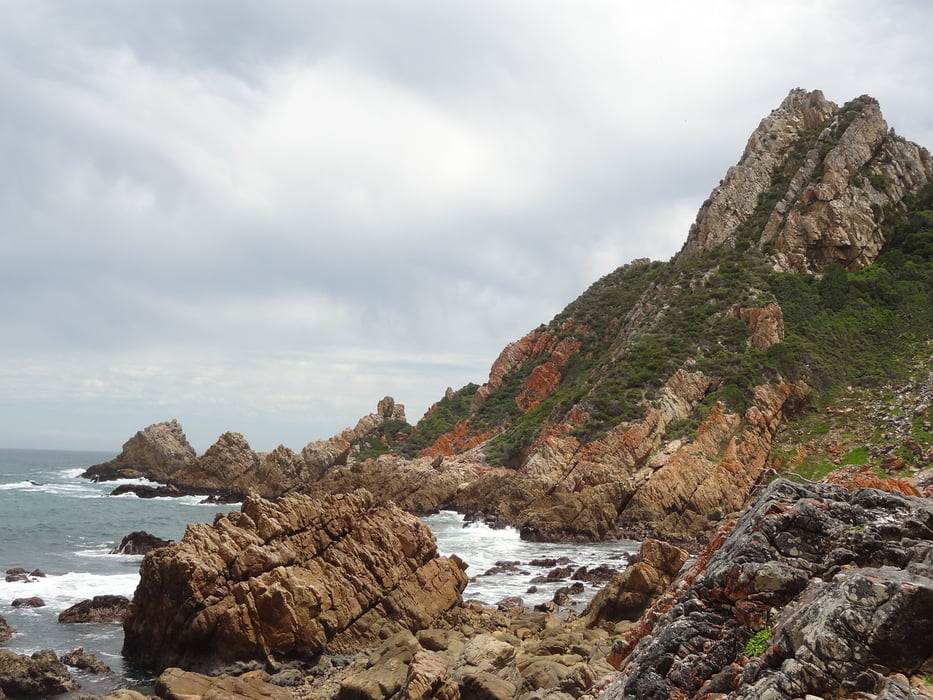
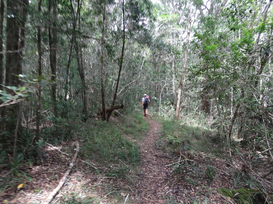
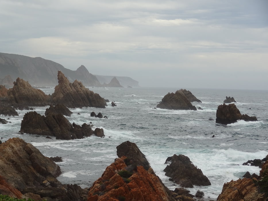
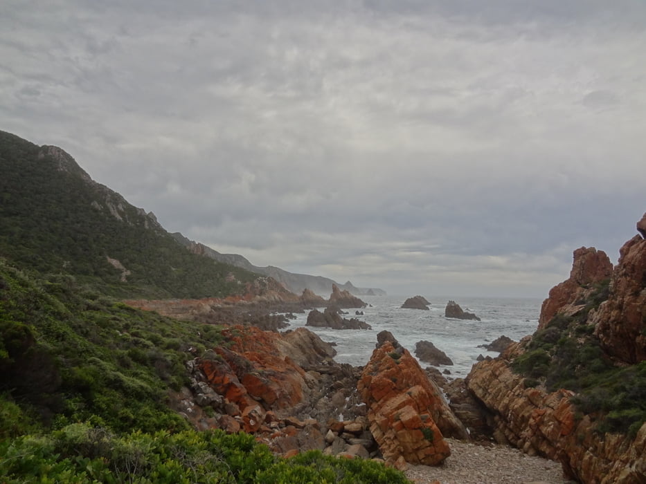
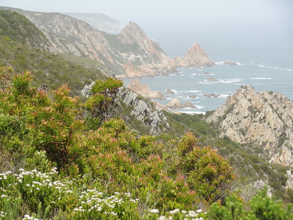
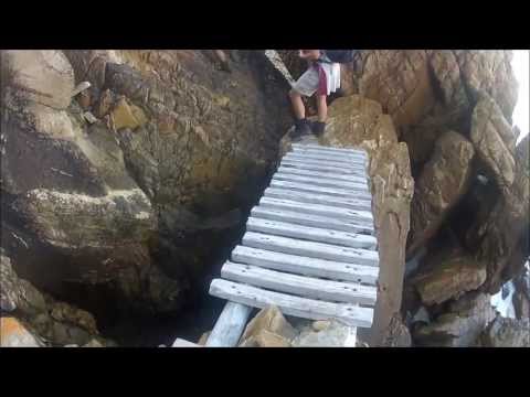
Nachdem wir uns beim Forester's Office angemeldet haben wandern wir durch den indigenen Wald, welcher leider auch mal von einer großen Rodungsfläche unterbrochen wird. Nach etwa knapp 10km erreichen wir die Kante des Plateaus und erblicken die Küste. Steil geht es bergab. Wir folgen der Küsten für die nächsten 2,2km, permanent über Felsen und Klippen auf- und absteigend. Ketten und Holztreppen helfen über die schwierigsten Passagen.
Dann steigen wir über viele Serpentinen etwa 190HM auf und erreichen auf dem Plateau unsere Übernachtungsmöglichkeit. Die Nacht verbringen wir in der Sinclair Hut (sie befindet sich auf dem Plateau über der Küste. Stockbetten/Matratzen sowie Toiletten/Waschbecken vorhanden. Ebenso Feuerholz, Grill und Feuerstelle. Die Hütte ist für max. 12 Personen ausgelegt. Kein Trinkwasser, kein Strom).
Bei nassen/feuchten Verhältnissen kann es auf den Felsen glitschig werden!
================
First day of Harkerville Coastal Trail:
After registering in Forester's Office we are hiking through indigenous forest which is unfortunately intercepted by a large clearance area. After around 10km we are approaching the edge of the Plateau and looking downwards the coast line. We are descending and for the next 2,2km we are climbing up and down over rocks and cliffs. Chains and wodden stairs helping for the most difficult parts.
On a windy trail, we are ascending about 190m in Elevation and reaching the Plateau where our accommodation is reached: Sinclair Hut (Situated on high ground overlooking the coast. Bunk beds and mattresses are provided as well as a veld toilet. Firewood is available for braaing and warmth. The hut shelters max. 12 People. No electricity, no trinking water)
Wet and clammy conditions will turn the rocks slippery!
=============
http://www.cape-hike.co.za/harkerville-coastal-trail/
https://hikesouthafrica.wordpress.com/harkerville/
http://www.gardenrouteadventureguide.com/harkerville-coastal-hiking-trail.html
http://www.sahikes.co.za/Details.asp?TrailID=93
http://www.gotrekking.co.za/index_files/harkervillehikingtrail.htm
http://www.jhbhiking.co.za/main/harkerville-trail
http://www.ralphpina.com/2013/05/harkerville-coastal-hiking-trail/
Further information at
/en/tracks/detail.138432.htmlTour gallery
Tour map and elevation profile
Minimum height -6 m
Maximum height 279 m
More about the tour author
|
|
Traenkerluis |
Comments

More about the tour author
|
|
Traenkerluis |
Add to my favorites
Remove from my favorites
Edit tags
Open track
My score
Rate