
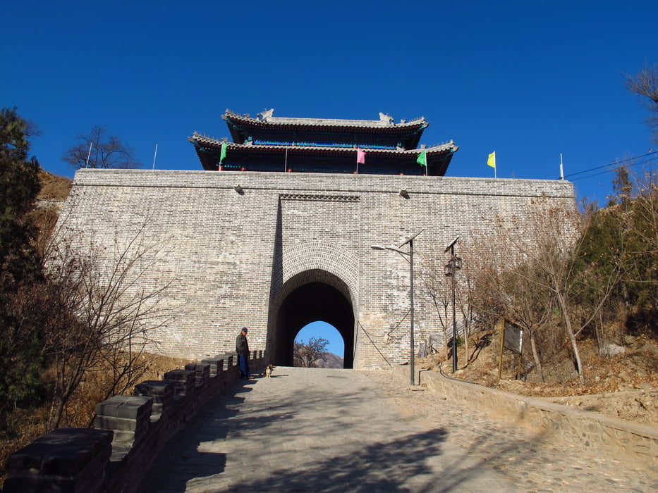

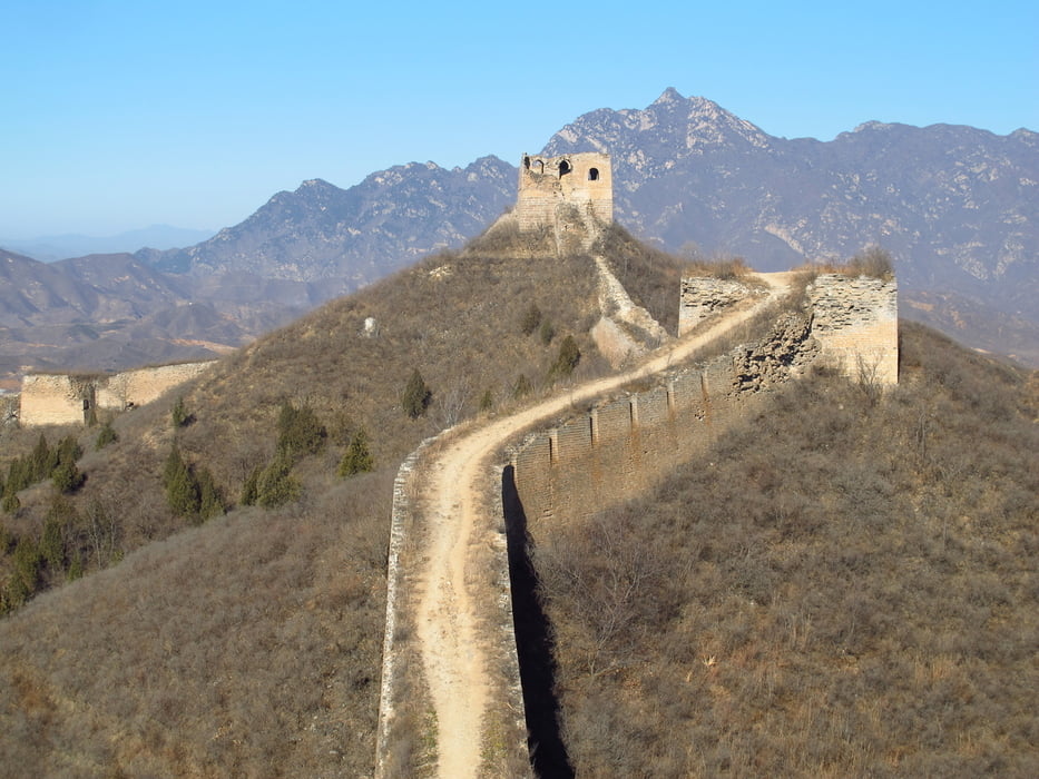
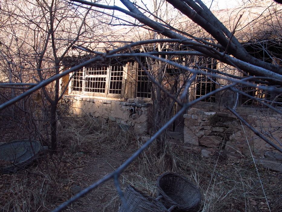
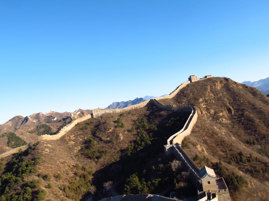
Am Ticket Office vorbei zum renovierten Tor (2014). Davor rechts den Hügel hinauf. Der Pfad führt am Tor vorbei zur Mauer. Gubeikou war eine Garnison in der MIng Zeit. Daher gibt es hier Befestigungsmauer die zur Garnison gehören und Chinesische Mauer. Diese verläuft dann bis Jinshanling und weiter. Am 16 Augen Turm muss man die Mauer verlassen und in das Tal absteigen. Die Mauer ist für ein Stück gesperrt. Militärisches Sperrgebiet. In diesem Tal gibt es verlassene Bauernhäuser und viele Felder mit Mais und anderen Feldfrüchten. Auch gibt es ein kleines Bauernrestaurant/Kiosk mit Toilette. Wenn man das Sperrgebiet passiert hat geht es zurück zur Mauer. Dort hat man einen super Blick in beide Richtungen an der Mauer entlang. An der Mauer weiter wandern bis zu einem kleinen Durchgang durch die Mauer ( hat Öffnungszeiten ). Sollte tagsüber aber kein Problem sein. Von dort geht es auf die Mauer und Richtung Jinshanling. An einem der nächsten Türme steht bestimmt ein Wächter der wieder Eintritt für Jinshanling verlangt. Am Turm mit dem Vorplatz auf dem eine Reiterstatur steht die Mauer verlassen und der Straße zum Ausgang des Nationalparks folgen. Wer möchte kann der Mauer noch weiter folgen und an einer späteren Stell in das Tal absteigen.
Tour gallery
Tour map and elevation profile
Minimum height 215 m
Maximum height 477 m
More about the tour author
|
|
Hastati |
Comments

More about the tour author
|
|
Hastati |
Add to my favorites
Remove from my favorites
Edit tags
Open track
My score
Rate