


Zwei Tage auf dem Obermain
Start / Ziel: Lichtenfels am Campingplatz ( gute Parkmöglichkeit und WC vorhanden! ) / Bischberg bei Bamberg
1.Etappe: Lichtenfels - Campingplatz Altmainsee bei Ebensfeld
Umtragen an zwei Wehren notwendig, unproblematisch! Für Faltboote geeignete Strecke..
2.Etappe: Campingplatz Altmainsee bis Bischberg bei Bamberg ( guter Anleger vorhanden! )
Keine Wehre dafür gefühlte 15 Sohleschwellen die aus heutiger Sicht für Faltboote nicht geeignet sind! Es sei denn, man hat eine alte Bootshaut und gönnt sich den Spaß! Unterhalb von Hallstadt wieder fahrbar für Faltboote............
Die Strecke ist von der Landschaft und der Ruhe perfekt zum entspannen und genießen........
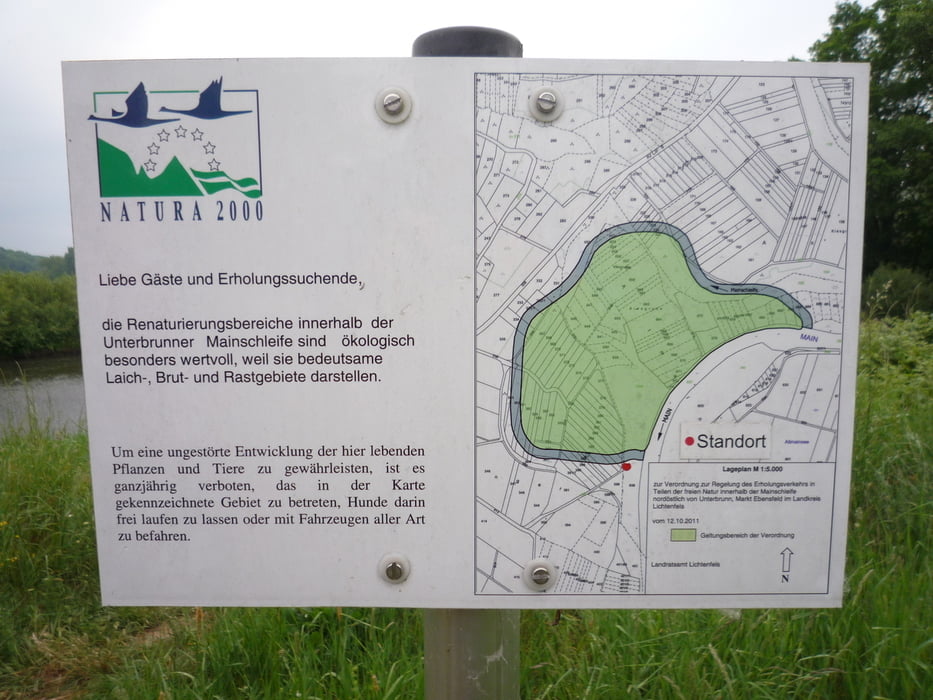
Beachte auf dieser Strecke die Befahrensregeln und den Wasserstand am Messpunkt Kemmern!
Gefahren mir einem Klepper Aerius 2 im Mai 2015.
Viel Spaß!
Further information at
http://www.kajak-channel.de/bkvpegel.htmTour gallery

Tour map and elevation profile
Minimum height 249 m
Maximum height 294 m
More about the tour author
|
|
FLU |
Comments

GPS tracks
Trackpoints-
GPX / Garmin Map Source (gpx) download
-
TCX / Garmin Training Center® (tcx) download
-
CRS / Garmin Training Center® (crs) download
-
Google Earth (kml) download
-
G7ToWin (g7t) download
-
TTQV (trk) download
-
Overlay (ovl) download
-
Fugawi (txt) download
-
Kompass (DAV) Track (tk) download
-
Track data sheet (pdf) download
-
Original file of the author (gpx) download
More about the tour author
|
|
FLU |
Add to my favorites
Remove from my favorites
Edit tags
Open track
My score
Rate