Login

Forgot your login?

Cookies have to be accepted!
Your browser's cookie functionality is disabled. Please enable this functionality.

Not a member yet?

Register now
Login

Available for registred users only

Log in to use this feature.

Forgot your login?

Cookies have to be accepted!
Your browser's cookie functionality is disabled. Please enable this functionality.

Not a member yet?

Register now
Filter
Categories
Advanced filters
  • Distance (km)
  • Height
Save filters Reset filter

TrackRank

QRCode

Technical data

Distance8,3 km Height448 m Way down510 m Duration03:00 h:m Date29.06.2015
Scores Author Landscape Fun factor Fitness Technique

Statistics

647 Views Scores 22 Downloads Average
Rate
  • Track data sheet
  • Directions
  • Downloads

Fantastic tour along a part of the ancient city wall of Seoul. Great views onto the city its sights and the surroundings.

The trail starts at Waryong park. Be sure you have your passport with you, because you need to register for the section between Malbawi Information Center and Changuimun Gate.

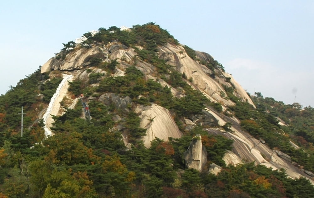
You come along the beautiful heights of Baegak mountain and Inwangsan mountain with fantastic views on the whole city and Gyeongbokgung Palace, Blue House, Namsan Tower and many other sights.

For more information go to: seoulcitywall.seoul.go.kr/front/eng/index.do


Further information at

https://en.wikipedia.org/wiki/Seoul

Tour gallery

Tour map and elevation profile

  • Open Street Map
  • Google
Minimum height 97 m Maximum height 387 m Detailed view

More about the tour author

grenz-pfad-fahrer
Member since 2009

Send private message

Comments

Take subway number 3 to Anguk station, then take bus number 2 to the final stop, where the track starts.

The track ends at Dongnimmun station; line number 3.


GPS tracks

Trackpoints
  • GPX / Garmin Map Source (gpx) download
  • TCX / Garmin Training Center® (tcx) download
  • CRS / Garmin Training Center® (crs) download
  • Google Earth (kml) download
  • G7ToWin (g7t) download
  • TTQV (trk) download
  • Overlay (ovl) download
  • Fugawi (txt) download
  • Kompass (DAV) Track (tk) download
  • Track data sheet (pdf) download
  • Original file of the author (gpx) download

More about the tour author

grenz-pfad-fahrer
Member since 2009

Send private message
Share track
Add to my favorites
Remove from my favorites
Edit tags
My score
Rate
Track: Seoul City Wall - Baegak and Inwangsan mountain
Type: Hiking
Distance: 8,3 km
Evaluated on:
Duration:
Day(s)
Hour(s)
Minute(s)
Score: Landscape Fun factor Fitness Technique