


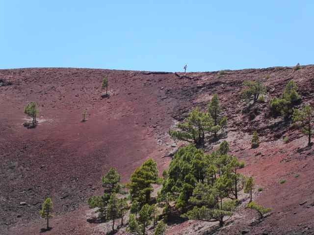
Wir starten in Los Canarios im Süden der Insel. Der Wanderweg GR 131 ist mit Wegweisern und Felsmarkierungen gut ausgeschildert. Zunächst geht es durch Pinienwälder im Halbschatten zum Teil steil aufwärts. Vorbei am Fuente de los Roques marschieren wir auf Lavasand und –geröll hinauf in das Kratergebiet des Volcán Martín. Einige Abstecher auf vorgegebenen Pfaden zum Kraterrand und zum benachbarten Gipfel sind sehr lohnenswert.
Immer wieder haben wir bei guter Fernsicht einen Blick auf die benachbarten Inseln Teneriffa, La Gomera und El Hierro. Beim Abstieg folgen wir ein Stück dem grün markierten Wanderweg SL FU 110 durch ein bizarres Lavafeld. Beim Montaña del Pina stoßen wir wieder auf unsere ursprüngliche Route.
Immer wieder haben wir bei guter Fernsicht einen Blick auf die benachbarten Inseln Teneriffa, La Gomera und El Hierro. Beim Abstieg folgen wir ein Stück dem grün markierten Wanderweg SL FU 110 durch ein bizarres Lavafeld. Beim Montaña del Pina stoßen wir wieder auf unsere ursprüngliche Route.
Tour gallery
Tour map and elevation profile
Minimum height 708 m
Maximum height 1626 m
More about the tour author

|
erwin.janko |
Comments

Mietwagen oder Bus
GPS tracks
Trackpoints-
GPX / Garmin Map Source (gpx) download
-
TCX / Garmin Training Center® (tcx) download
-
CRS / Garmin Training Center® (crs) download
-
Google Earth (kml) download
-
G7ToWin (g7t) download
-
TTQV (trk) download
-
Overlay (ovl) download
-
Fugawi (txt) download
-
Kompass (DAV) Track (tk) download
-
Track data sheet (pdf) download
-
Original file of the author (g7t) download
More about the tour author
|
|
erwin.janko |
Add to my favorites
Remove from my favorites
Edit tags
Open track
My score
Rate