Login

Forgot your login?

Cookies have to be accepted!
Your browser's cookie functionality is disabled. Please enable this functionality.

Not a member yet?

Register now
Login

Available for registred users only

Log in to use this feature.

Forgot your login?

Cookies have to be accepted!
Your browser's cookie functionality is disabled. Please enable this functionality.

Not a member yet?

Register now
Filter
Categories
Advanced filters
  • Distance (km)
  • Height
Save filters Reset filter

TrackRank

QRCode

Technical data

Distance7,6 km Height545 m Way down587 m Duration00:00 h:m Date24.09.2015
Scores Author Landscape Fun factor Fitness Technique

Statistics

365 Views Scores 21 Downloads Average
Rate
  • Track data sheet
  • Directions
  • Downloads
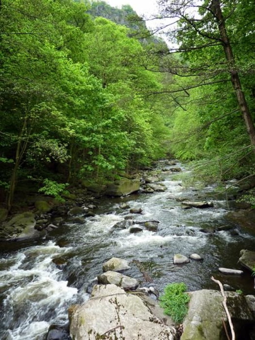
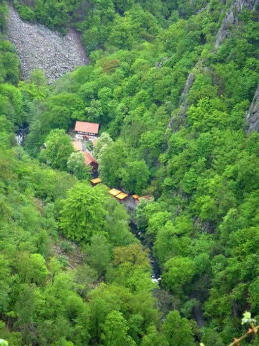
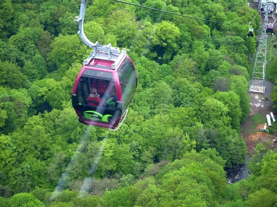
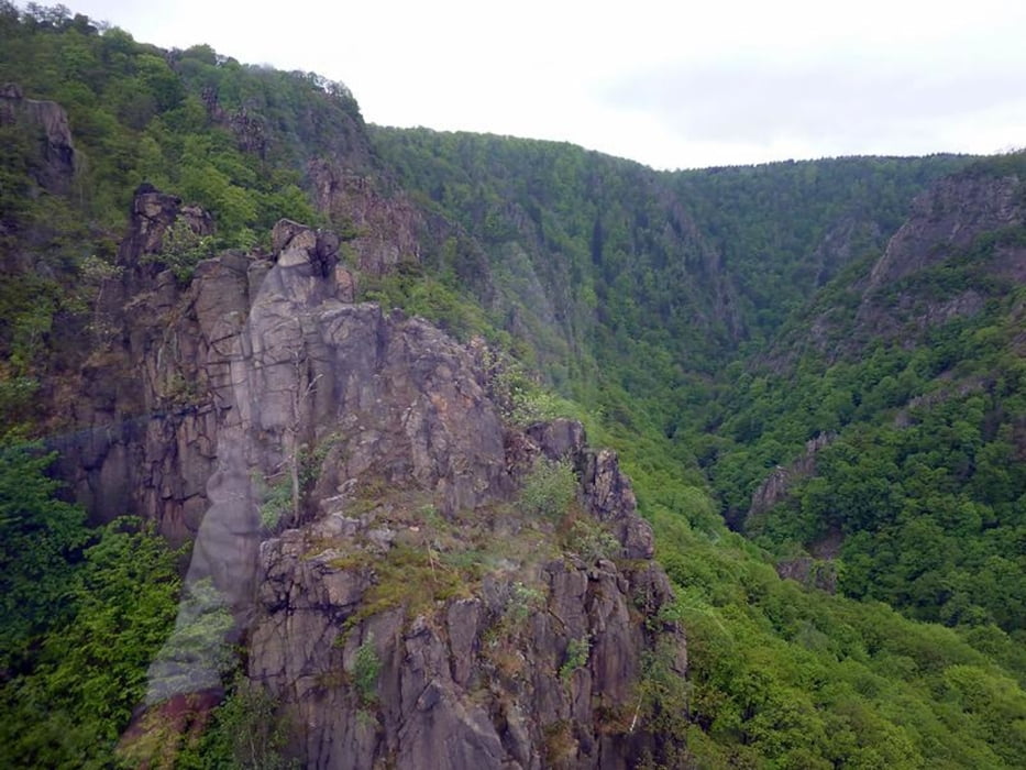
Diese kleine Wanderung beginnt am Gasthaus Königsruh im schönen Bodetal. Von dort geht es über eine mehr als 100 Jahre alte Steinbrück recht steil hinauf zum Hexentanzplatz. Mit der neu eröffnetten Seilbahn geht es hinab nach Thale. Von dort kann man mit einer luftigen Schwebebahn hinauf zur Rosstrappe. Entweder man kommt auf selbem Wege wieder zurück und läuft die ca. 1,5 km von der Talstation bis zum Ausgangspunkt, oder man wandert gleich von oben hinab direkt zum Gasthaus Königsruh (ca. 2,75 km ). Einkehrmöglichkeiten gibt es reichlich . . .

Further information at

http://www.harzinfo.de/

Tour gallery

Tour map and elevation profile

  • Open Street Map
  • Google
Minimum height 171 m Maximum height 467 m Detailed view

More about the tour author

Colin1972
Member since 2015

Send private message

Comments

Der Harz als Urlaubsregion mitten in Deutschland ist aus allen Himmelsrichtungen, ob auf Straße oder Schiene, gut erreichbar.

Zahlreiche Autobahnanbindungen sind vorhanden und viele Orte am Harzrand sind gut mit der Bahn erreichbar.

Am Urlaubsort angekommen finden Sie verschiedene Busverbindungen für Ausflüge und die Harzer Schmalspurbahnen verbinden ebenfalls über 20 Orte im Harz mit regelmäßigem Zugverkehr.

GPS tracks

Trackpoints
  • GPX / Garmin Map Source (gpx) download
  • TCX / Garmin Training Center® (tcx) download
  • CRS / Garmin Training Center® (crs) download
  • Google Earth (kml) download
  • G7ToWin (g7t) download
  • TTQV (trk) download
  • Overlay (ovl) download
  • Fugawi (txt) download
  • Kompass (DAV) Track (tk) download
  • Track data sheet (pdf) download
  • Original file of the author (gpx) download

More about the tour author

Colin1972
Member since 2015

Send private message
Share track
Add to my favorites
Remove from my favorites
Edit tags
My score
Rate
Track: Harz - Hexentanzplatz / Rosstrappe
Type: Mountain hiking
Distance: 7,6 km
Evaluated on:
Duration:
Day(s)
Hour(s)
Minute(s)
Score: Landscape Fun factor Fitness Technique