Login

Forgot your login?

Cookies have to be accepted!
Your browser's cookie functionality is disabled. Please enable this functionality.

Not a member yet?

Register now
Login

Available for registred users only

Log in to use this feature.

Forgot your login?

Cookies have to be accepted!
Your browser's cookie functionality is disabled. Please enable this functionality.

Not a member yet?

Register now
Filter
Categories
Advanced filters
  • Distance (km)
  • Height
Save filters Reset filter

TrackRank

QRCode

Technical data

Distance10,2 km Height422 m Way down425 m Duration03:00 h:m Date27.10.2015
Scores Author Landscape Fun factor Fitness Technique

Statistics

1116 Views Scores 30 Downloads Average
Rate
  • Track data sheet
  • Directions
  • Downloads
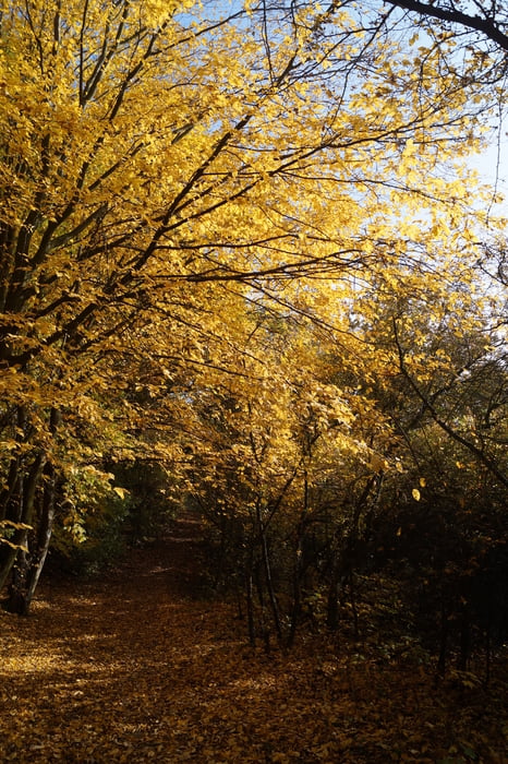
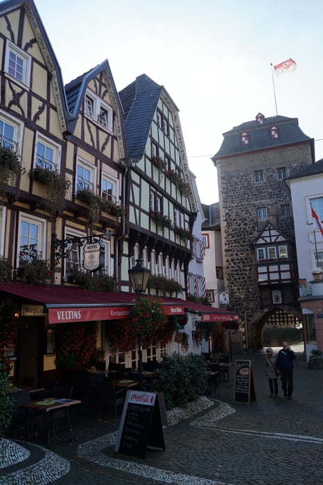
Falls man mal keine Lust auf eine lange Etappe hat, bietet sich dieses Teilstück mit schönen Waldwegen und einigen schönen Ausblicken ins Rheintal und darüber hinaus an. Der Weg samt Zuwegen ist durchgehend gut markiert. Vom Bahnhof in Unkel ist es ca. ein Kilometer bis zum eigentlichen Rheinsteig. Von hier geht's vorbei an der Erpeler Ley und dem Kasbachtal bis zum Etappenziel im netten Örtchen Linz.

Tour gallery

Tour map and elevation profile

  • Open Street Map
  • Google
Minimum height 36 m Maximum height 212 m Detailed view

More about the tour author

sstraesser
Member since 2012

Send private message

Comments

GPS tracks

Trackpoints
  • GPX / Garmin Map Source (gpx) download
  • TCX / Garmin Training Center® (tcx) download
  • CRS / Garmin Training Center® (crs) download
  • Google Earth (kml) download
  • G7ToWin (g7t) download
  • TTQV (trk) download
  • Overlay (ovl) download
  • Fugawi (txt) download
  • Kompass (DAV) Track (tk) download
  • Track data sheet (pdf) download
  • Original file of the author (gpx) download

More about the tour author

sstraesser
Member since 2012

Send private message
Share track
Add to my favorites
Remove from my favorites
Edit tags
My score
Rate
Track: Auf dem Rheinsteig von Unkel nach Linz
Type: Hiking
Distance: 10,2 km
Evaluated on:
Duration:
Day(s)
Hour(s)
Minute(s)
Score: Landscape Fun factor Fitness Technique