Login

Forgot your login?

Cookies have to be accepted!
Your browser's cookie functionality is disabled. Please enable this functionality.

Not a member yet?

Register now
Login

Available for registred users only

Log in to use this feature.

Forgot your login?

Cookies have to be accepted!
Your browser's cookie functionality is disabled. Please enable this functionality.

Not a member yet?

Register now
Filter
Categories
Advanced filters
  • Distance (km)
  • Height
Save filters Reset filter

TrackRank

QRCode

Technical data

Distance8,5 km Height325 m Way down401 m Duration00:00 h:m Date08.02.2016
Scores Author Landscape Fun factor Fitness Technique

Statistics

484 Views Scores 52 Downloads Average
Rate
  • Track data sheet
  • Directions
  • Downloads

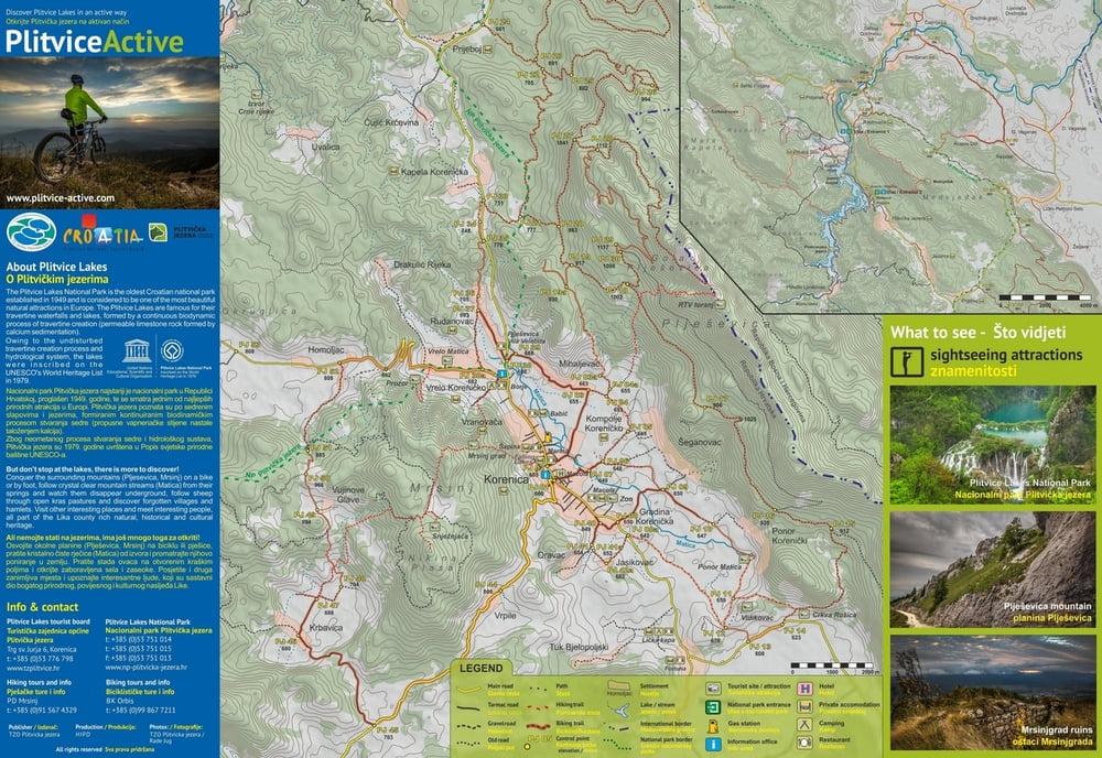
The remarkable experience of the Park is even more exciting if one takes a closer look at its forest ecological systems, prevailing on over three-quarters of its surface. These instructive trails tell stories about the forest systems native to the Plitvice lakes area that harbour biodiversity helping the lake ecosystems proliferate. The trails lead through large forest complexes and mountain meadows with wonderful viewpoints. Boards accompany the itinerary, leading the reader through enchanting forest wildlife habitats and historical and cultural sights of this area. The trails are quite long and the terrain varies, so explorers will also benefit from its recreational aspects.

The forests and meadows are home to various wildlife species such as bear, wolf, roe deer, red deer, lynx and wildcat. Therefore, if you are lucky enough, you may encounter some of these on the way! If this does not happen, though, the tracks they leave are also interesting (prints, excrement etc.) Birdsong (woodpeckers and singing birds) in harmony with the creaking of centennial tree branches swaying in the wind create an unforgettable symphony of nature.

Tour gallery

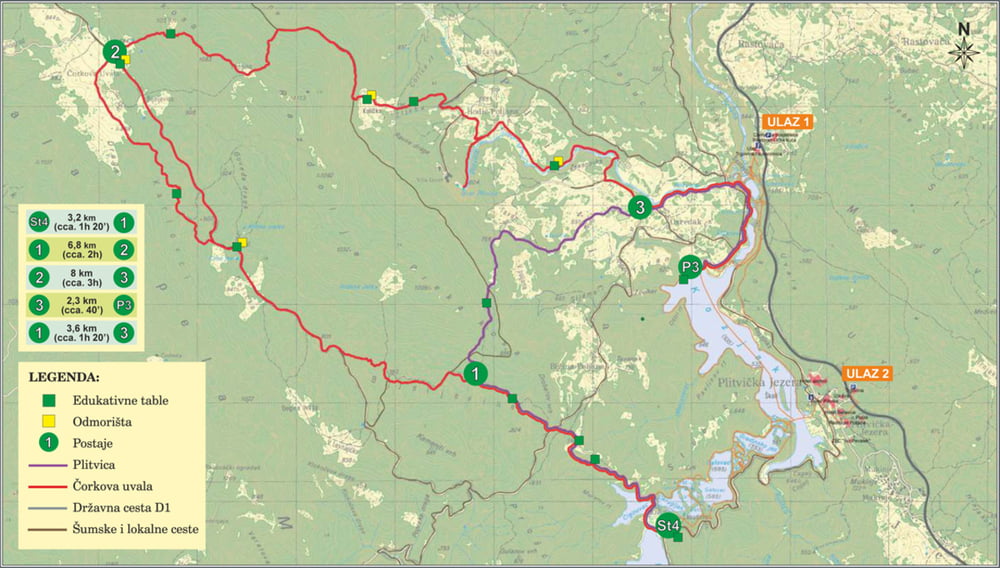
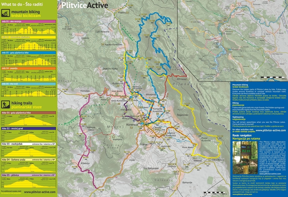
Tour map and elevation profile

  • Open Street Map
  • Google
Minimum height 523 m Maximum height 894 m Detailed view

More about the tour author

PlitviceActive
Member since 2013

Send private message

Comments

The beginning of this trail is at Labudovac (panoramic train stop no. 4), over point no. 1, where it forks off from 'Corkova uvala' Trail towards point no. 3, where it re-connects the 'Corkova Uvala' Trail continuing further on downstream along the Plitvica Stream to the Great Fall and the ship dock P3 at Kozjacka draga.

GPS tracks

Trackpoints
  • GPX / Garmin Map Source (gpx) download
  • TCX / Garmin Training Center® (tcx) download
  • CRS / Garmin Training Center® (crs) download
  • Google Earth (kml) download
  • G7ToWin (g7t) download
  • TTQV (trk) download
  • Overlay (ovl) download
  • Fugawi (txt) download
  • Kompass (DAV) Track (tk) download
  • Track data sheet (pdf) download
  • Original file of the author (gpx) download

More about the tour author

PlitviceActive
Member since 2013

Send private message
Share track
Add to my favorites
Remove from my favorites
Edit tags
My score
Rate
Track: Hike 05 Plitvica
Type: Mountain hiking
Distance: 8,5 km
Evaluated on:
Duration:
Day(s)
Hour(s)
Minute(s)
Score: Landscape Fun factor Fitness Technique