


Diese kleine Tour war nur Plan B. Eigentlich wollten wir eine kleine Runde im inneren des Parks laufen.
Im Sommer ist dieser Bereich jedoch nur über Shuttle erreichbar. An unserem Wandertag (Samstag) war jedoch kein Platz auf dem Parkplatz am Busbahnhof mehr zu bekommen. Schilder forderten uns auf, außerhalb des Parks in Springdale zu parken. Das war uns jedoch zu aufwendig. Also Plan B.
Gut das wir nicht den Eintritt von 30$ bezahlt hatten ;-)
Der Trailhead mit nur ca. 10 Parkplätzen befindet sich gleich hinter dem langen Tunnel und kann nur in Richtung Carmel Junction angefahren werden. Der Tunnel kann wegen der vielen Wohnmobile de fakto nur einspurig befahren werden. Unser Glück. Denn so konnte sich der Parkplatz wärend der Tunnelsperrung etwas leeren und wir dann einen der zwei freigewordenen Parkplätze ergattern.
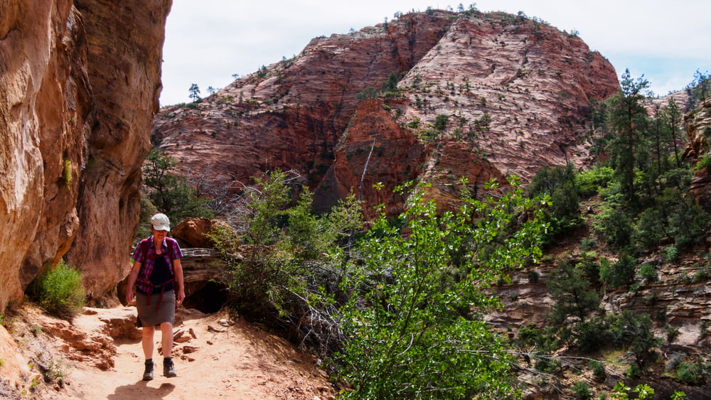
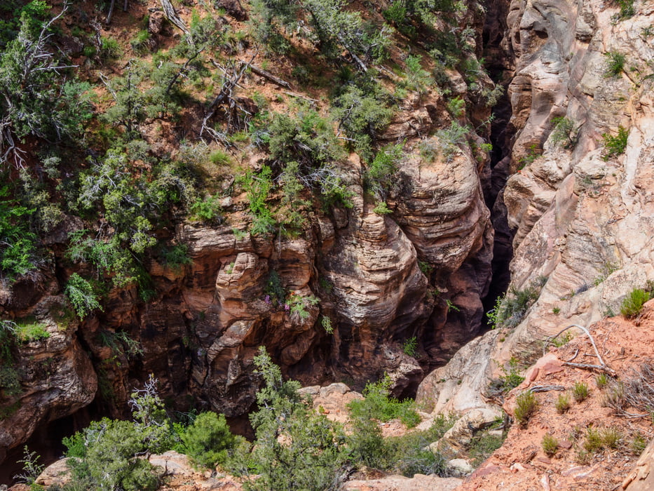
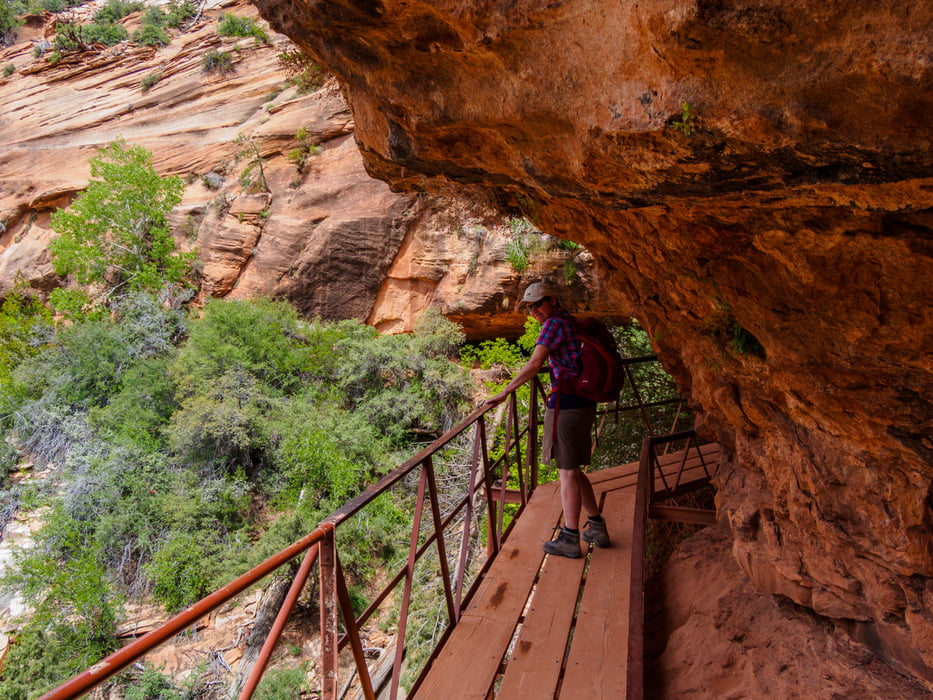
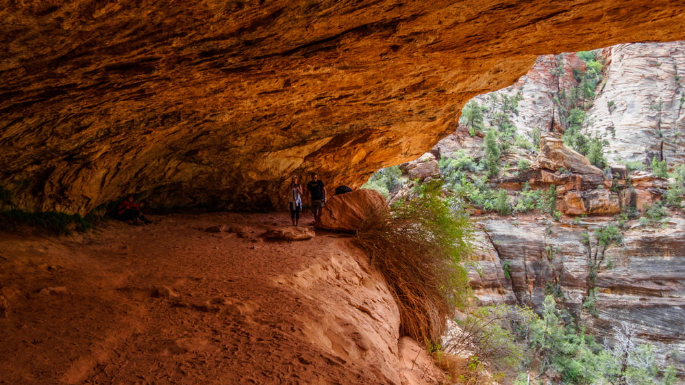
Der kleine Trail lohnt sich. Am Anfang sieht es nach einem Spaziergang aus. Der Pfad verläuft ohne große Höhenänderung an einer Flanke des Canyons des sich zunehmend tiefer eingeschneidenden Pine Creek. Einige luftige Stellen sind gesichert, andere weniger. Am Outlook bietet sich ein grandioser Blick den hier sich weitenden Pine Creek Canyon hinunter bis zum Virgin River. Zurück geht es auf dem selben Weg.
Die gewonnene Zeit nutzten wir noch zu einem Abstecher zum Marble Canyon und zu Lee's Ferry am Colorado.
Further information at
http://www.zionnational-park.com/zion-canyon-overlook-trail.htmTour gallery
Tour map and elevation profile
Minimum height 1566 m
Maximum height 1600 m
More about the tour author
|
|
ds5 |
Comments

From the North: Travel I-15 south, past Beaver. exit on Hwy 20. Follow US-89 to Mount Carmel Junction. Take SR-9 to Zion's east entrance.
From Arizona: Travel US-89A through Fredonia, Arizona and Kanab Utah. Follow US-89 to Mount Carmel Junction. Take SR-9 to the east park entrance.
From the South: Travel I-15 north. Take exit 16 and travel through Hurricane to LaVerkin. Continue on SR-9 to the south entrance of the park. SR-9 through Zion National Park is always open and is also called the Zion-Mt. Carmel Highway
Zion Park Fees:
Private Vehicle $30 for 7 days (oder anuall pass)
GPS tracks
Trackpoints-
GPX / Garmin Map Source (gpx) download
-
TCX / Garmin Training Center® (tcx) download
-
CRS / Garmin Training Center® (crs) download
-
Google Earth (kml) download
-
G7ToWin (g7t) download
-
TTQV (trk) download
-
Overlay (ovl) download
-
Fugawi (txt) download
-
Kompass (DAV) Track (tk) download
-
Track data sheet (pdf) download
-
Original file of the author (gpx) download
More about the tour author
|
|
ds5 |
Add to my favorites
Remove from my favorites
Edit tags
Open track
My score
Rate