
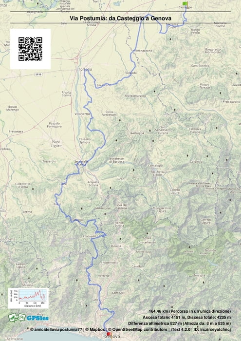

Continuando tra i colli si arriva a Gavi, col suo castello e la chiesa di San Giacomo, per poi scalare i monti e arrivare a Bosio e Voltaggio col suo ponte romano, Altre montagne e arriviamo a Fraconalto, per poi passare il passo della Bocchetta e scendere verso Pontedecimo, ultima salita e via sul sentiero dei forti di Genova , per arrivare al mare nella bella città ligure
Further information at
https://www.facebook.com/groups/319290031614676/?ref=bookmarksTour map and elevation profile
Minimum height 17 m
Maximum height 832 m
More about the tour author

|
viapostumia |
Comments

Si arriva in treno
GPS tracks
Trackpoints-
GPX / Garmin Map Source (gpx) download
-
TCX / Garmin Training Center® (tcx) download
-
CRS / Garmin Training Center® (crs) download
-
Google Earth (kml) download
-
G7ToWin (g7t) download
-
TTQV (trk) download
-
Overlay (ovl) download
-
Fugawi (txt) download
-
Kompass (DAV) Track (tk) download
-
Track data sheet (pdf) download
-
Original file of the author (gpx) download
More about the tour author
|
|
viapostumia |
Add to my favorites
Remove from my favorites
Edit tags
Open track
My score
Rate