Login

Forgot your login?

Cookies have to be accepted!
Your browser's cookie functionality is disabled. Please enable this functionality.

Not a member yet?

Register now
Login

Available for registred users only

Log in to use this feature.

Forgot your login?

Cookies have to be accepted!
Your browser's cookie functionality is disabled. Please enable this functionality.

Not a member yet?

Register now
Filter
Categories
Advanced filters
  • Distance (km)
  • Height
Save filters Reset filter

TrackRank

QRCode

Technical data

Distance11,4 km Height631 m Way down1443 m Duration03:30 h:m Date07.05.2017
Scores Author Landscape Fun factor Fitness Technique

Statistics

298 Views Scores 24 Downloads Average
Rate
  • Track data sheet
  • Directions
  • Downloads

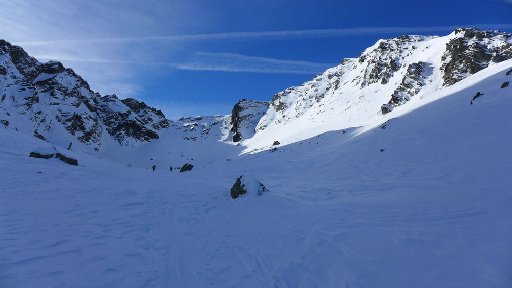
Von der Cabana Balea Lac den zugefrorenen See überqueren und nach Westen in eine Scharte Curmatura Balei aufsteigen

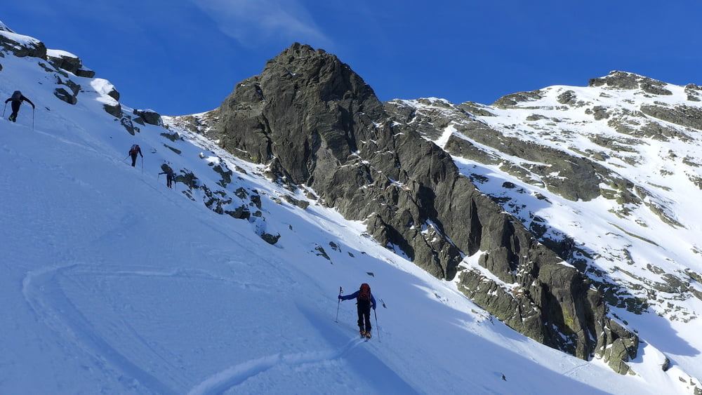
Auf der Rückseite bis ca. 2000 m ins Doamnei-Tal abfahren und gen Talschluss aufsteigen. Am Schluss steil von links nach rechts in eine Scharte ansteigen und über den SO-Rücken zum Gipfel

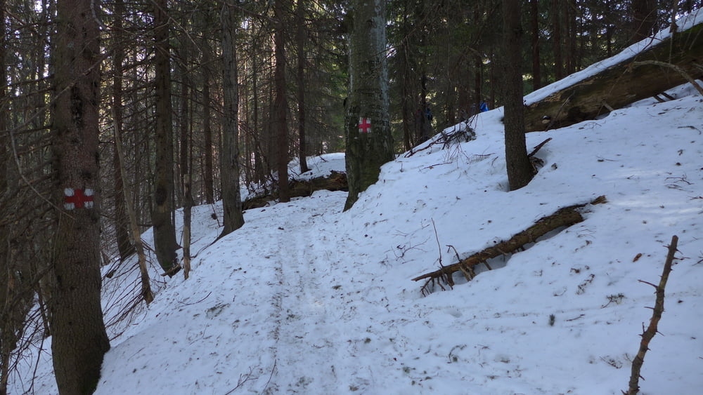
Abfahrt zunächst wie Aufstieg, dann weiter das Doamnei Tal hinab bis auf ca. 1350m, wo man den Talgrund nach rechts auf den mit einem roten Kreuz markierten Wanderweg verlässt. Zunächst leicht fallend queren, dann kommt ein kleiner gegenanstieg bis auf den Rücken. Von dort wieder abwärts bis knapp oberhalb Balea Cascada. Den Bach überqueren und nach Balea Cascada. Mit der Seilbahn zurück

  Jahreszeit der Tour: Mitte Februar

Tour gallery

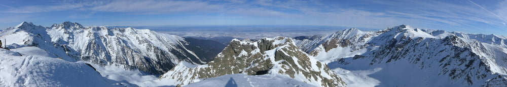
Tour map and elevation profile

  • Open Street Map
  • Google
Minimum height 1233 m Maximum height 2360 m Detailed view

More about the tour author

Gi
Member since 2010

Send private message

Comments

siehe https://www.gps-tour.info/de/touren/detail.157076.html


GPS tracks

Trackpoints
  • GPX / Garmin Map Source (gpx) download
  • TCX / Garmin Training Center® (tcx) download
  • CRS / Garmin Training Center® (crs) download
  • Google Earth (kml) download
  • G7ToWin (g7t) download
  • TTQV (trk) download
  • Overlay (ovl) download
  • Fugawi (txt) download
  • Kompass (DAV) Track (tk) download
  • Track data sheet (pdf) download
  • Original file of the author (gpx) download

More about the tour author

Gi
Member since 2010

Send private message
Share track
Add to my favorites
Remove from my favorites
Edit tags
My score
Rate
Track: Vf. Laita
Type: Ski touring
Distance: 11,4 km
Evaluated on:
Duration:
Day(s)
Hour(s)
Minute(s)
Score: Landscape Fun factor Fitness Technique