Login

Forgot your login?

Cookies have to be accepted!
Your browser's cookie functionality is disabled. Please enable this functionality.

Not a member yet?

Register now
Login

Available for registred users only

Log in to use this feature.

Forgot your login?

Cookies have to be accepted!
Your browser's cookie functionality is disabled. Please enable this functionality.

Not a member yet?

Register now
Filter
Categories
Advanced filters
  • Distance (km)
  • Height
Save filters Reset filter

TrackRank

QRCode

Technical data

Distance3,1 km Height378 m Way down405 m Duration01:30 h:m Date08.05.2017
Scores Author Landscape Fun factor Fitness Technique

Statistics

325 Views Scores 19 Downloads Average
Rate
  • Track data sheet
  • Directions
  • Downloads

Nette Nachmittagstour auf einen technisch gar nicht so einfachen Gipfel

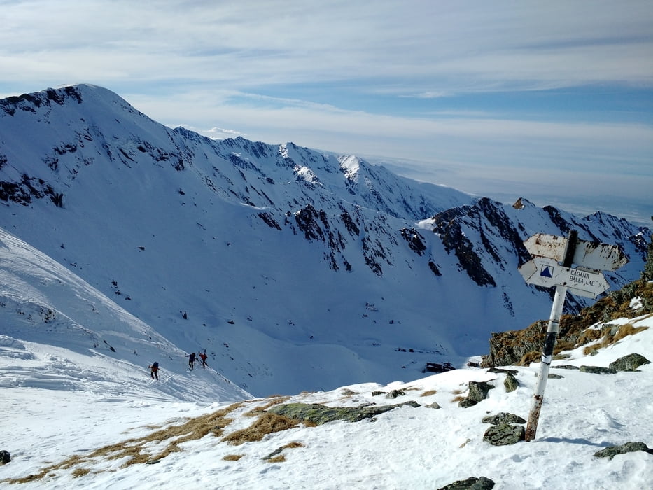
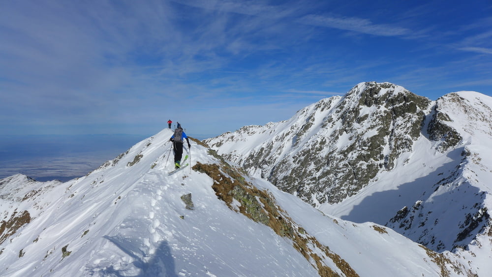
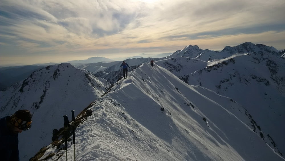
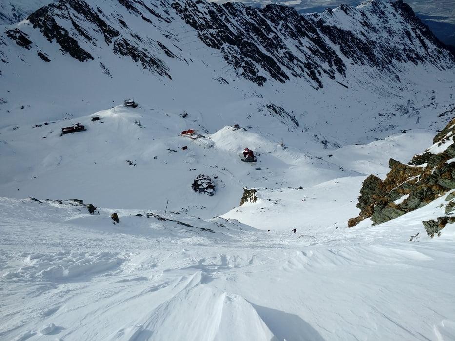
Von der Cabana Balea Lac steil hinauf nach Süden zur offensichtlichen Saua Capra Scharte. Nun über den Grat nach links, im oberen Teil sehr schmal zum Gipfel. Abfahrt entweder über den Aufstiegsweg oder die Südflanke zum Capra See. Von dort Wiederaufstieg zur Saua Capra und Abfahrt entlang dem Aufstieg zur Cabana Balea Lac

  Jahreszeit der Tour: Mitte Februar

Tour gallery

Tour map and elevation profile

  • Open Street Map
  • Google
Minimum height 2031 m Maximum height 2404 m Detailed view

More about the tour author

Gi
Member since 2010

Send private message

Comments

siehe https://www.gps-tour.info/de/touren/detail.157076.html


GPS tracks

Trackpoints
  • GPX / Garmin Map Source (gpx) download
  • TCX / Garmin Training Center® (tcx) download
  • CRS / Garmin Training Center® (crs) download
  • Google Earth (kml) download
  • G7ToWin (g7t) download
  • TTQV (trk) download
  • Overlay (ovl) download
  • Fugawi (txt) download
  • Kompass (DAV) Track (tk) download
  • Track data sheet (pdf) download
  • Original file of the author (gpx) download

More about the tour author

Gi
Member since 2010

Send private message
Share track
Add to my favorites
Remove from my favorites
Edit tags
My score
Rate
Track: Vf. Vaiuga
Type: Ski touring
Distance: 3,1 km
Evaluated on:
Duration:
Day(s)
Hour(s)
Minute(s)
Score: Landscape Fun factor Fitness Technique