


Arata-Colle d'Esischie-Colle Fauniera (Marco Pantani)-
Colle Valcavera-Colle Cologna-Passo Gardetta-
Passo di Rocca Brancia-Sambuco
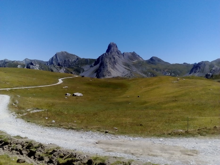
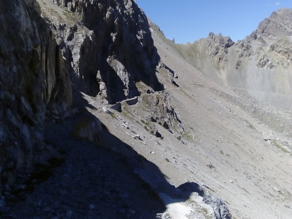
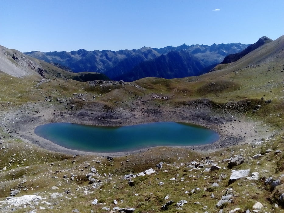
Wieder ein kleines Bergstraßerl, das kaum befahren ist. Bis Colle Fauniera (die Einheimischen sprechen nur vom Pantani, sein Denkmal steht da) ca 15 km gut zu fahrende Steigung. Ab Colle Valcavera auf der Schotterpiste hinein ins große Rund: Panorama vom Feinsten! Besonders sticht die Rocca la Meja hervor, Kletterberg. Ein bisschen unterhalb des Rif Gardetta geht’s dann noch mal gute 300 hm hoch. Vom Passo Gardetta weg hab ich bis zum Passo Rocca di Brancia meist geschoben - ca 20 Min, mit viel Kraft und Geschick wäre es auch fahrbar. Die Abfahrt hat's wieder in sich, sehr anspruchsvoller Steig ca 1300 hm hinunter. Ich bin ungefähr die Hälfte gefahren. Die Kulisse bleibt spektakulär. Nach dem Colle Valcavera gibt es angeblich eine neue Abfahtsmöglichkeit direkt nach Sambuco, die nicht so schwierig ist. In Sambuco hab ich großes Glück noch ein Quartier zu finden. Albergo della Pace, gut. HP 75€. Da hab ich noch zwei nette Dresdner kennengelernt, die schon seit 10 Wochen zu Fuß von Spittal(!) nach Nizza unterwegs sind! http://www.albergodellapace.com/index.php/de/
Wieder ein kleines Bergstraßerl, das kaum befahren ist. Bis Colle Fauniera (die Einheimischen sprechen nur vom Pantani, sein Denkmal steht da) ca 15 km gut zu fahrende Steigung. Ab Colle Valcavera auf der Schotterpiste hinein ins große Rund: Panorama vom Feinsten! Besonders sticht die Rocca la Meja hervor, Kletterberg. Ein bisschen unterhalb des Rif Gardetta geht’s dann noch mal gute 300 hm hoch. Vom Passo Gardetta weg hab ich bis zum Passo Rocca di Brancia meist geschoben - ca 20 Min, mit viel Kraft und Geschick wäre es auch fahrbar. Die Abfahrt hat's wieder in sich, sehr anspruchsvoller Steig ca 1300 hm hinunter. Ich bin ungefähr die Hälfte gefahren. Die Kulisse bleibt spektakulär. Nach dem Colle Valcavera gibt es angeblich eine neue Abfahtsmöglichkeit direkt nach Sambuco, die nicht so schwierig ist. In Sambuco hab ich großes Glück noch ein Quartier zu finden. Albergo della Pace, gut. HP 75€. Da hab ich noch zwei nette Dresdner kennengelernt, die schon seit 10 Wochen zu Fuß von Spittal(!) nach Nizza unterwegs sind! http://www.albergodellapace.com/index.php/de/
Further information at
http://www.albergodellapace.com/index.php/de/Tour gallery
Tour map and elevation profile
Minimum height 1212 m
Maximum height 2620 m
More about the tour author
|
|
mitter |
Comments

Start in Arata vom Brec dal Vern.
GPS tracks
Trackpoints-
GPX / Garmin Map Source (gpx) download
-
TCX / Garmin Training Center® (tcx) download
-
CRS / Garmin Training Center® (crs) download
-
Google Earth (kml) download
-
G7ToWin (g7t) download
-
TTQV (trk) download
-
Overlay (ovl) download
-
Fugawi (txt) download
-
Kompass (DAV) Track (tk) download
-
Track data sheet (pdf) download
-
Original file of the author (gpx) download
More about the tour author
|
|
mitter |
Add to my favorites
Remove from my favorites
Edit tags
Open track
My score
Rate