


Rifugio Don Barbera-Poggio Lagone-Saccarello-
Rif. San Remo(zu)-Passo di Garlanda-Monte Frontè-
Colle di Garezzo-Passo della Guardia-Triora-Cetta-
Montalto Ligure-Bardalucco-Taggia-Riva Ligure-Taggia
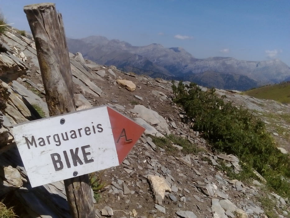
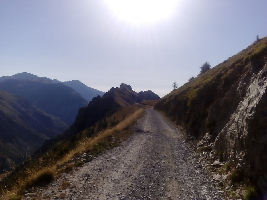
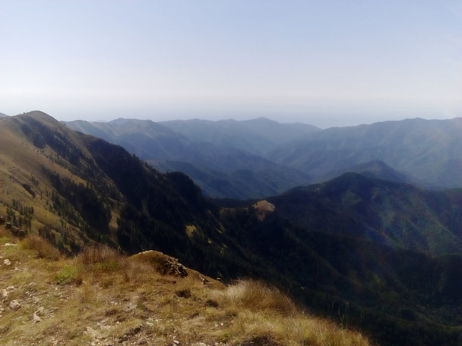
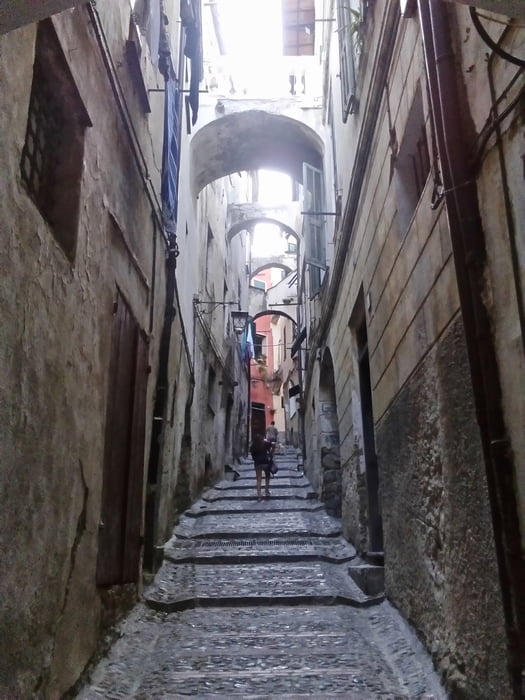
Eine sagenhafte Strecke durch den Bosco delle Navette (Naturschutzgebiet in privater Hand der Franzosen): Zirbenwald. Auf passabler Militärstraße kommt man gut voran. Auf und ab bis zum Saccarello mit großer Christo Re Statue kommen über 700 hm zusammen. Von da schon ein wunderbarer Blick zum Meer! Zwischendurch wird der Weg dann auch wieder recht anspruchsvoll, holprig und tricky. Von Cetta runter gibt es einen sentiero, der anfangs sehr diffizil ist, bald aber gut fahrbar ist. Achtung frana! Da hat eine Mure offenbar schon vor längerem den Weg mitgerissen, paar hundert Meter vorher rechts steil rauf. Später auf der strada provinciale geht’s mal rechts weg : das Fahrverbotsschild besser beachten, denn da gibt’s kein Durchkommen! Ich bleibe also auf der SP bis zum Meer. Da beginnt dann die schwierige Quartiersuche am Ferragosto… Ca 20 km hin und her, rauf und runter. Schließlich werde ich in Taggia fündig. Quartier Pension Argentina mit Pizzeria, naja. NF 50€.
Eine sagenhafte Strecke durch den Bosco delle Navette (Naturschutzgebiet in privater Hand der Franzosen): Zirbenwald. Auf passabler Militärstraße kommt man gut voran. Auf und ab bis zum Saccarello mit großer Christo Re Statue kommen über 700 hm zusammen. Von da schon ein wunderbarer Blick zum Meer! Zwischendurch wird der Weg dann auch wieder recht anspruchsvoll, holprig und tricky. Von Cetta runter gibt es einen sentiero, der anfangs sehr diffizil ist, bald aber gut fahrbar ist. Achtung frana! Da hat eine Mure offenbar schon vor längerem den Weg mitgerissen, paar hundert Meter vorher rechts steil rauf. Später auf der strada provinciale geht’s mal rechts weg : das Fahrverbotsschild besser beachten, denn da gibt’s kein Durchkommen! Ich bleibe also auf der SP bis zum Meer. Da beginnt dann die schwierige Quartiersuche am Ferragosto… Ca 20 km hin und her, rauf und runter. Schließlich werde ich in Taggia fündig. Quartier Pension Argentina mit Pizzeria, naja. NF 50€.
Further information at
http://www.albergoristoranteargentina.com/Homepage.htmTour gallery
Tour map and elevation profile
Minimum height 12 m
Maximum height 2260 m
More about the tour author
|
|
mitter |
Comments

Start beim Rifugio Don Barbera.
GPS tracks
Trackpoints-
GPX / Garmin Map Source (gpx) download
-
TCX / Garmin Training Center® (tcx) download
-
CRS / Garmin Training Center® (crs) download
-
Google Earth (kml) download
-
G7ToWin (g7t) download
-
TTQV (trk) download
-
Overlay (ovl) download
-
Fugawi (txt) download
-
Kompass (DAV) Track (tk) download
-
Track data sheet (pdf) download
-
Original file of the author (gpx) download
More about the tour author
|
|
mitter |
Add to my favorites
Remove from my favorites
Edit tags
Open track
My score
Rate