


We start at the lower parking area from Hotel Rouista in VOURGARELI.
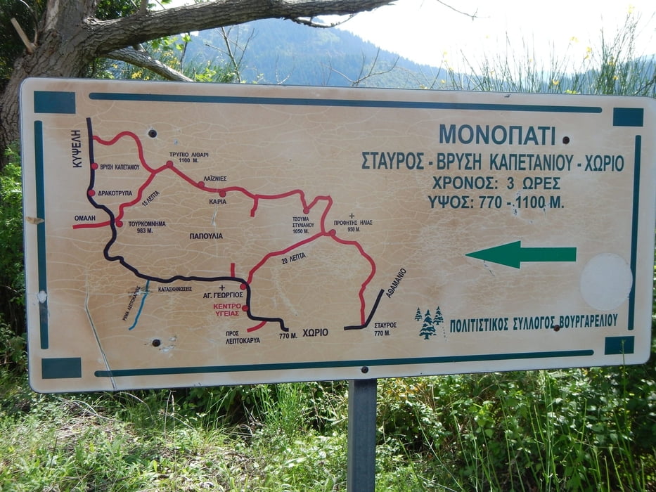
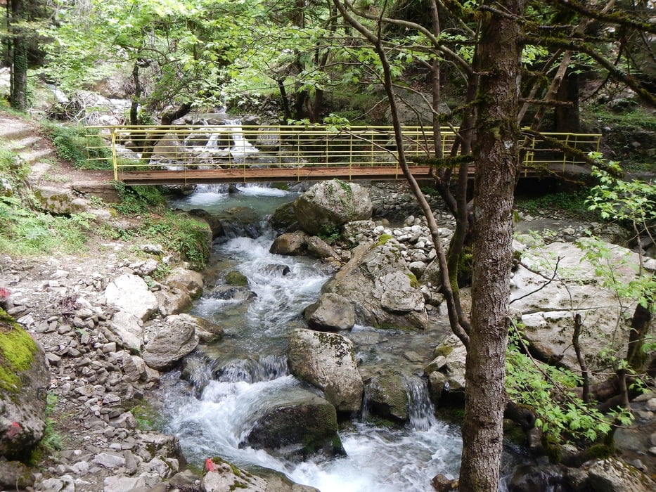
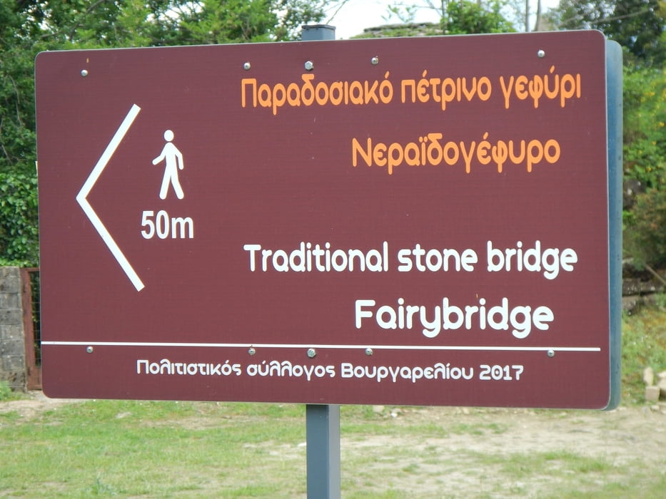
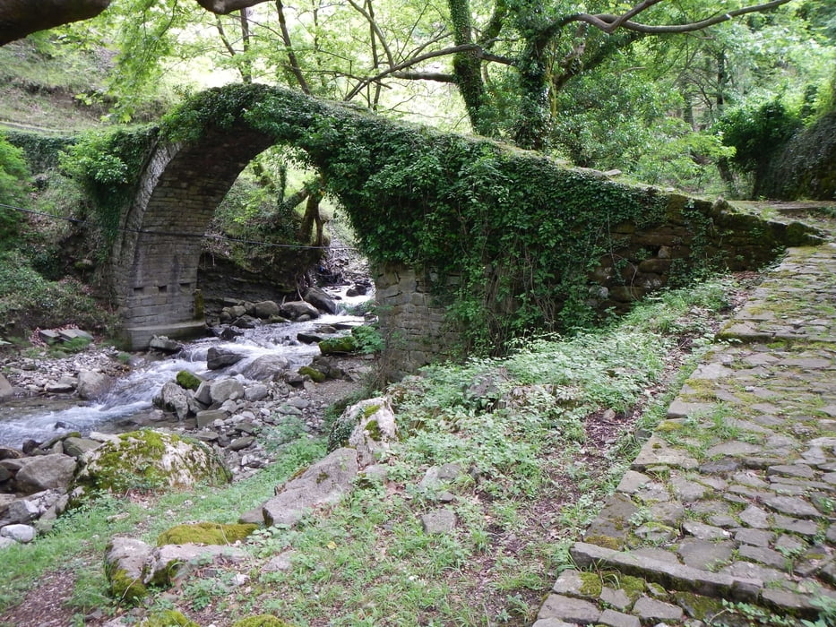
A little up the dust road, there start the small tail to the place of Stavros. Follow this trail, up to the main road. After 300m you see on the left side a dust road up to the small church. There starts the trail up the hill, to Profitis Ilias. This is the highest point of this tour. Follow the dust road down, later on the paved small road, to the main road. After 500m on the main road (you pass the monastery Ag. Georgios), there start right a dust road. Follow this down in the valley till the bridge over the river. Direct after the bridge, left, down, start the small trail along the river. This part is a little tricky, be careful. At the end of this part, you have a short part of a dust road and after the main road. After some meters on the left side there start again a trail. The first part is paved with stones. You cross the river on the stone bridge Neraido, and over some small roads you are back to the starting point.
A little up the dust road, there start the small tail to the place of Stavros. Follow this trail, up to the main road. After 300m you see on the left side a dust road up to the small church. There starts the trail up the hill, to Profitis Ilias. This is the highest point of this tour. Follow the dust road down, later on the paved small road, to the main road. After 500m on the main road (you pass the monastery Ag. Georgios), there start right a dust road. Follow this down in the valley till the bridge over the river. Direct after the bridge, left, down, start the small trail along the river. This part is a little tricky, be careful. At the end of this part, you have a short part of a dust road and after the main road. After some meters on the left side there start again a trail. The first part is paved with stones. You cross the river on the stone bridge Neraido, and over some small roads you are back to the starting point.
Tour gallery
Tour map and elevation profile
Minimum height 706 m
Maximum height 975 m
More about the tour author

|
Mapdekode |
Comments

More about the tour author
|
|
Mapdekode |
Add to my favorites
Remove from my favorites
Edit tags
Open track
My score
Rate