


On Saturday we had the Ötzi trail on our schedule, as we had read many good things about this in the "Vinschgau Trails" book by Ralf Glazer and Matze Gruber. But we have adapted their route slightly to our own wishes.
So Saturday morning we went by car to Rabland to take the Seilbahn (522-1350m) up to Aschbach. So we have bridged the first 828 altimeters. It is very busy here on weekends with hikers going up, but fortunately the lifty was helpful with placing the bikes before we were left in the cabin. This saves a lot of trouble and prevents a lot of mutual irritation between hikers and bikers and like this we can all remain friends.
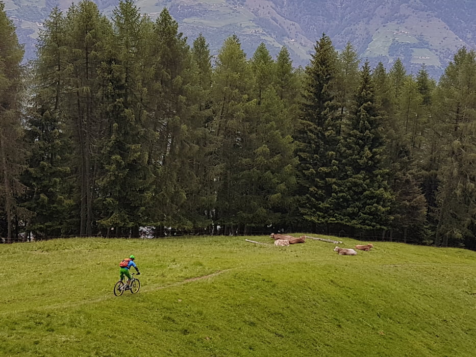
Once you have arrived at the top, there is another climb of about 600 vertical meters towards the Vigiljoch. The first few kilometers are on asphalt but you will not encounter any other traffic. At a certain moment the route changes in a wide forest path which leads to Vigiljoch. After passing the gate, we turn to the right somewhat steeper uphill over a wide dirt road. This is mostly through the forest which gives a bit of shelter from the sun. Over the highest point the road leads us further to the "Naturnser Alm". This Einkehrmöchlickeit we have tackled to eat some Kaizerschmarrn and drink some Holunder schorle after being in the saddle for 1hour and 30 minutes. From here the fun starts. Just underneath the mountain hut we take the single trail “Almenweg“. The start of this trail is certainly not easy (S1), but therefore so much more fun with the many rock and root passages which we have to overcome. A little further in the trail it becomes a little bit easier, but still a challenge to ride fast and smoothly as possible. This trail finishes just above the next Einkehrmöchlichkeit (restaurant), the Alt-alm. From here we took the trail underneath the restaurant. Just through a gate on the left and then a short but beautiful rocky descent to the "Almenweg" (S3). Probably this is a start of undocumented nature downhill trail. Certainly something to discover next time.
When you arrive on the forest road, you go left and again to the left to continue your way uphill to the start of the Ötzi trail. At the Ötzi trail we have to climb another 150 altitude meters to actually start at 1834m at the beginning!
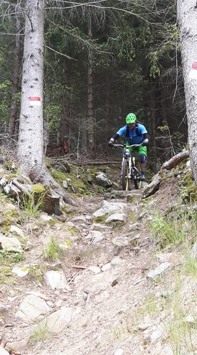
The description of the Ötzi trail leaves nothing to be desired. It immediatly with level S2 and S3. A super nice nature downhill trail. Bigger and smaller steps and drops on both rocks and roots adorn the course. That's how we blast 875 hardcore vertical meters down the mountain.
Thinking it is over at the finish, we are being surprised! What turns out ... they build an Ötzi flow trail underneath. The last part consists of a serpentine of beautiful bermed bends, welle and jumps. A super fat icing on the cake!
The last part of our trip back 7km goes along the river on the bike path to Rabland where we started. All together, we have been on the road for about 5 hours to bridge the 30km and 1000 vertical meters up.
So Saturday morning we went by car to Rabland to take the Seilbahn (522-1350m) up to Aschbach. So we have bridged the first 828 altimeters. It is very busy here on weekends with hikers going up, but fortunately the lifty was helpful with placing the bikes before we were left in the cabin. This saves a lot of trouble and prevents a lot of mutual irritation between hikers and bikers and like this we can all remain friends.
Once you have arrived at the top, there is another climb of about 600 vertical meters towards the Vigiljoch. The first few kilometers are on asphalt but you will not encounter any other traffic. At a certain moment the route changes in a wide forest path which leads to Vigiljoch. After passing the gate, we turn to the right somewhat steeper uphill over a wide dirt road. This is mostly through the forest which gives a bit of shelter from the sun. Over the highest point the road leads us further to the "Naturnser Alm". This Einkehrmöchlickeit we have tackled to eat some Kaizerschmarrn and drink some Holunder schorle after being in the saddle for 1hour and 30 minutes. From here the fun starts. Just underneath the mountain hut we take the single trail “Almenweg“. The start of this trail is certainly not easy (S1), but therefore so much more fun with the many rock and root passages which we have to overcome. A little further in the trail it becomes a little bit easier, but still a challenge to ride fast and smoothly as possible. This trail finishes just above the next Einkehrmöchlichkeit (restaurant), the Alt-alm. From here we took the trail underneath the restaurant. Just through a gate on the left and then a short but beautiful rocky descent to the "Almenweg" (S3). Probably this is a start of undocumented nature downhill trail. Certainly something to discover next time.
When you arrive on the forest road, you go left and again to the left to continue your way uphill to the start of the Ötzi trail. At the Ötzi trail we have to climb another 150 altitude meters to actually start at 1834m at the beginning!
The description of the Ötzi trail leaves nothing to be desired. It immediatly with level S2 and S3. A super nice nature downhill trail. Bigger and smaller steps and drops on both rocks and roots adorn the course. That's how we blast 875 hardcore vertical meters down the mountain.
Thinking it is over at the finish, we are being surprised! What turns out ... they build an Ötzi flow trail underneath. The last part consists of a serpentine of beautiful bermed bends, welle and jumps. A super fat icing on the cake!
The last part of our trip back 7km goes along the river on the bike path to Rabland where we started. All together, we have been on the road for about 5 hours to bridge the 30km and 1000 vertical meters up.
Tour gallery


Tour map and elevation profile
Minimum height 509 m
Maximum height 1962 m
More about the tour author
|
|
Kanski |
Comments

More about the tour author
|
|
Kanski |
Add to my favorites
Remove from my favorites
Edit tags
Open track
My score
Rate