Login

Forgot your login?

Cookies have to be accepted!
Your browser's cookie functionality is disabled. Please enable this functionality.

Not a member yet?

Register now
Login

Available for registred users only

Log in to use this feature.

Forgot your login?

Cookies have to be accepted!
Your browser's cookie functionality is disabled. Please enable this functionality.

Not a member yet?

Register now
Filter
Categories
Advanced filters
  • Distance (km)
  • Height
Save filters Reset filter

TrackRank

QRCode

Technical data

Distance333,8 km Height7513 m Way down8075 m Duration6 days 0 h Date12.08.2018
Scores Author Landscape Fun factor Fitness Technique

Statistics

1199 Views Scores 278 Downloads Average
Rate
  • Track data sheet
  • Directions
  • Downloads

Start Arnoldstein

1.Etappe Arnoldstein - Kranjska Gora 25km,1052 hm

2.Etappe Kanjska Gora - Bovec, 50km,1110 hm

3. Etappe Bovec - Kobarid, 44km,1093 hm

4.Etappe Kobarid - Smartno, 68km,1523 hm

5.Etappe Smartno - Lipica, 84 km, 1630 hm

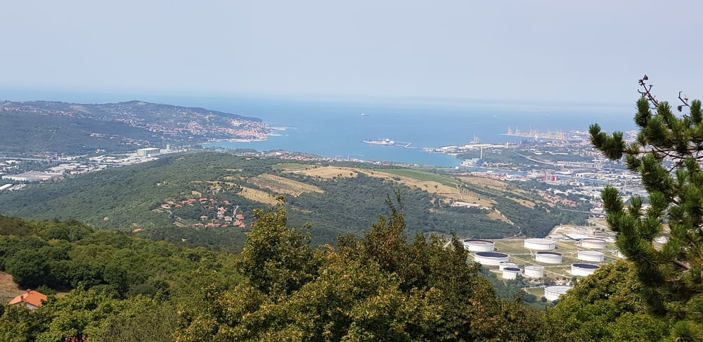
6.Etappe Lipica - Piran, 65 km, 1084 hm

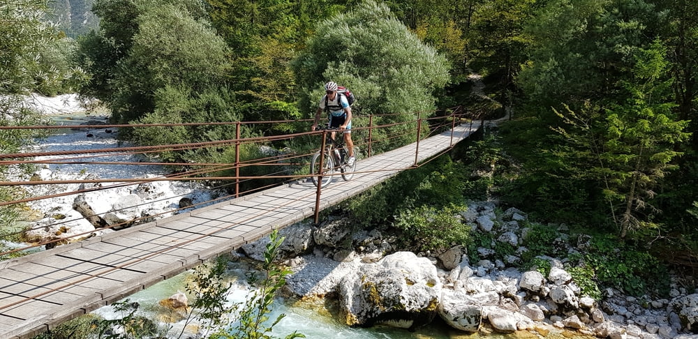
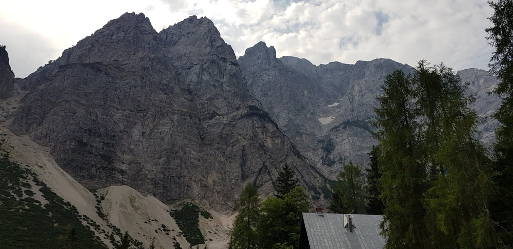
sehr abwechslungsreiche Tour ( Hochgebirge, Mittelgebirge, Weinanbaugebiet, Adriaküste)

Viele schöne fahrbare Trails!

Tour gallery

Tour map and elevation profile

  • Open Street Map
  • Google
Minimum height 2 m Maximum height 1687 m Detailed view

More about the tour author

ABC65
Member since 2016

Send private message

Comments

Arnoldstein liegt an der Bundesstraße Thörl-Maglern-Villach, (Bezirk Villach-Land,Kärnten),    erreichbar auch über die Südautobahn A2 (Ausfahrt Arnoldstein)

GPS tracks

Trackpoints
  • GPX / Garmin Map Source (gpx) download
  • TCX / Garmin Training Center® (tcx) download
  • CRS / Garmin Training Center® (crs) download
  • Google Earth (kml) download
  • G7ToWin (g7t) download
  • TTQV (trk) download
  • Overlay (ovl) download
  • Fugawi (txt) download
  • Kompass (DAV) Track (tk) download
  • Track data sheet (pdf) download
  • Original file of the author (gpx) download

More about the tour author

ABC65
Member since 2016

Send private message
Share track
Add to my favorites
Remove from my favorites
Edit tags
My score
Rate
Track: Sloweniencross
Type: Transalp
Distance: 333,8 km
Evaluated on:
Duration:
Day(s)
Hour(s)
Minute(s)
Score: Landscape Fun factor Fitness Technique