Login

Forgotten password?

Cookies have to be accepted!
Your browser's cookie functionality is disabled. Please enable this functionality.

Not a member yet?

Register now
Login

Available for registred users only

Log in to use this feature.

Forgotten password?

Cookies have to be accepted!
Your browser's cookie functionality is disabled. Please enable this functionality.

Not a member yet?

Register now
Filter
Categories
Advanced filters
  • Distance (km)
  • Height
Save filters Reset filter

TrackRank

QRCode

Technical data

Distance40,7 km Height1031 m Way down1020 m Duration03:35 h:m Date07.10.2019
Scores Author Landscape Fun factor Fitness Technique

Statistics

224 Views Scores 57 Downloads Average
Rate
  • Track data sheet
  • Directions
  • Downloads
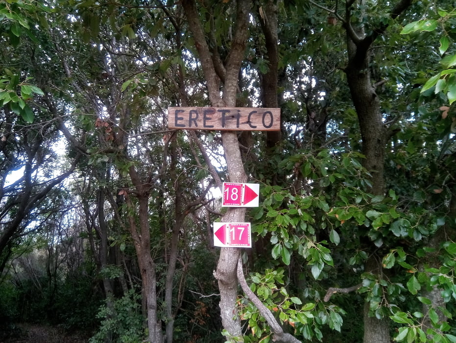
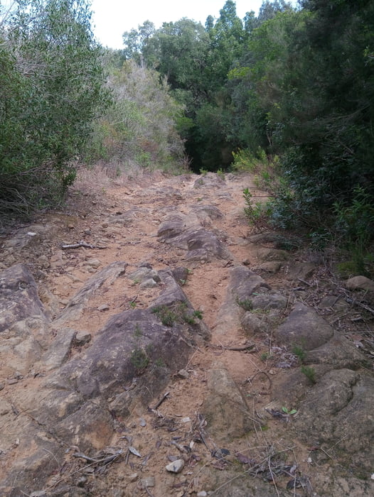
vom Camping Baia Verde auf dem I Cavalli zurm Sträßchen nach Pian Lama und weiter den Forst/Kiesweg hinauf Richtung Scarlino. Oben fahren wir links hoch auf den Buca della Neve und dan runter zum Monte Muro. Über den Traverso gelangen wir zum Eretico-Trail (S1-S3). Den runter und über Trails rüber auf den Bergrücken hinter der Calaviolina. Hier noch ein paar schöne Trails mitgenommen und zurück zum Camping.

Further information at

https://www.baiaverde.com/de/

Tour gallery

Tour map and elevation profile

  • Open Street Map
  • Google
Minimum height -41 m Maximum height 425 m Detailed view

More about the tour author

Fruehaufsteher
Member since 2008

Send private message

Comments

GPS tracks

Trackpoints
  • GPX / Garmin Map Source (gpx) download
  • TCX / Garmin Training Center® (tcx) download
  • CRS / Garmin Training Center® (crs) download
  • Google Earth (kml) download
  • G7ToWin (g7t) download
  • TTQV (trk) download
  • Overlay (ovl) download
  • Fugawi (txt) download
  • Kompass (DAV) Track (tk) download
  • Track data sheet (pdf) download
  • Original file of the author (gpx) download

More about the tour author

Fruehaufsteher
Member since 2008

Send private message
Share track
Add to my favorites
Remove from my favorites
Edit tags
My score
Rate
Track: Punta Ala-EMTB-Eretico-Trail
Type: Mountain bike
Distance: 40,7 km
Evaluated on:
Duration:
Day(s)
Hour(s)
Minute(s)
Score: Landscape Fun factor Fitness Technique