Login

Forgotten password?

Cookies have to be accepted!
Your browser's cookie functionality is disabled. Please enable this functionality.

Not a member yet?

Register now
Login

Available for registred users only

Log in to use this feature.

Forgotten password?

Cookies have to be accepted!
Your browser's cookie functionality is disabled. Please enable this functionality.

Not a member yet?

Register now
Filter
Categories
Advanced filters
  • Distance (km)
  • Height
Save filters Reset filter

TrackRank

QRCode

Technical data

Distance29,3 km Height616 m Way down766 m Duration00:00 h:m Date24.05.2020
Scores Author Landscape Fun factor Fitness Technique

Statistics

285 Views Scores 4 Downloads Average
Rate
  • Track data sheet
  • Directions
  • Downloads

Dies ist der schönste Teil des Aar-Höhenweges. Er verläuft hauptsächlich auf kleinen Pfaden im Wald.

Die Abschnitte des Aar-Höhenweges davor und danach kann ich nicht empfehlen. Sie verlaufen meist durch Felder, aber leider oft auf geteerten Sträßchen.

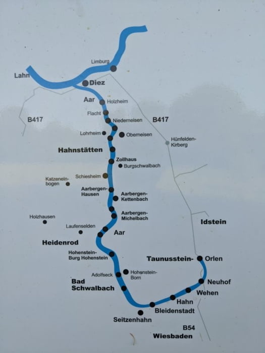
Man kann diesen Abschnitt auch nur bis Adolfseck (12,6km) oder Breithardt/Burg Hohenstein (18,1km) laufen. Die Anbindung an der ÖPNV ist auf diesem Abschnitt halbwegs ok.

Die Burg Hohenstein ist auf dieser Wanderung nicht zu gut besichtigen. Sie liegt ziemlich hoch auf der anderen Talseite und es gibt auch keinen schönen Fußweg hinauf. Das macht man besser mal mit dem Auto.

Tour map and elevation profile

  • Open Street Map
  • Google
Minimum height 190 m Maximum height 401 m Detailed view

More about the tour author

Rum2014
Member since 2014

Send private message

Comments

GPS tracks

Trackpoints
  • GPX / Garmin Map Source (gpx) download
  • TCX / Garmin Training Center® (tcx) download
  • CRS / Garmin Training Center® (crs) download
  • Google Earth (kml) download
  • G7ToWin (g7t) download
  • TTQV (trk) download
  • Overlay (ovl) download
  • Fugawi (txt) download
  • Kompass (DAV) Track (tk) download
  • Track data sheet (pdf) download
  • Original file of the author (gpx) download

More about the tour author

Rum2014
Member since 2014

Send private message
Share track
Add to my favorites
Remove from my favorites
Edit tags
My score
Rate
Track: Aar-Höhenweg - der schönste Teil
Type: Hiking
Distance: 29,3 km
Evaluated on:
Duration:
Day(s)
Hour(s)
Minute(s)
Score: Landscape Fun factor Fitness Technique