


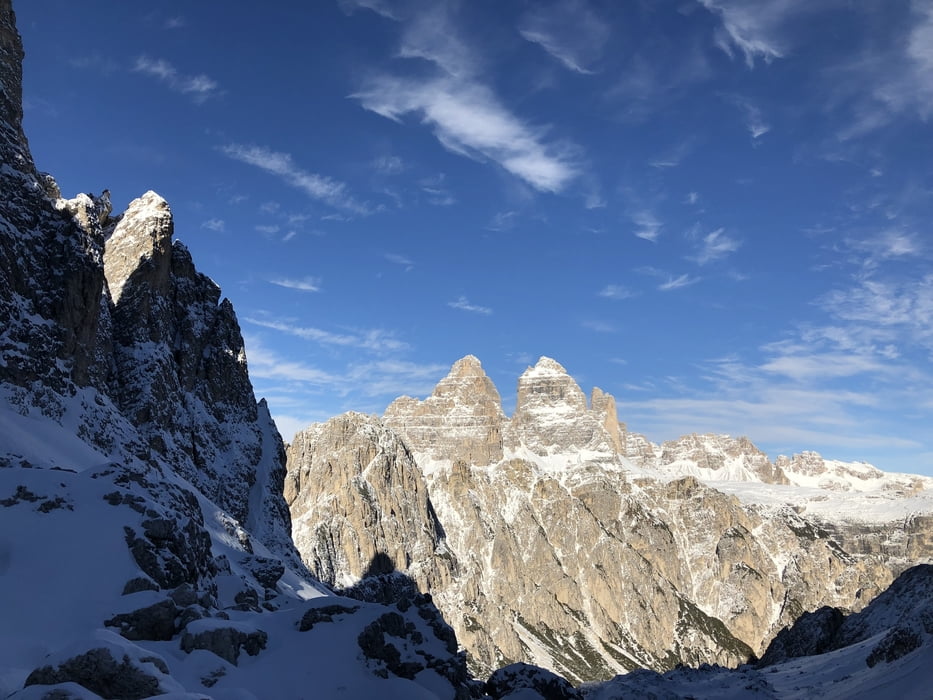
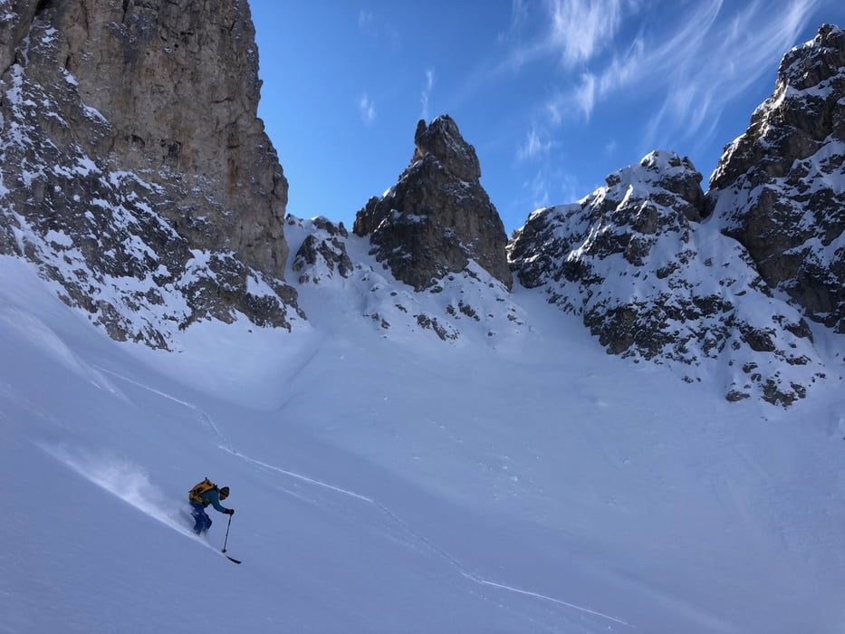
Beautiful ski touring excursion leading to Forcella del Nevaio through an awesome landscape in classic and typical Dolomitic surroundings, with sharp pinnacles, passes and deep valleys of amazing beauty. This ski touring itinerary in the Cadini di Misurina is moderately challenging and technical but is quite rewarding with an amazing off-piste skiing descent. In any case it develops in a mountain environment, to ensure your safety use a mountain guide.
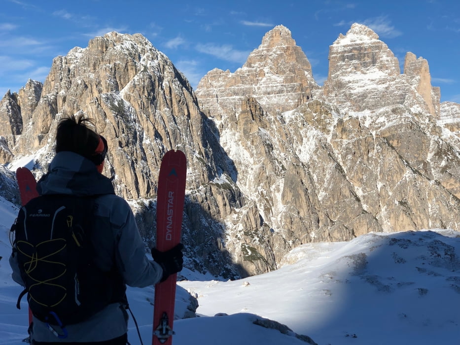
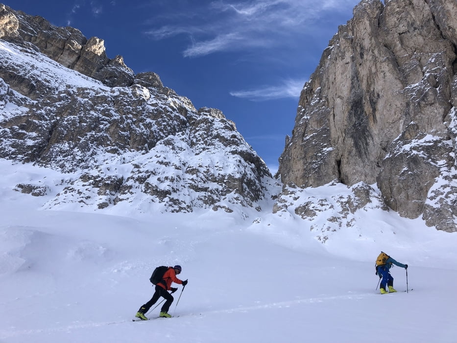
The path begins at Lake Antorno, in front of the majestic Tre Cime di Lavaredo. It follows the summer route first going up through the woods and then wide slopes up to the Fonda Savio refuge. From the refuge, continue south-west in a spectacular environment along the Cadin del Nevaio valley up to the saddle at 2624 metres.
The descent itinerary offers very nice off-piste skiing, first along the Cadin del Nevaio up to Forcella Rin Bianco and then along beautiful slopes up to the starting point.
Further information at
https://www.powrock.com/sp/en/ei/ski-mountaineering-forcella-nevaio-cadini-di-misurina.3spTour gallery
Tour map and elevation profile
Minimum height 1853 m
Maximum height 2636 m
More about the tour author
|
|
Powrock |
Comments

Follow the state road that leads from Cortina d'Ampezzo or from Auronzo di Cadore to Misurina, continue to Lake Antorno following the road to the Tre Cime di Lavaredo.
Parking at Lake Antorno
GPS tracks
Trackpoints-
GPX / Garmin Map Source (gpx) download
-
TCX / Garmin Training Center® (tcx) download
-
CRS / Garmin Training Center® (crs) download
-
Google Earth (kml) download
-
G7ToWin (g7t) download
-
TTQV (trk) download
-
Overlay (ovl) download
-
Fugawi (txt) download
-
Kompass (DAV) Track (tk) download
-
Track data sheet (pdf) download
-
Original file of the author (gpx) download
More about the tour author
|
|
Powrock |
Add to my favorites
Remove from my favorites
Edit tags
Open track
My score
Rate