Login

Forgot your login?

Cookies have to be accepted!
Your browser's cookie functionality is disabled. Please enable this functionality.

Not a member yet?

Register now
Login

Available for registred users only

Log in to use this feature.

Forgot your login?

Cookies have to be accepted!
Your browser's cookie functionality is disabled. Please enable this functionality.

Not a member yet?

Register now
Filter
Categories
Advanced filters
  • Distance (km)
  • Height
Save filters Reset filter

TrackRank

QRCode

Technical data

Distance36,9 km Height1215 m Way down1198 m Duration00:00 h:m Date24.04.2023
Scores Author Landscape Fun factor Fitness Technique

Statistics

110 Views Scores 2 Downloads Average
Rate
  • Track data sheet
  • Directions
  • Downloads

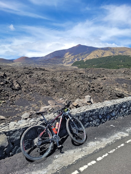
Krožna pot z lepimi razgledi. Vzpon po manj prometni cesti in spust po bolj razgledni cesti.

A circular route with beautiful views. Ascent on a road with less traffic and descent on a more scenic road.

Tour gallery

Tour map and elevation profile

  • Open Street Map
  • Google
Minimum height 767 m Maximum height 1955 m Detailed view

More about the tour author

Flisek
Member since 2017

Send private message

Comments

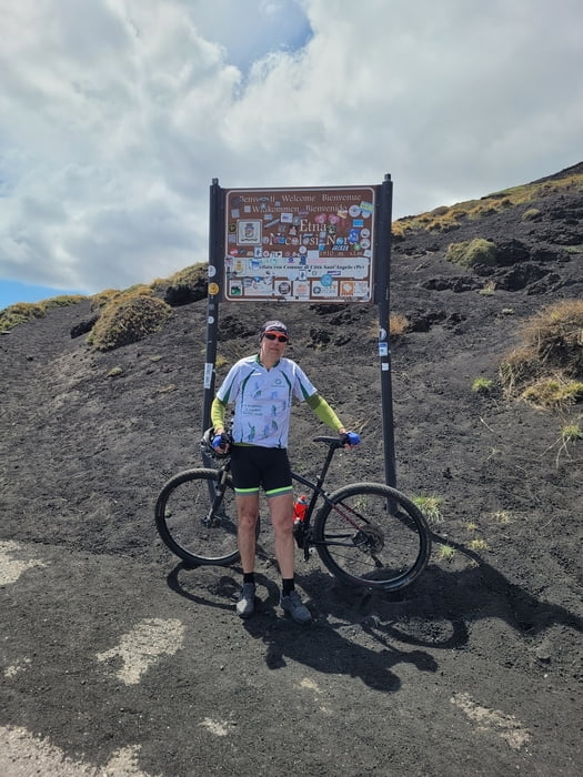
Začetek iz parkirnega mesta v kraju Nicolasi. Parking je gratis.

Start from the parking lot in Nicolasi. Parking is free.

GPS tracks

Trackpoints
  • GPX / Garmin Map Source (gpx) download
  • TCX / Garmin Training Center® (tcx) download
  • CRS / Garmin Training Center® (crs) download
  • Google Earth (kml) download
  • G7ToWin (g7t) download
  • TTQV (trk) download
  • Overlay (ovl) download
  • Fugawi (txt) download
  • Kompass (DAV) Track (tk) download
  • Track data sheet (pdf) download
  • Original file of the author (gpx) download

More about the tour author

Flisek
Member since 2017

Send private message
Share track
Add to my favorites
Remove from my favorites
Edit tags
My score
Rate
Track: Etna
Type: Mountain bike
Distance: 36,9 km
Evaluated on:
Duration:
Day(s)
Hour(s)
Minute(s)
Score: Landscape Fun factor Fitness Technique