

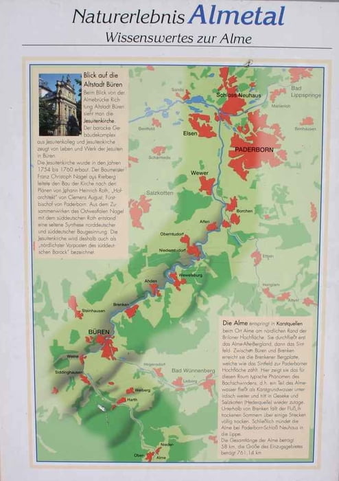
Brilon Marktplatz 0 km
Alme (Kirche) 9,7 km
Ringelstein (Waldbf.) 18,4 km
Siddinghausen (Mitte) 22,4 km
Weine (K 78) 24,9 km
Büren (Alte Post) 28,1 km
Brenken (L 637) 33,4 km
Ahden (Kirche) 38,0 km
Wewelsburg (L 751) 42,5 km
Niederntudorf (L 636) 46,9 km
Alfen (L 756) 51,2 km
Kirchborchen (Bf.) 54,2 km
Wewer (Kirche) 58,6 km
Schloß Neuhaus 67,5 km
In Büren Ecke Lindenhof/Limdenstraße links neben der Hauptstraße Richtung Kläranlage. Die Wegweiser sind sehr unübersichtlich.
Den optimalen Track finden Sie unter
http://www.paderborn.de/freizeit/radfahren/sp_auto_13190.php
Further information at
http://www.paderborn.de/freizeit/radfahren/sp_auto_13190.phpTour gallery
Tour map and elevation profile
Minimum height 94 m
Maximum height 471 m
More about the tour author

|
LWAF |
Comments

A 44 Dortmund - Kassel Abfahrt Bad Wünnenberg Haaren B 480 Richtung Brilon
GPS tracks
Trackpoints-
GPX / Garmin Map Source (gpx) download
-
TCX / Garmin Training Center® (tcx) download
-
CRS / Garmin Training Center® (crs) download
-
Google Earth (kml) download
-
G7ToWin (g7t) download
-
TTQV (trk) download
-
Overlay (ovl) download
-
Fugawi (txt) download
-
Kompass (DAV) Track (tk) download
-
Track data sheet (pdf) download
-
Original file of the author (gpx) download
More about the tour author
|
|
LWAF |
Add to my favorites
Remove from my favorites
Edit tags
Open track
My score
Rate