Login

Forgotten password?

Cookies have to be accepted!
Your browser's cookie functionality is disabled. Please enable this functionality.

Not a member yet?

Register now
Login

Available for registred users only

Log in to use this feature.

Forgotten password?

Cookies have to be accepted!
Your browser's cookie functionality is disabled. Please enable this functionality.

Not a member yet?

Register now
Filter
Categories
Advanced filters
  • Distance (km)
  • Height
Save filters Reset filter

TrackRank

QRCode

Technical data

Distance8,8 km Height1483 m Way down0 m Duration05:00 h:m Date17.06.2009
Scores Author Landscape Fun factor Fitness Technique

Statistics

4445 Views Scores 370 Downloads Average
Rate
  • Track data sheet
  • Directions
  • Downloads

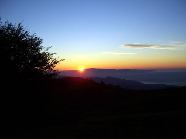
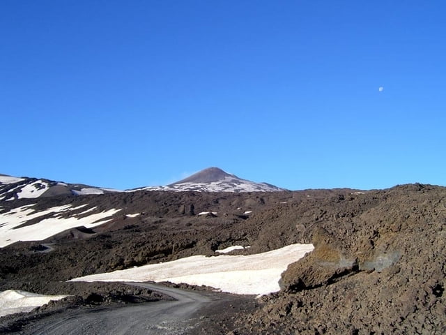
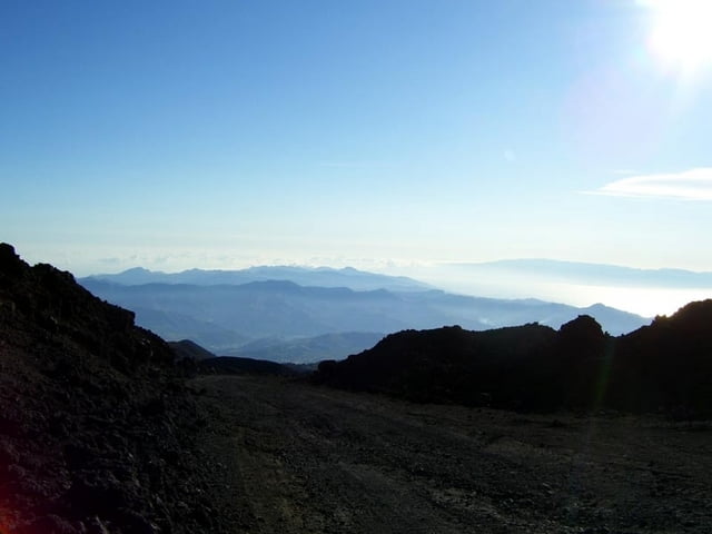
Ascent from the Etna-nord region (Piano Provenzana(1800m) to one of the summit-craters(3320m), maybe even the highest point. Spectacluar view into the crater, but also to Sicilia. You are 3000m above the surrounding landscape!

More beautiful than from the South side, less tourists, but longer!

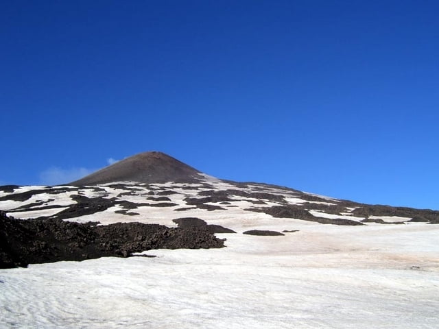
The track is easy, but the Etna is dangerous! Thunderstorm! Storm! Fog! Please pay attention to the safety-warnings f.e. www.vulkan-etna-update.de(in German). Takewarm and windproof clothing, cap, glasses(against the sandy wind),water. The crater is - as shown on the picture - nerved with deep gaps and gives impression of instability!

-----------------------------------------------------------------------------------------------------------------------------------

Aufstieg von der Nordseite des Ätna (Beschilderung Etna-Nord / Piano Provenzana) zu einem seiner Hauptkrater, möglicherweise derzeit der höchste Punkt. Großartige Sicht in die Krater, aber auch über Sizilien. Man ist 3200m über dem der umgebenden Landschaft!

Schöner als von der Südseite und es ist weniger los, aber länger!

Warnhinweise beachten unter vulkan-etna-update.de. Warme, winddichte Sachen, Mütze, Brille gegen Sandstaub und Wasser mitnehmen. Der Gipfelkrater ist, wie man auf dem Bild sieht, von tiefen Rissen durchzogen und macht einen instabilen Eindruck.

Further information at

http://www.vulkan-etna-update.de

Tour gallery

Tour map and elevation profile

  • Open Street Map
  • Google
Minimum height 1800 m Maximum height 3316 m Detailed view

More about the tour author

hans-lauber
Member since 2009

Send private message

Comments

By car from Linguaglossa or Zafferana Etnea to Etna-Nord. There is a big parking area.

------------------------------------------------------------------------------------------------------------------------------------

Von Linguaglossa oder Zafferana nach Etna-Nord /Piano Provenzana fahren. Dort ist ein großer Parkplatz.

GPS tracks

Trackpoints
  • GPX / Garmin Map Source (gpx) download
  • TCX / Garmin Training Center® (tcx) download
  • CRS / Garmin Training Center® (crs) download
  • Google Earth (kml) download
  • G7ToWin (g7t) download
  • TTQV (trk) download
  • Overlay (ovl) download
  • Fugawi (txt) download
  • Kompass (DAV) Track (tk) download
  • Track data sheet (pdf) download
  • Original file of the author (gpx) download

More about the tour author

hans-lauber
Member since 2009

Send private message
Share track
Add to my favorites
Remove from my favorites
Edit tags
My score
Rate
Track: Etna-Nord: Piano Provenzana(1800m) - summit-crater(3316m)
Type: Hiking
Distance: 8,8 km
Evaluated on:
Duration:
Day(s)
Hour(s)
Minute(s)
Score: Landscape Fun factor Fitness Technique