

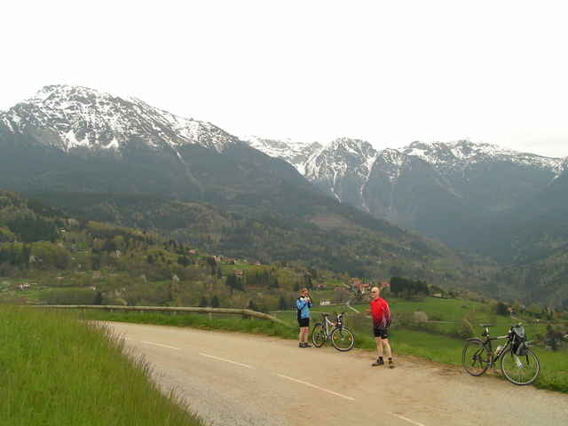

Grenoble is surrounded by three mountain ranges: Chartreuse, Vercors and Belledonnes. During this trip we revisited lower parts of Belledonnes. We set off from the city as usual.
We enter the moutains in Gieres and follow a not so frequently used road to le Chalp. The further climb to le Chapon seems to be even more forgotten by any cars. We descend to St Nizier where we take a look at an old church and then start a second climb to Pinet - the highest point of this trip. The descent to St-Martin-d'Uriage is a little bit tricky and followed by the slight ascent to the already visited church at St Nizier. To descend back to Gieres we enjoy a small road first and finally the busy D524 route.
This trip follows many minor unused roads and includes lots of turns, but a good map and some concetration will prevent you from getting lost. Still, the roads are usually of good quality and the views are remarkable. The trip is not so long and the climbs are not so demanding.
We enter the moutains in Gieres and follow a not so frequently used road to le Chalp. The further climb to le Chapon seems to be even more forgotten by any cars. We descend to St Nizier where we take a look at an old church and then start a second climb to Pinet - the highest point of this trip. The descent to St-Martin-d'Uriage is a little bit tricky and followed by the slight ascent to the already visited church at St Nizier. To descend back to Gieres we enjoy a small road first and finally the busy D524 route.
This trip follows many minor unused roads and includes lots of turns, but a good map and some concetration will prevent you from getting lost. Still, the roads are usually of good quality and the views are remarkable. The trip is not so long and the climbs are not so demanding.
Tour map and elevation profile
Minimum height 216 m
Maximum height 815 m
More about the tour author

|
azzie |
Comments

More about the tour author
|
|
azzie |
Add to my favorites
Remove from my favorites
Edit tags
Open track


My score
Rate