


7. April 2009
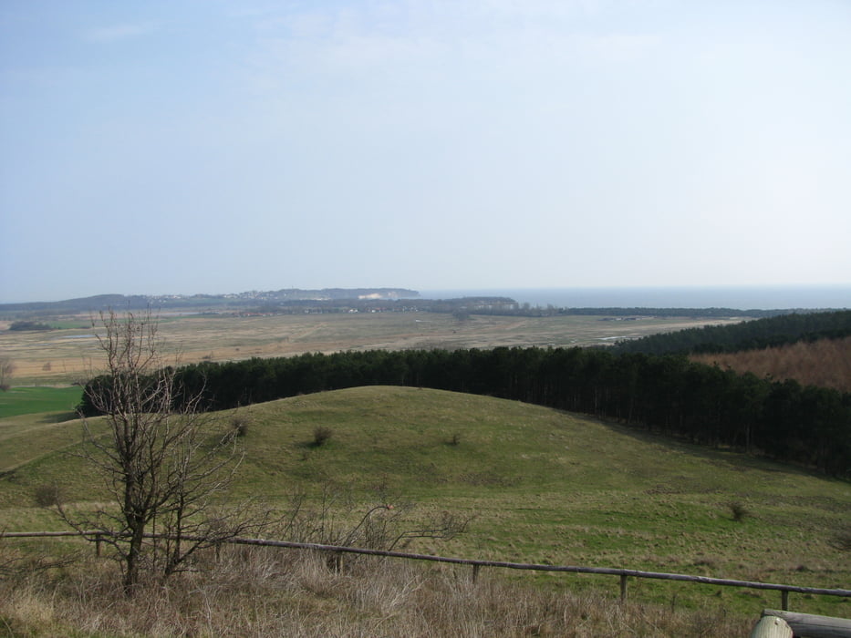
Wir laufen erst mal wieder ein Stück die Strasse zurück bis wir auf einen schmalen Pfad links abbiegen, der uns sanft aufwärts hinauf zum höchsten Punkt unserer Wanderung auf den Bakenberg führt. Wir werden mit einer tollen Rundsicht belohnt.
Von dort laufen wir westwärts weiter mal auf mal ab bis uns eine steile Holztreppe hinab zum Strand bringt. Wir entscheiden uns dazu am Strand zu bleiben und laufen entlang der steilen Küste Richtung Gross Zicker.
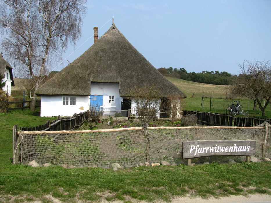
Irgendwann wir das Gelände wieder flacher und wir wandern einige hundert Meter landeinwärts zu einem Feldweg, der uns rasch in den Ort zurück bringt. Wir werfen einen kurzen Blick auf das historische Pfarrwitwenhaus, bevor wir unsere Wanderung mit einem Fischbrötchen in dem Restaurant nahe dem Parkplatz beenden.
Tour gallery


Tour map and elevation profile
Minimum height -5 m
Maximum height 73 m
More about the tour author

|
Comments

Parkplatz in Gross Zicker
GPS tracks
Trackpoints-
GPX / Garmin Map Source (gpx) download
-
TCX / Garmin Training Center® (tcx) download
-
CRS / Garmin Training Center® (crs) download
-
Google Earth (kml) download
-
G7ToWin (g7t) download
-
TTQV (trk) download
-
Overlay (ovl) download
-
Fugawi (txt) download
-
Kompass (DAV) Track (tk) download
-
Track data sheet (pdf) download
-
Original file of the author (gpx) download
More about the tour author
|
|
Add to my favorites
Remove from my favorites
Edit tags
Open track
My score
Rate