Login

Forgot your login?

Cookies have to be accepted!
Your browser's cookie functionality is disabled. Please enable this functionality.

Not a member yet?

Register now
Login

Available for registred users only

Log in to use this feature.

Forgot your login?

Cookies have to be accepted!
Your browser's cookie functionality is disabled. Please enable this functionality.

Not a member yet?

Register now
Filter
Categories
Advanced filters
  • Distance (km)
  • Height
Save filters Reset filter

TrackRank

QRCode

Technical data

Distance14,8 km Height758 m Way down673 m Duration05:23 h:m Date08.04.2010
Scores Author User Landscape Fun factor Fitness Technique

Statistics

654 Views 2 Scores 44 Downloads 3.00 Average
Rate
  • Track data sheet
  • Directions
  • Downloads

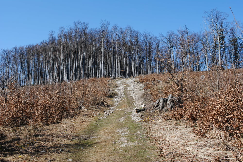
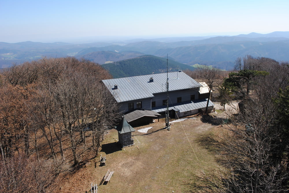
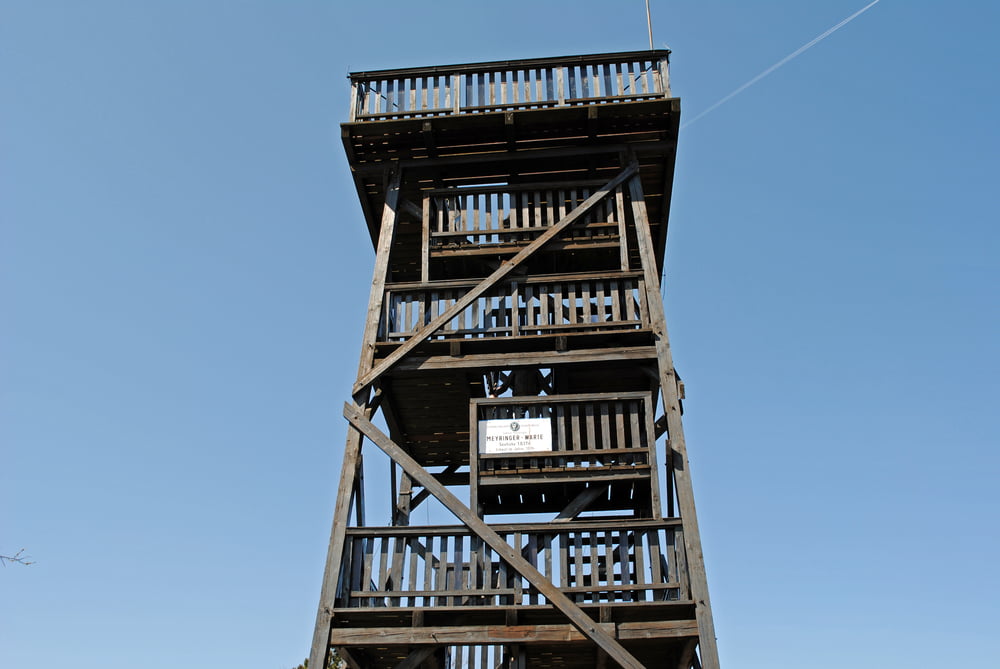
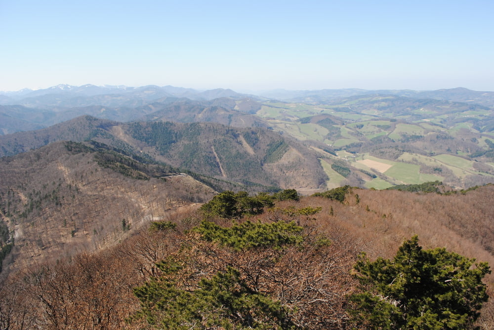
Ausgangspunkt Altenmarkt a.d.Tristing(alte Bahnstation Tasshof).Beschränkte Parkmöglichkeit.Über die Brücke auf blau,gelber Markierung über Wiese bis zu einer Wegkreuzung.Rechts weiter auf nunmehr gelber Markierung immer mässig steil den Kamm hinauf bis zu einer Kreuzung wo der Weg direkt aus Altenmarkt mit roter Markierung einmündet.Wir bleiben auf rot und ereichen nach etwas anstrengender Steigung das Hocheckschutzhaus(neu-nunmehr Dienstag und Mitwoch Ruhetag).Besuch der Aussichtswarte und Rückweg wie Aufstieg.Ich habe die Alternative über Eberbach (rot)gewählt,die Abzweigung auf die Eberbacher Höhe (angeblich blaue Markierung)nicht gefunden.War ein langer Weg zum Auto!!!

Tour gallery

Tour map and elevation profile

  • Open Street Map
  • Google
Minimum height 305 m Maximum height 1042 m Detailed view

More about the tour author

LeoCheops
Member since 2008

Send private message

Comments

GPS tracks

Trackpoints
  • GPX / Garmin Map Source (gpx) download
  • TCX / Garmin Training Center® (tcx) download
  • CRS / Garmin Training Center® (crs) download
  • Google Earth (kml) download
  • G7ToWin (g7t) download
  • TTQV (trk) download
  • Overlay (ovl) download
  • Fugawi (txt) download
  • Kompass (DAV) Track (tk) download
  • Track data sheet (pdf) download
  • Original file of the author (gpx) download

More about the tour author

LeoCheops
Member since 2008

Send private message
Share track
Add to my favorites
Remove from my favorites
Edit tags
My score
Rate
Track: Aufs Hocheck über den Ostkamm (08.04.2010)
Type: Mountain hiking
Distance: 14,8 km
Evaluated on:
Duration:
Day(s)
Hour(s)
Minute(s)
Score: Landscape Fun factor Fitness Technique